Gengchen Mai
Spatial-Agent: Agentic Geo-spatial Reasoning with Scientific Core Concepts
Jan 23, 2026Abstract:Geospatial reasoning is essential for real-world applications such as urban analytics, transportation planning, and disaster response. However, existing LLM-based agents often fail at genuine geospatial computation, relying instead on web search or pattern matching while hallucinating spatial relationships. We present Spatial-Agent, an AI agent grounded in foundational theories of spatial information science. Our approach formalizes geo-analytical question answering as a concept transformation problem, where natural-language questions are parsed into executable workflows represented as GeoFlow Graphs -- directed acyclic graphs with nodes corresponding to spatial concepts and edges representing transformations. Drawing on spatial information theory, Spatial-Agent extracts spatial concepts, assigns functional roles with principled ordering constraints, and composes transformation sequences through template-based generation. Extensive experiments on MapEval-API and MapQA benchmarks demonstrate that Spatial-Agent significantly outperforms existing baselines including ReAct and Reflexion, while producing interpretable and executable geospatial workflows.
Digital Twin AI: Opportunities and Challenges from Large Language Models to World Models
Jan 04, 2026Abstract:Digital twins, as precise digital representations of physical systems, have evolved from passive simulation tools into intelligent and autonomous entities through the integration of artificial intelligence technologies. This paper presents a unified four-stage framework that systematically characterizes AI integration across the digital twin lifecycle, spanning modeling, mirroring, intervention, and autonomous management. By synthesizing existing technologies and practices, we distill a unified four-stage framework that systematically characterizes how AI methodologies are embedded across the digital twin lifecycle: (1) modeling the physical twin through physics-based and physics-informed AI approaches, (2) mirroring the physical system into a digital twin with real-time synchronization, (3) intervening in the physical twin through predictive modeling, anomaly detection, and optimization strategies, and (4) achieving autonomous management through large language models, foundation models, and intelligent agents. We analyze the synergy between physics-based modeling and data-driven learning, highlighting the shift from traditional numerical solvers to physics-informed and foundation models for physical systems. Furthermore, we examine how generative AI technologies, including large language models and generative world models, transform digital twins into proactive and self-improving cognitive systems capable of reasoning, communication, and creative scenario generation. Through a cross-domain review spanning eleven application domains, including healthcare, aerospace, smart manufacturing, robotics, and smart cities, we identify common challenges related to scalability, explainability, and trustworthiness, and outline directions for responsible AI-driven digital twin systems.
Whose Truth? Pluralistic Geo-Alignment for (Agentic) AI
Aug 07, 2025Abstract:AI (super) alignment describes the challenge of ensuring (future) AI systems behave in accordance with societal norms and goals. While a quickly evolving literature is addressing biases and inequalities, the geographic variability of alignment remains underexplored. Simply put, what is considered appropriate, truthful, or legal can differ widely across regions due to cultural norms, political realities, and legislation. Alignment measures applied to AI/ML workflows can sometimes produce outcomes that diverge from statistical realities, such as text-to-image models depicting balanced gender ratios in company leadership despite existing imbalances. Crucially, some model outputs are globally acceptable, while others, e.g., questions about Kashmir, depend on knowing the user's location and their context. This geographic sensitivity is not new. For instance, Google Maps renders Kashmir's borders differently based on user location. What is new is the unprecedented scale and automation with which AI now mediates knowledge, expresses opinions, and represents geographic reality to millions of users worldwide, often with little transparency about how context is managed. As we approach Agentic AI, the need for spatio-temporally aware alignment, rather than one-size-fits-all approaches, is increasingly urgent. This paper reviews key geographic research problems, suggests topics for future work, and outlines methods for assessing alignment sensitivity.
4KAgent: Agentic Any Image to 4K Super-Resolution
Jul 09, 2025Abstract:We present 4KAgent, a unified agentic super-resolution generalist system designed to universally upscale any image to 4K resolution (and even higher, if applied iteratively). Our system can transform images from extremely low resolutions with severe degradations, for example, highly distorted inputs at 256x256, into crystal-clear, photorealistic 4K outputs. 4KAgent comprises three core components: (1) Profiling, a module that customizes the 4KAgent pipeline based on bespoke use cases; (2) A Perception Agent, which leverages vision-language models alongside image quality assessment experts to analyze the input image and make a tailored restoration plan; and (3) A Restoration Agent, which executes the plan, following a recursive execution-reflection paradigm, guided by a quality-driven mixture-of-expert policy to select the optimal output for each step. Additionally, 4KAgent embeds a specialized face restoration pipeline, significantly enhancing facial details in portrait and selfie photos. We rigorously evaluate our 4KAgent across 11 distinct task categories encompassing a total of 26 diverse benchmarks, setting new state-of-the-art on a broad spectrum of imaging domains. Our evaluations cover natural images, portrait photos, AI-generated content, satellite imagery, fluorescence microscopy, and medical imaging like fundoscopy, ultrasound, and X-ray, demonstrating superior performance in terms of both perceptual (e.g., NIQE, MUSIQ) and fidelity (e.g., PSNR) metrics. By establishing a novel agentic paradigm for low-level vision tasks, we aim to catalyze broader interest and innovation within vision-centric autonomous agents across diverse research communities. We will release all the code, models, and results at: https://4kagent.github.io.
ZooplanktonBench: A Geo-Aware Zooplankton Recognition and Classification Dataset from Marine Observations
May 24, 2025Abstract:Plankton are small drifting organisms found throughout the world's oceans. One component of this plankton community is the zooplankton, which includes gelatinous animals and crustaceans (e.g. shrimp), as well as the early life stages (i.e., eggs and larvae) of many commercially important fishes. Being able to monitor zooplankton abundances accurately and understand how populations change in relation to ocean conditions is invaluable to marine science research, with important implications for future marine seafood productivity. While new imaging technologies generate massive amounts of video data of zooplankton, analyzing them using general-purpose computer vision tools developed for general objects turns out to be highly challenging due to the high similarity in appearance between the zooplankton and its background (e.g., marine snow). In this work, we present the ZooplanktonBench, a benchmark dataset containing images and videos of zooplankton associated with rich geospatial metadata (e.g., geographic coordinates, depth, etc.) in various water ecosystems. ZooplanktonBench defines a collection of tasks to detect, classify, and track zooplankton in challenging settings, including highly cluttered environments, living vs non-living classification, objects with similar shapes, and relatively small objects. Our dataset presents unique challenges and opportunities for state-of-the-art computer vision systems to evolve and improve visual understanding in a dynamic environment with huge variations and be geo-aware.
Feature-Augmented Deep Networks for Multiscale Building Segmentation in High-Resolution UAV and Satellite Imagery
May 08, 2025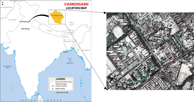
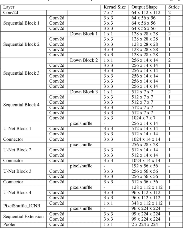
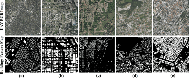

Abstract:Accurate building segmentation from high-resolution RGB imagery remains challenging due to spectral similarity with non-building features, shadows, and irregular building geometries. In this study, we present a comprehensive deep learning framework for multiscale building segmentation using RGB aerial and satellite imagery with spatial resolutions ranging from 0.4m to 2.7m. We curate a diverse, multi-sensor dataset and introduce feature-augmented inputs by deriving secondary representations including Principal Component Analysis (PCA), Visible Difference Vegetation Index (VDVI), Morphological Building Index (MBI), and Sobel edge filters from RGB channels. These features guide a Res-U-Net architecture in learning complex spatial patterns more effectively. We also propose training policies incorporating layer freezing, cyclical learning rates, and SuperConvergence to reduce training time and resource usage. Evaluated on a held-out WorldView-3 image, our model achieves an overall accuracy of 96.5%, an F1-score of 0.86, and an Intersection over Union (IoU) of 0.80, outperforming existing RGB-based benchmarks. This study demonstrates the effectiveness of combining multi-resolution imagery, feature augmentation, and optimized training strategies for robust building segmentation in remote sensing applications.
GAIR: Improving Multimodal Geo-Foundation Model with Geo-Aligned Implicit Representations
Mar 20, 2025


Abstract:Advancements in vision and language foundation models have inspired the development of geo-foundation models (GeoFMs), enhancing performance across diverse geospatial tasks. However, many existing GeoFMs primarily focus on overhead remote sensing (RS) data while neglecting other data modalities such as ground-level imagery. A key challenge in multimodal GeoFM development is to explicitly model geospatial relationships across modalities, which enables generalizability across tasks, spatial scales, and temporal contexts. To address these limitations, we propose GAIR, a novel multimodal GeoFM architecture integrating overhead RS data, street view (SV) imagery, and their geolocation metadata. We utilize three factorized neural encoders to project an SV image, its geolocation, and an RS image into the embedding space. The SV image needs to be located within the RS image's spatial footprint but does not need to be at its geographic center. In order to geographically align the SV image and RS image, we propose a novel implicit neural representations (INR) module that learns a continuous RS image representation and looks up the RS embedding at the SV image's geolocation. Next, these geographically aligned SV embedding, RS embedding, and location embedding are trained with contrastive learning objectives from unlabeled data. We evaluate GAIR across 10 geospatial tasks spanning RS image-based, SV image-based, and location embedding-based benchmarks. Experimental results demonstrate that GAIR outperforms state-of-the-art GeoFMs and other strong baselines, highlighting its effectiveness in learning generalizable and transferable geospatial representations.
Learning Street View Representations with Spatiotemporal Contrast
Feb 07, 2025


Abstract:Street view imagery is extensively utilized in representation learning for urban visual environments, supporting various sustainable development tasks such as environmental perception and socio-economic assessment. However, it is challenging for existing image representations to specifically encode the dynamic urban environment (such as pedestrians, vehicles, and vegetation), the built environment (including buildings, roads, and urban infrastructure), and the environmental ambiance (such as the cultural and socioeconomic atmosphere) depicted in street view imagery to address downstream tasks related to the city. In this work, we propose an innovative self-supervised learning framework that leverages temporal and spatial attributes of street view imagery to learn image representations of the dynamic urban environment for diverse downstream tasks. By employing street view images captured at the same location over time and spatially nearby views at the same time, we construct contrastive learning tasks designed to learn the temporal-invariant characteristics of the built environment and the spatial-invariant neighborhood ambiance. Our approach significantly outperforms traditional supervised and unsupervised methods in tasks such as visual place recognition, socioeconomic estimation, and human-environment perception. Moreover, we demonstrate the varying behaviors of image representations learned through different contrastive learning objectives across various downstream tasks. This study systematically discusses representation learning strategies for urban studies based on street view images, providing a benchmark that enhances the applicability of visual data in urban science. The code is available at https://github.com/yonglleee/UrbanSTCL.
The KnowWhereGraph Ontology
Oct 17, 2024


Abstract:KnowWhereGraph is one of the largest fully publicly available geospatial knowledge graphs. It includes data from 30 layers on natural hazards (e.g., hurricanes, wildfires), climate variables (e.g., air temperature, precipitation), soil properties, crop and land-cover types, demographics, and human health, various place and region identifiers, among other themes. These have been leveraged through the graph by a variety of applications to address challenges in food security and agricultural supply chains; sustainability related to soil conservation practices and farm labor; and delivery of emergency humanitarian aid following a disaster. In this paper, we introduce the ontology that acts as the schema for KnowWhereGraph. This broad overview provides insight into the requirements and design specifications for the graph and its schema, including the development methodology (modular ontology modeling) and the resources utilized to implement, materialize, and deploy KnowWhereGraph with its end-user interfaces and public query SPARQL endpoint.
Examining the Commitments and Difficulties Inherent in Multimodal Foundation Models for Street View Imagery
Aug 23, 2024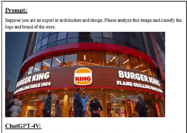

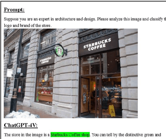
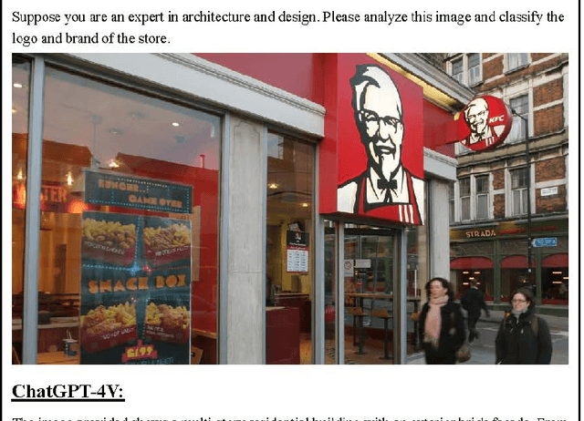
Abstract:The emergence of Large Language Models (LLMs) and multimodal foundation models (FMs) has generated heightened interest in their applications that integrate vision and language. This paper investigates the capabilities of ChatGPT-4V and Gemini Pro for Street View Imagery, Built Environment, and Interior by evaluating their performance across various tasks. The assessments include street furniture identification, pedestrian and car counts, and road width measurement in Street View Imagery; building function classification, building age analysis, building height analysis, and building structure classification in the Built Environment; and interior room classification, interior design style analysis, interior furniture counts, and interior length measurement in Interior. The results reveal proficiency in length measurement, style analysis, question answering, and basic image understanding, but highlight limitations in detailed recognition and counting tasks. While zero-shot learning shows potential, performance varies depending on the problem domains and image complexities. This study provides new insights into the strengths and weaknesses of multimodal foundation models for practical challenges in Street View Imagery, Built Environment, and Interior. Overall, the findings demonstrate foundational multimodal intelligence, emphasizing the potential of FMs to drive forward interdisciplinary applications at the intersection of computer vision and language.
 Add to Chrome
 Add to Firefox
 Add to Edge