Damon Conover
TransLocNet: Cross-Modal Attention for Aerial-Ground Vehicle Localization with Contrastive Learning
Dec 11, 2025Abstract:Aerial-ground localization is difficult due to large viewpoint and modality gaps between ground-level LiDAR and overhead imagery. We propose TransLocNet, a cross-modal attention framework that fuses LiDAR geometry with aerial semantic context. LiDAR scans are projected into a bird's-eye-view representation and aligned with aerial features through bidirectional attention, followed by a likelihood map decoder that outputs spatial probability distributions over position and orientation. A contrastive learning module enforces a shared embedding space to improve cross-modal alignment. Experiments on CARLA and KITTI show that TransLocNet outperforms state-of-the-art baselines, reducing localization error by up to 63% and achieving sub-meter, sub-degree accuracy. These results demonstrate that TransLocNet provides robust and generalizable aerial-ground localization in both synthetic and real-world settings.
VLAD-Grasp: Zero-shot Grasp Detection via Vision-Language Models
Nov 08, 2025Abstract:Robotic grasping is a fundamental capability for autonomous manipulation; however, most existing methods rely on large-scale expert annotations and necessitate retraining to handle new objects. We present VLAD-Grasp, a Vision-Language model Assisted zero-shot approach for Detecting grasps. From a single RGB-D image, our method (1) prompts a large vision-language model to generate a goal image where a straight rod "impales" the object, representing an antipodal grasp, (2) predicts depth and segmentation to lift this generated image into 3D, and (3) aligns generated and observed object point clouds via principal component analysis and correspondence-free optimization to recover an executable grasp pose. Unlike prior work, our approach is training-free and does not rely on curated grasp datasets. Despite this, VLAD-Grasp achieves performance that is competitive with or superior to that of state-of-the-art supervised models on the Cornell and Jacquard datasets. We further demonstrate zero-shot generalization to novel real-world objects on a Franka Research 3 robot, highlighting vision-language foundation models as powerful priors for robotic manipulation.
HessianForge: Scalable LiDAR reconstruction with Physics-Informed Neural Representation and Smoothness Energy Constraints
Mar 11, 2025Abstract:Accurate and efficient 3D mapping of large-scale outdoor environments from LiDAR measurements is a fundamental challenge in robotics, particularly towards ensuring smooth and artifact-free surface reconstructions. Although the state-of-the-art methods focus on memory-efficient neural representations for high-fidelity surface generation, they often fail to produce artifact-free manifolds, with artifacts arising due to noisy and sparse inputs. To address this issue, we frame surface mapping as a physics-informed energy optimization problem, enforcing surface smoothness by optimizing an energy functional that penalizes sharp surface ridges. Specifically, we propose a deep learning based approach that learns the signed distance field (SDF) of the surface manifold from raw LiDAR point clouds using a physics-informed loss function that optimizes the $L_2$-Hessian energy of the surface. Our learning framework includes a hierarchical octree based input feature encoding and a multi-scale neural network to iteratively refine the signed distance field at different scales of resolution. Lastly, we introduce a test-time refinement strategy to correct topological inconsistencies and edge distortions that can arise in the generated mesh. We propose a \texttt{CUDA}-accelerated least-squares optimization that locally adjusts vertex positions to enforce feature-preserving smoothing. We evaluate our approach on large-scale outdoor datasets and demonstrate that our approach outperforms current state-of-the-art methods in terms of improved accuracy and smoothness. Our code is available at \href{https://github.com/HrishikeshVish/HessianForge/}{https://github.com/HrishikeshVish/HessianForge/}
FlashSLAM: Accelerated RGB-D SLAM for Real-Time 3D Scene Reconstruction with Gaussian Splatting
Dec 01, 2024Abstract:We present FlashSLAM, a novel SLAM approach that leverages 3D Gaussian Splatting for efficient and robust 3D scene reconstruction. Existing 3DGS-based SLAM methods often fall short in sparse view settings and during large camera movements due to their reliance on gradient descent-based optimization, which is both slow and inaccurate. FlashSLAM addresses these limitations by combining 3DGS with a fast vision-based camera tracking technique, utilizing a pretrained feature matching model and point cloud registration for precise pose estimation in under 80 ms - a 90% reduction in tracking time compared to SplaTAM - without costly iterative rendering. In sparse settings, our method achieves up to a 92% improvement in average tracking accuracy over previous methods. Additionally, it accounts for noise in depth sensors, enhancing robustness when using unspecialized devices such as smartphones. Extensive experiments show that FlashSLAM performs reliably across both sparse and dense settings, in synthetic and real-world environments. Evaluations on benchmark datasets highlight its superior accuracy and efficiency, establishing FlashSLAM as a versatile and high-performance solution for SLAM, advancing the state-of-the-art in 3D reconstruction across diverse applications.
COLLAGE: Collaborative Human-Agent Interaction Generation using Hierarchical Latent Diffusion and Language Models
Sep 30, 2024Abstract:We propose a novel framework COLLAGE for generating collaborative agent-object-agent interactions by leveraging large language models (LLMs) and hierarchical motion-specific vector-quantized variational autoencoders (VQ-VAEs). Our model addresses the lack of rich datasets in this domain by incorporating the knowledge and reasoning abilities of LLMs to guide a generative diffusion model. The hierarchical VQ-VAE architecture captures different motion-specific characteristics at multiple levels of abstraction, avoiding redundant concepts and enabling efficient multi-resolution representation. We introduce a diffusion model that operates in the latent space and incorporates LLM-generated motion planning cues to guide the denoising process, resulting in prompt-specific motion generation with greater control and diversity. Experimental results on the CORE-4D, and InterHuman datasets demonstrate the effectiveness of our approach in generating realistic and diverse collaborative human-object-human interactions, outperforming state-of-the-art methods. Our work opens up new possibilities for modeling complex interactions in various domains, such as robotics, graphics and computer vision.
Go-SLAM: Grounded Object Segmentation and Localization with Gaussian Splatting SLAM
Sep 25, 2024


Abstract:We introduce Go-SLAM, a novel framework that utilizes 3D Gaussian Splatting SLAM to reconstruct dynamic environments while embedding object-level information within the scene representations. This framework employs advanced object segmentation techniques, assigning a unique identifier to each Gaussian splat that corresponds to the object it represents. Consequently, our system facilitates open-vocabulary querying, allowing users to locate objects using natural language descriptions. Furthermore, the framework features an optimal path generation module that calculates efficient navigation paths for robots toward queried objects, considering obstacles and environmental uncertainties. Comprehensive evaluations in various scene settings demonstrate the effectiveness of our approach in delivering high-fidelity scene reconstructions, precise object segmentation, flexible object querying, and efficient robot path planning. This work represents an additional step forward in bridging the gap between 3D scene reconstruction, semantic object understanding, and real-time environment interactions.
Dynamic Obstacle Avoidance through Uncertainty-Based Adaptive Planning with Diffusion
Sep 25, 2024Abstract:By framing reinforcement learning as a sequence modeling problem, recent work has enabled the use of generative models, such as diffusion models, for planning. While these models are effective in predicting long-horizon state trajectories in deterministic environments, they face challenges in dynamic settings with moving obstacles. Effective collision avoidance demands continuous monitoring and adaptive decision-making. While replanning at every timestep could ensure safety, it introduces substantial computational overhead due to the repetitive prediction of overlapping state sequences -- a process that is particularly costly with diffusion models, known for their intensive iterative sampling procedure. We propose an adaptive generative planning approach that dynamically adjusts replanning frequency based on the uncertainty of action predictions. Our method minimizes the need for frequent, computationally expensive, and redundant replanning while maintaining robust collision avoidance performance. In experiments, we obtain a 13.5% increase in the mean trajectory length and a 12.7% increase in mean reward over long-horizon planning, indicating a reduction in collision rates and an improved ability to navigate the environment safely.
CrossLoc3D: Aerial-Ground Cross-Source 3D Place Recognition
Mar 31, 2023Abstract:We present CrossLoc3D, a novel 3D place recognition method that solves a large-scale point matching problem in a cross-source setting. Cross-source point cloud data corresponds to point sets captured by depth sensors with different accuracies or from different distances and perspectives. We address the challenges in terms of developing 3D place recognition methods that account for the representation gap between points captured by different sources. Our method handles cross-source data by utilizing multi-grained features and selecting convolution kernel sizes that correspond to most prominent features. Inspired by the diffusion models, our method uses a novel iterative refinement process that gradually shifts the embedding spaces from different sources to a single canonical space for better metric learning. In addition, we present CS-Campus3D, the first 3D aerial-ground cross-source dataset consisting of point cloud data from both aerial and ground LiDAR scans. The point clouds in CS-Campus3D have representation gaps and other features like different views, point densities, and noise patterns. We show that our CrossLoc3D algorithm can achieve an improvement of 4.74% - 15.37% in terms of the top 1 average recall on our CS-Campus3D benchmark and achieves performance comparable to state-of-the-art 3D place recognition method on the Oxford RobotCar. We will release the code and CS-Campus3D benchmark.
VERN: Vegetation-aware Robot Navigation in Dense Unstructured Outdoor Environments
Mar 25, 2023Abstract:We propose a novel method for autonomous legged robot navigation in densely vegetated environments with a variety of pliable/traversable and non-pliable/untraversable vegetation. We present a novel few-shot learning classifier that can be trained on a few hundred RGB images to differentiate flora that can be navigated through, from the ones that must be circumvented. Using the vegetation classification and 2D lidar scans, our method constructs a vegetation-aware traversability cost map that accurately represents the pliable and non-pliable obstacles with lower, and higher traversability costs, respectively. Our cost map construction accounts for misclassifications of the vegetation and further lowers the risk of collisions, freezing and entrapment in vegetation during navigation. Furthermore, we propose holonomic recovery behaviors for the robot for scenarios where it freezes, or gets physically entrapped in dense, pliable vegetation. We demonstrate our method on a Boston Dynamics Spot robot in real-world unstructured environments with sparse and dense tall grass, bushes, trees, etc. We observe an increase of 25-90% in success rates, 10-90% decrease in freezing rate, and up to 65% decrease in the false positive rate compared to existing methods.
Small Drone Field Experiment: Data Collection & Processing
Nov 29, 2017


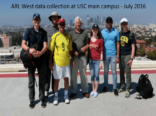
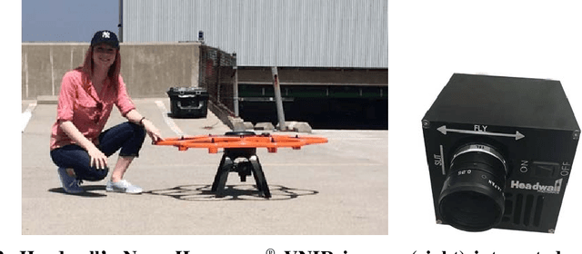
Abstract:Following an initiative formalized in April 2016 formally known as ARL West between the U.S. Army Research Laboratory (ARL) and University of Southern California's Institute for Creative Technologies (USC ICT), a field experiment was coordinated and executed in the summer of 2016 by ARL, USC ICT, and Headwall Photonics. The purpose was to image part of the USC main campus in Los Angeles, USA, using two portable COTS (commercial off the shelf) aerial drone solutions for data acquisition, for photogrammetry (3D reconstruction from images), and fusion of hyperspectral data with the recovered set of 3D point clouds representing the target area. The research aims for determining the viability of having a machine capable of segmenting the target area into key material classes (e.g., manmade structures, live vegetation, water) for use in multiple purposes, to include providing the user with a more accurate scene understanding and enabling the unsupervised automatic sampling of meaningful material classes from the target area for adaptive semi-supervised machine learning. In the latter, a target set library may be used for automatic machine training with data of local material classes, as an example, to increase the prediction chances of machines recognizing targets. The field experiment and associated data post processing approach to correct for reflectance, geo-rectify, recover the area's dense point clouds from images, register spectral with elevation properties of scene surfaces from the independently collected datasets, and generate the desired scene segmented maps are discussed. Lessons learned from the experience are also highlighted throughout the paper.
 Add to Chrome
 Add to Firefox
 Add to Edge