Sarah Narges Fatholahi
Monitoring surface deformation over oilfield using MT-InSAR and production well data
Mar 18, 2021


Abstract:Surface displacements associated with the average subsidence due to hydrocarbon exploitation in southwest of Iran which has a long history in oil production, can lead to significant damages to surface and subsurface structures, and requires serious consideration. In this study, the Small BAseline Subset (SBAS) approach, which is a multi-temporal Interferometric Synthetic Aperture Radar (InSAR) algorithm was employed to resolve ground deformation in the Marun region, Iran. A total of 22 interferograms were generated using 10 Envisat ASAR images. The mean velocity map obtained in the Line-Of-Sight (LOS) direction of satellite to the ground reveals the maximum subsidence on order of 13.5 mm per year over the field due to both tectonic and non-tectonic features. In order to assess the effect of non-tectonic features such as petroleum extraction on ground surface displacement, the results of InSAR have been compared with the oil production rate, which have shown a good agreement.
A comparative study of deep learning methods for building footprints detection using high spatial resolution aerial images
Mar 16, 2021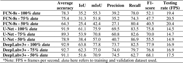
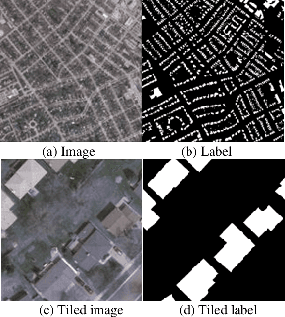
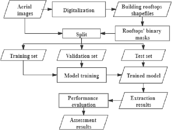
Abstract:Building footprints data is of importance in several urban applications and natural disaster management. In contrast to traditional surveying and mapping, using high spatial resolution aerial images, deep learning-based building footprints extraction methods can extract building footprints accurately and efficiently. With rapidly development of deep learning methods, it is hard for novice to harness the powerful tools in building footprints extraction. The paper aims at providing the whole process of building footprints extraction from high spatial resolution images using deep learning-based methods. In addition, we also compare the commonly used methods, including Fully Convolutional Networks (FCN)-8s, U-Net and DeepLabv3+. At the end of the work, we change the data size used in models training to explore the influence of data size to the performance of the algorithms. The experiments show that, in different data size, DeepLabv3+ is the best algorithm among them with the highest accuracy and moderate efficiency; FCN-8s has the worst accuracy and highest efficiency; U-Net shows the moderate accuracy and lowest efficiency. In addition, with more training data, algorithms converged faster with higher accuracy in extraction results.
A Review on Deep Learning in UAV Remote Sensing
Jan 29, 2021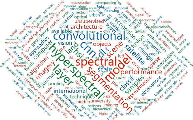

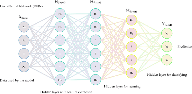
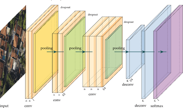
Abstract:Deep Neural Networks (DNNs) learn representation from data with an impressive capability, and brought important breakthroughs for processing images, time-series, natural language, audio, video, and many others. In the remote sensing field, surveys and literature revisions specifically involving DNNs algorithms' applications have been conducted in an attempt to summarize the amount of information produced in its subfields. Recently, Unmanned Aerial Vehicles (UAV) based applications have dominated aerial sensing research. However, a literature revision that combines both "deep learning" and "UAV remote sensing" thematics has not yet been conducted. The motivation for our work was to present a comprehensive review of the fundamentals of Deep Learning (DL) applied in UAV-based imagery. We focused mainly on describing classification and regression techniques used in recent applications with UAV-acquired data. For that, a total of 232 papers published in international scientific journal databases was examined. We gathered the published material and evaluated their characteristics regarding application, sensor, and technique used. We relate how DL presents promising results and has the potential for processing tasks associated with UAV-based image data. Lastly, we project future perspectives, commentating on prominent DL paths to be explored in the UAV remote sensing field. Our revision consists of a friendly-approach to introduce, commentate, and summarize the state-of-the-art in UAV-based image applications with DNNs algorithms in diverse subfields of remote sensing, grouping it in the environmental, urban, and agricultural contexts.
 Add to Chrome
 Add to Firefox
 Add to Edge