Mihail Sichitiu
Fusion of Cellular ISAC and Passive RF Sensing for UAV Detection and Tracking
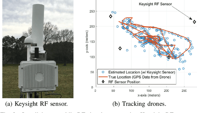
Dec 16, 2025Abstract:The rapid growth of unmanned aerial vehicles (UAVs) in civilian and critical-infrastructure airspace has created a need for reliable detection and tracking systems that operate under diverse environmental and sensing conditions. This paper presents a UAV detection and tracking system that fuses measurements from a network of passive Keysight N6841A RF sensors and a Ku-band Fortem TrueView R20 radar operating in the FR3 spectrum (16.3 GHz) as an ISAC proxy. Real-world experiments at the NSF AERPAW testbed demonstrate that radar and RF sensing provide complementary strengths under varying geometric, range, and line-of-sight conditions. A Kalman filter using a constant-velocity motion model integrates the asynchronous 2D RF and 3D radar observations, suppressing large standalone errors, improving accuracy over individual modalities, and increasing tracking coverage without degrading performance. These results demonstrate the effectiveness of multi-modal, ISAC-oriented sensing for robust UAV tracking in outdoor environments.
A UAV-assisted Wireless Localization Challenge on AERPAW
Jul 16, 2024


Abstract:As wireless researchers are tasked to enable wireless communication as infrastructure in more dynamic aerial settings, there is a growing need for large-scale experimental platforms that provide realistic, reproducible, and reliable experimental validation. To bridge the research-to-implementation gap, the Aerial Experimentation and Research Platform for Advanced Wireless (AERPAW) offers open-source tools, reference experiments, and hardware to facilitate and evaluate the development of wireless research in controlled digital twin environments and live testbed flights. The inaugural AERPAW Challenge, "Find a Rover," was issued to spark collaborative efforts and test the platform's capabilities. The task involved localizing a narrowband wireless signal, with teams given ten minutes to find the "rover" within a twenty-acre area. By engaging in this exercise, researchers can validate the platform's value as a tool for innovation in wireless communications research within aerial robotics. This paper recounts the methods and experiences of the top three teams in automating and rapidly locating a wireless signal by automating and controlling an aerial drone in a realistic testbed scenario.
Spectrum Monitoring and Analysis in Urban and Rural Environments at Different Altitudes
Jan 06, 2023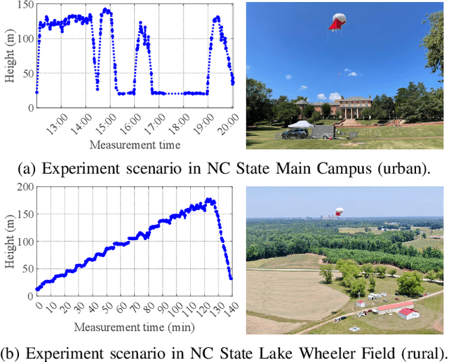
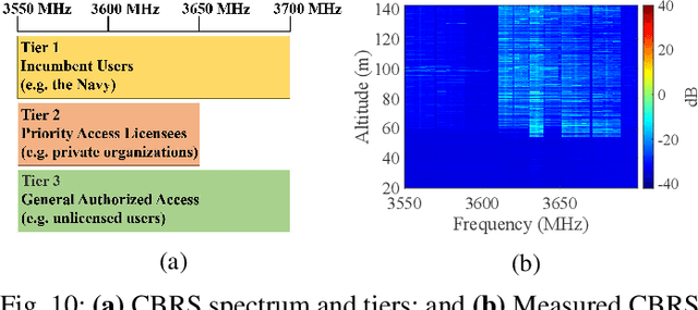
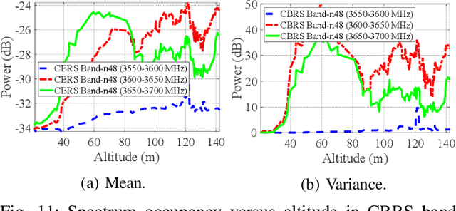
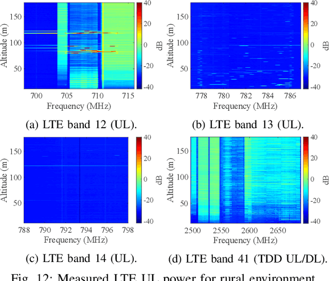
Abstract:Due to the scarcity of spectrum resources, the emergence of new technologies and ever-increasing number of wireless devices operating in the radio frequency spectrum lead to data congestion and interference. In this work, we study the effect of altitude on sub-6 GHz spectrum measurement results obtained at a Helikite flying over two distinct scenarios; i.e., urban and rural environments. Specifically, we aim at investigating the spectrum occupancy of various long-term evolution (LTE), $5^{\text{th}}$ generation (5G) and citizens broadband radio service (CBRS) bands utilized in the United States for both uplink and downlink at altitudes up to 180 meters. Our results reveal that generally the mean value of the measured power increases as the altitude increases where the line-of-sight links with nearby base stations is more available. SigMF-compliant spectrum measurement datasets used in this paper covering all the bands between 100~MHz to 6~GHz are also provided.
AERIQ: SDR-Based LTE I/Q Measurement and Analysis Framework for Air-to-Ground Propagation Modeling
Oct 14, 2022
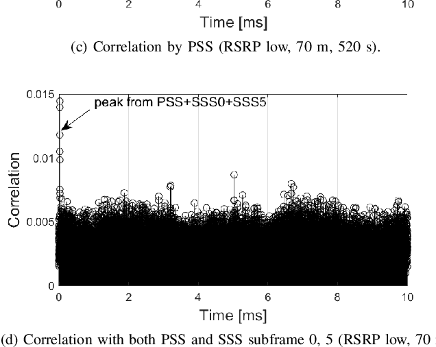
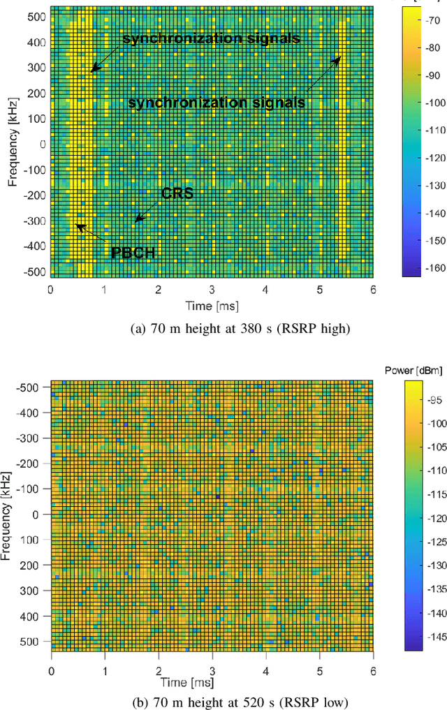
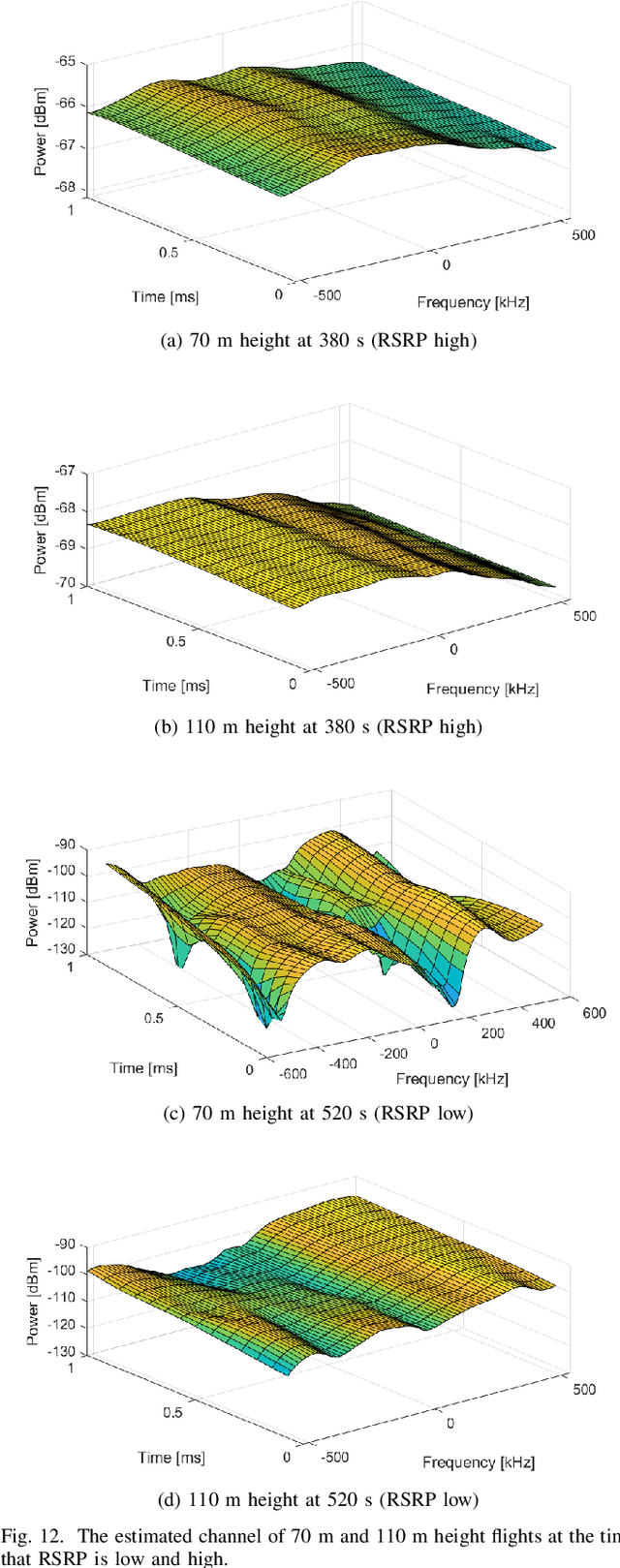
Abstract:Radio dynamic zones (RDZs) are areas or volumes with automatic spectrum management mechanisms that control electromagnetic energy entering, escaping, or occupying the zone. In order to have real-time volumetric spectrum awareness in an RDZ, it is critical to understand the propagation characteristics throughout that RDZ, such as time, frequency, and spatial correlation for various communications scenarios and configurations. This requires wireless measurement campaigns that can be carried out flexibly and are repeatable for different experiment configurations, parameters, and transmitter/receiver locations. Such measurements should also provide raw data from which various key parameters of interest (KPIs) can be conveniently extracted for further analysis. In this paper, we propose AERIQ: a software-defined radio (SDR) based I/Q measurement and analysis framework that is flexible, repeatable, and provides raw I/Q samples for post-processing the data to extract various KPIs. Using SDRs, we collect I/Q data with unmanned aerial vehicles (UAVs) flying at various different altitudes in an RDZ-like outdoor environment, from a 4G LTE eNB that we configure to operate at 3.51 GHz. Using the raw I/Q samples, and using Matlab's LTE Toolbox, we provide a step-by-step description for the following post-processing stages of an aerial receiver: frequency offset estimation/correction, synchronization, cell search, channel estimation, and reference signal received power (RSRP). We provide various representative results for each step, such as RSRP measurements and corresponding analytical approximation at different UAV altitudes, and coherence bandwidth of the channel at different UAV altitudes and link distances. The collected raw data as well as the software developed for obtaining and post-processing such data are provided publicly for potential use by other researchers.
National Radio Dynamic Zone Concept with Autonomous Aerial and Ground Spectrum Sensors
Mar 17, 2022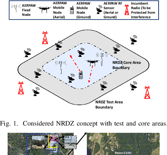
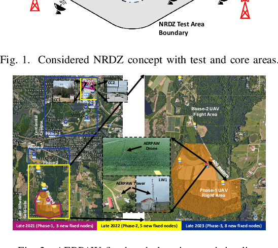

Abstract:National radio dynamic zone (NRDZs) are intended to be geographically bounded areas within which controlled experiments can be carried out while protecting the nearby licensed users of the spectrum. An NRDZ will facilitate research and development of new spectrum technologies, waveforms, and protocols, in typical outdoor operational environments of such technologies. In this paper, we introduce and describe an NRDZ concept that relies on a combination of autonomous aerial and ground sensor nodes for spectrum sensing and radio environment monitoring (REM). We elaborate on key characteristics and features of an NRDZ to enable advanced wireless experimentation while also coexisting with licensed users. Some preliminary results based on simulation and experimental evaluations are also provided on out-of-zone leakage monitoring and real-time REMs.
 Add to Chrome
 Add to Firefox
 Add to Edge