Yueshuai He
Reconstructing Human Mobility Pattern: A Semi-Supervised Approach for Cross-Dataset Transfer Learning
Oct 03, 2024


Abstract:Understanding human mobility patterns is crucial for urban planning, transportation management, and public health. This study tackles two primary challenges in the field: the reliance on trajectory data, which often fails to capture the semantic interdependencies of activities, and the inherent incompleteness of real-world trajectory data. We have developed a model that reconstructs and learns human mobility patterns by focusing on semantic activity chains. We introduce a semi-supervised iterative transfer learning algorithm to adapt models to diverse geographical contexts and address data scarcity. Our model is validated using comprehensive datasets from the United States, where it effectively reconstructs activity chains and generates high-quality synthetic mobility data, achieving a low Jensen-Shannon Divergence (JSD) value of 0.001, indicating a close similarity between synthetic and real data. Additionally, sparse GPS data from Egypt is used to evaluate the transfer learning algorithm, demonstrating successful adaptation of US mobility patterns to Egyptian contexts, achieving a 64\% of increase in similarity, i.e., a JSD reduction from 0.09 to 0.03. This mobility reconstruction model and the associated transfer learning algorithm show significant potential for global human mobility modeling studies, enabling policymakers and researchers to design more effective and culturally tailored transportation solutions.
NUMOSIM: A Synthetic Mobility Dataset with Anomaly Detection Benchmarks
Sep 04, 2024
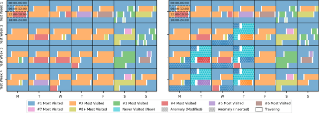
Abstract:Collecting real-world mobility data is challenging. It is often fraught with privacy concerns, logistical difficulties, and inherent biases. Moreover, accurately annotating anomalies in large-scale data is nearly impossible, as it demands meticulous effort to distinguish subtle and complex patterns. These challenges significantly impede progress in geospatial anomaly detection research by restricting access to reliable data and complicating the rigorous evaluation, comparison, and benchmarking of methodologies. To address these limitations, we introduce a synthetic mobility dataset, NUMOSIM, that provides a controlled, ethical, and diverse environment for benchmarking anomaly detection techniques. NUMOSIM simulates a wide array of realistic mobility scenarios, encompassing both typical and anomalous behaviours, generated through advanced deep learning models trained on real mobility data. This approach allows NUMOSIM to accurately replicate the complexities of real-world movement patterns while strategically injecting anomalies to challenge and evaluate detection algorithms based on how effectively they capture the interplay between demographic, geospatial, and temporal factors. Our goal is to advance geospatial mobility analysis by offering a realistic benchmark for improving anomaly detection and mobility modeling techniques. To support this, we provide open access to the NUMOSIM dataset, along with comprehensive documentation, evaluation metrics, and benchmark results.
Agent-based Simulation Model and Deep Learning Techniques to Evaluate and Predict Transportation Trends around COVID-19
Sep 23, 2020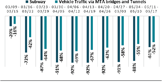

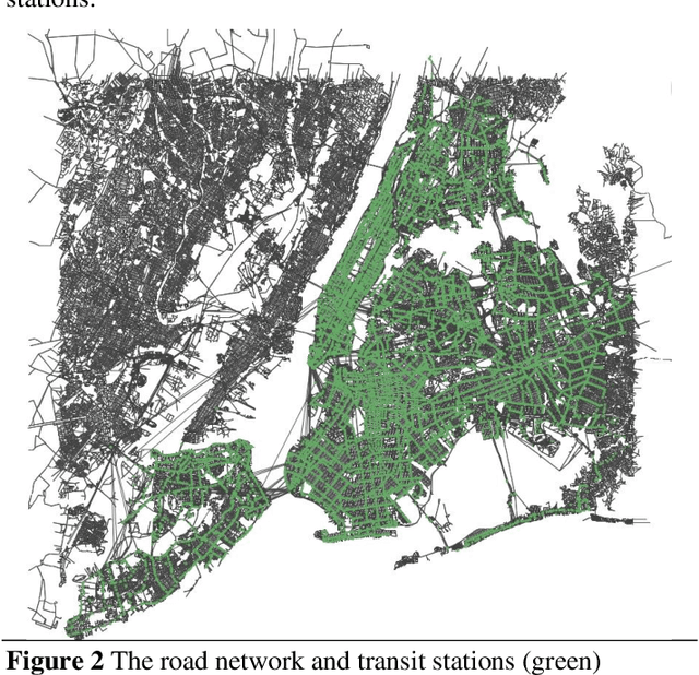
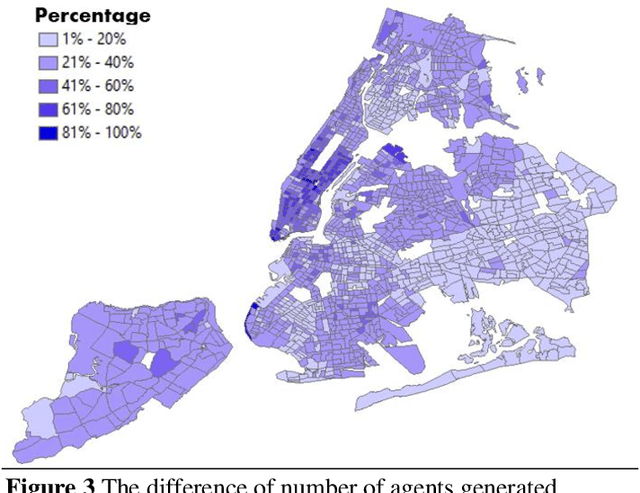
Abstract:The COVID-19 pandemic has affected travel behaviors and transportation system operations, and cities are grappling with what policies can be effective for a phased reopening shaped by social distancing. This edition of the white paper updates travel trends and highlights an agent-based simulation model's results to predict the impact of proposed phased reopening strategies. It also introduces a real-time video processing method to measure social distancing through cameras on city streets.
 Add to Chrome
 Add to Firefox
 Add to Edge