Sharathchandra Pankanti
Learning and Recognizing Archeological Features from LiDAR Data
Apr 05, 2020
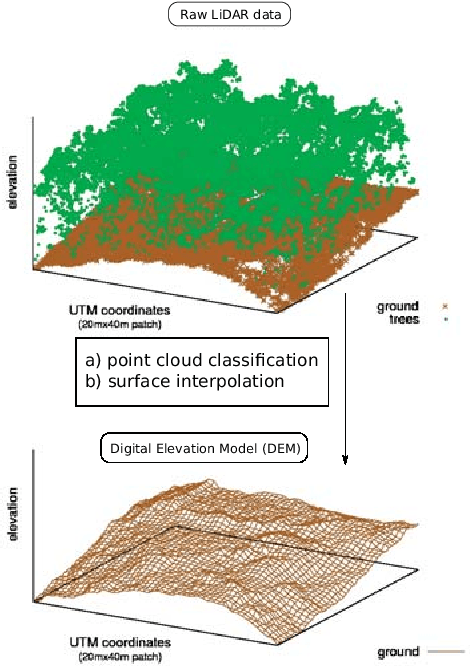
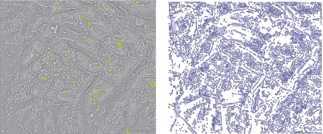
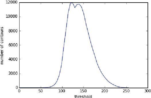
Abstract:We present a remote sensing pipeline that processes LiDAR (Light Detection And Ranging) data through machine & deep learning for the application of archeological feature detection on big geo-spatial data platforms such as e.g. IBM PAIRS Geoscope. Today, archeologists get overwhelmed by the task of visually surveying huge amounts of (raw) LiDAR data in order to identify areas of interest for inspection on the ground. We showcase a software system pipeline that results in significant savings in terms of expert productivity while missing only a small fraction of the artifacts. Our work employs artificial neural networks in conjunction with an efficient spatial segmentation procedure based on domain knowledge. Data processing is constraint by a limited amount of training labels and noisy LiDAR signals due to vegetation cover and decay of ancient structures. We aim at identifying geo-spatial areas with archeological artifacts in a supervised fashion allowing the domain expert to flexibly tune parameters based on her needs.
RepMet: Representative-based metric learning for classification and one-shot object detection
Jun 15, 2018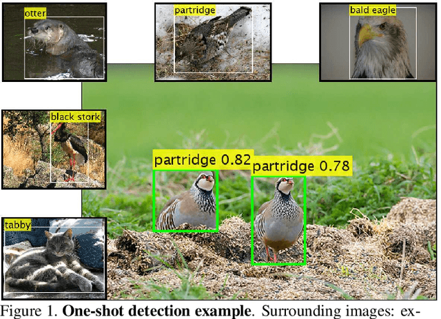

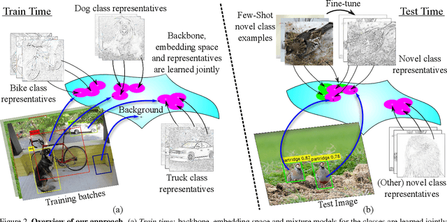
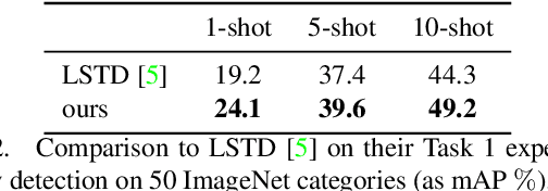
Abstract:Distance metric learning (DML) has been successfully applied to object classification, both in the standard regime of rich training data and in the few-shot scenario, where each category is represented by only few examples. In this work, we propose a new method for DML, featuring a joint learning of the embedding space and of the data distribution of the training categories, in a single training process. Our method improves upon leading algorithms for DML-based object classification. Furthermore, it opens the door for a new task in Computer Vision - a few-shot object detection, since the proposed DML architecture can be naturally embedded as the classification head of any standard object detector. In numerous experiments, we achieve state-of-the-art classification results on a variety of fine-grained datasets, and offer the community a benchmark on the few-shot detection task, performed on the Imagenet-LOC dataset. The code will be made available upon acceptance.
 Add to Chrome
 Add to Firefox
 Add to Edge