Marcus Freitag
Climatic & Anthropogenic Hazards to the Nasca World Heritage: Application of Remote Sensing, AI, and Flood Modelling
May 20, 2024
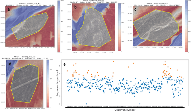
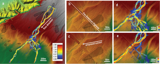
Abstract:Preservation of the Nasca geoglyphs at the UNESCO World Heritage Site in Peru is urgent as natural and human impact accelerates. More frequent weather extremes such as flashfloods threaten Nasca artifacts. We demonstrate that runoff models based on (sub-)meter scale, LiDAR-derived digital elevation data can highlight AI-detected geoglyphs that are in danger of erosion. We recommend measures of mitigation to protect the famous "lizard", "tree", and "hand" geoglyphs located close by, or even cut by the Pan-American Highway.
TensorBank:Tensor Lakehouse for Foundation Model Training
Sep 07, 2023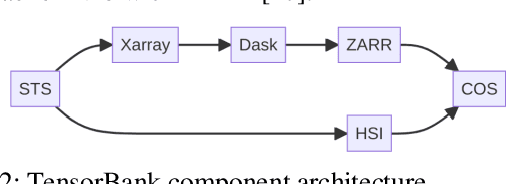
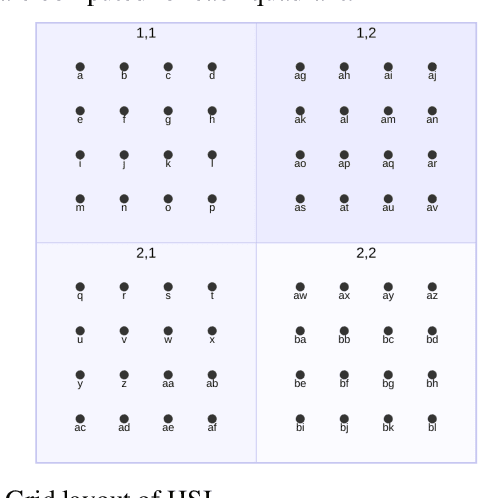
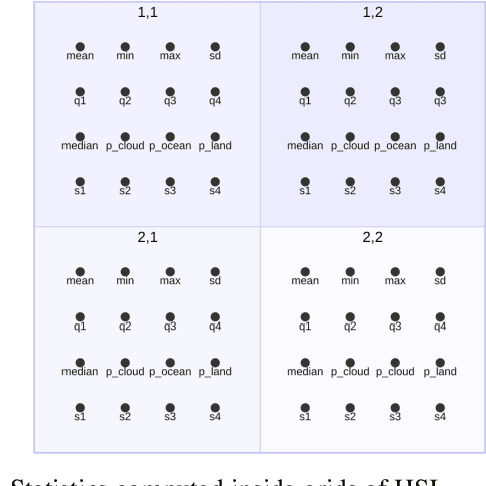
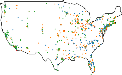
Abstract:Storing and streaming high dimensional data for foundation model training became a critical requirement with the rise of foundation models beyond natural language. In this paper we introduce TensorBank, a petabyte scale tensor lakehouse capable of streaming tensors from Cloud Object Store (COS) to GPU memory at wire speed based on complex relational queries. We use Hierarchical Statistical Indices (HSI) for query acceleration. Our architecture allows to directly address tensors on block level using HTTP range reads. Once in GPU memory, data can be transformed using PyTorch transforms. We provide a generic PyTorch dataset type with a corresponding dataset factory translating relational queries and requested transformations as an instance. By making use of the HSI, irrelevant blocks can be skipped without reading them as those indices contain statistics on their content at different hierarchical resolution levels. This is an opinionated architecture powered by open standards and making heavy use of open-source technology. Although, hardened for production use using geospatial-temporal data, this architecture generalizes to other use case like computer vision, computational neuroscience, biological sequence analysis and more.
Learning and Recognizing Archeological Features from LiDAR Data
Apr 05, 2020
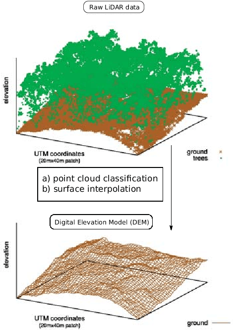
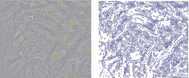
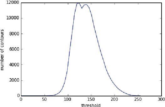
Abstract:We present a remote sensing pipeline that processes LiDAR (Light Detection And Ranging) data through machine & deep learning for the application of archeological feature detection on big geo-spatial data platforms such as e.g. IBM PAIRS Geoscope. Today, archeologists get overwhelmed by the task of visually surveying huge amounts of (raw) LiDAR data in order to identify areas of interest for inspection on the ground. We showcase a software system pipeline that results in significant savings in terms of expert productivity while missing only a small fraction of the artifacts. Our work employs artificial neural networks in conjunction with an efficient spatial segmentation procedure based on domain knowledge. Data processing is constraint by a limited amount of training labels and noisy LiDAR signals due to vegetation cover and decay of ancient structures. We aim at identifying geo-spatial areas with archeological artifacts in a supervised fashion allowing the domain expert to flexibly tune parameters based on her needs.
 Add to Chrome
 Add to Firefox
 Add to Edge