Mathias Rothermel
Integrated monitoring of ice in selected Swiss lakes. Final project report
Aug 02, 2020
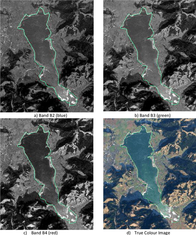

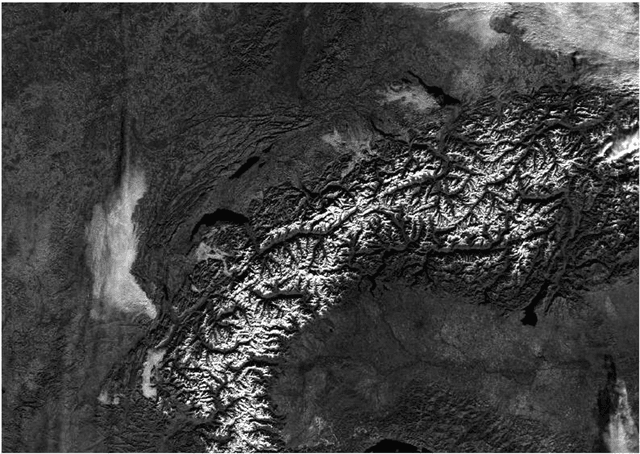
Abstract:Various lake observables, including lake ice, are related to climate and climate change and provide a good opportunity for long-term monitoring. Lakes (and as part of them lake ice) is therefore considered an Essential Climate Variable (ECV) of the Global Climate Observing System (GCOS). Following the need for an integrated multi-temporal monitoring of lake ice in Switzerland, MeteoSwiss in the framework of GCOS Switzerland supported this 2-year project to explore not only the use of satellite images but also the possibilities of Webcams and in-situ measurements. The aim of this project is to monitor some target lakes and detect the extent of ice and especially the ice-on/off dates, with focus on the integration of various input data and processing methods. The target lakes are: St. Moritz, Silvaplana, Sils, Sihl, Greifen and Aegeri, whereby only the first four were mainly frozen during the observation period and thus processed. The observation period was mainly the winter 2016-17. During the project, various approaches were developed, implemented, tested and compared. Firstly, low spatial resolution (250 - 1000 m) but high temporal resolution (1 day) satellite images from the optical sensors MODIS and VIIRS were used. Secondly, and as a pilot project, the use of existing public Webcams was investigated for (a) validation of results from satellite data, and (b) independent estimation of lake ice, especially for small lakes like St. Moritz, that could not be possibly monitored in the satellite images. Thirdly, in-situ measurements were made in order to characterize the development of the temperature profiles and partly pressure before freezing and under the ice-cover until melting. This report presents the results of the project work.
Photometric Multi-View Mesh Refinement for High-Resolution Satellite Images
May 12, 2020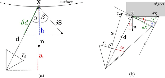


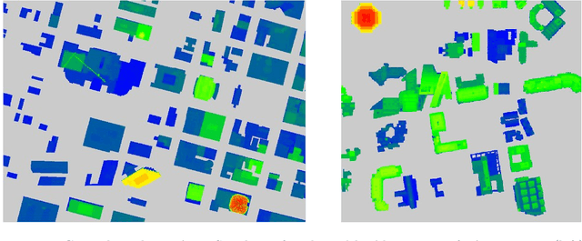
Abstract:Modern high-resolution satellite sensors collect optical imagery with ground sampling distances (GSDs) of 30-50cm, which has sparked a renewed interest in photogrammetric 3D surface reconstruction from satellite data. State-of-the-art reconstruction methods typically generate 2.5D elevation data. Here, we present an approach to recover full 3D surface meshes from multi-view satellite imagery. The proposed method takes as input a coarse initial mesh and refines it by iteratively updating all vertex positions to maximize the photo-consistency between images. Photo-consistency is measured in image space, by transferring texture from one image to another via the surface. We derive the equations to propagate changes in texture similarity through the rational function model (RFM), often also referred to as rational polynomial coefficient (RPC) model. Furthermore, we devise a hierarchical scheme to optimize the surface with gradient descent. In experiments with two different datasets, we show that the refinement improves the initial digital elevation models (DEMs) generated with conventional dense image matching. Moreover, we demonstrate that our method is able to reconstruct true 3D geometry, such as facade structures, if off-nadir views are available.
Lake Ice Monitoring with Webcams and Crowd-Sourced Images
Feb 18, 2020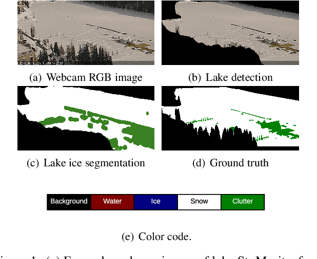

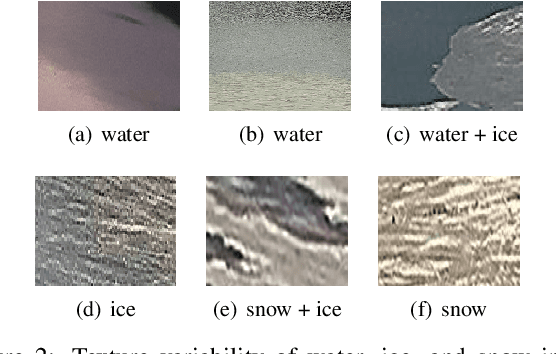
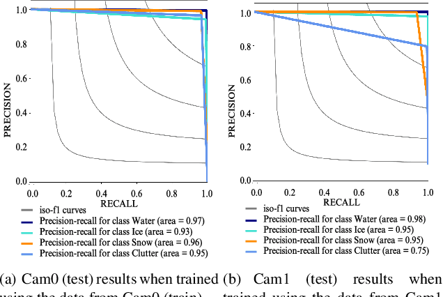
Abstract:Lake ice is a strong climate indicator and has been recognised as part of the Essential Climate Variables (ECV) by the Global Climate Observing System (GCOS). The dynamics of freezing and thawing, and possible shifts of freezing patterns over time, can help in understanding the local and global climate systems. One way to acquire the spatio-temporal information about lake ice formation, independent of clouds, is to analyse webcam images. This paper intends to move towards a universal model for monitoring lake ice with freely available webcam data. We demonstrate good performance, including the ability to generalise across different winters and different lakes, with a state-of-the-art Convolutional Neural Network (CNN) model for semantic image segmentation, Deeplab v3+. Moreover, we design a variant of that model, termed Deep-U-Lab, which predicts sharper, more correct segmentation boundaries. We have tested the model's ability to generalise with data from multiple camera views and two different winters. On average, it achieves intersection-over-union (IoU) values of ~71% across different cameras and ~69% across different winters, greatly outperforming prior work. Going even further, we show that the model even achieves 60% IoU on arbitrary images scraped from photo-sharing web sites. As part of the work, we introduce a new benchmark dataset of webcam images, Photi-LakeIce, from multiple cameras and two different winters, along with pixel-wise ground truth annotations.
Semantically Informed Multiview Surface Refinement
Jun 26, 2017


Abstract:We present a method to jointly refine the geometry and semantic segmentation of 3D surface meshes. Our method alternates between updating the shape and the semantic labels. In the geometry refinement step, the mesh is deformed with variational energy minimization, such that it simultaneously maximizes photo-consistency and the compatibility of the semantic segmentations across a set of calibrated images. Label-specific shape priors account for interactions between the geometry and the semantic labels in 3D. In the semantic segmentation step, the labels on the mesh are updated with MRF inference, such that they are compatible with the semantic segmentations in the input images. Also, this step includes prior assumptions about the surface shape of different semantic classes. The priors induce a tight coupling, where semantic information influences the shape update and vice versa. Specifically, we introduce priors that favor (i) adaptive smoothing, depending on the class label; (ii) straightness of class boundaries; and (iii) semantic labels that are consistent with the surface orientation. The novel mesh-based reconstruction is evaluated in a series of experiments with real and synthetic data. We compare both to state-of-the-art, voxel-based semantic 3D reconstruction, and to purely geometric mesh refinement, and demonstrate that the proposed scheme yields improved 3D geometry as well as an improved semantic segmentation.
 Add to Chrome
 Add to Firefox
 Add to Edge