Damien Bouffard
Probabilistic modeling of lake surface water temperature using a Bayesian spatio-temporal graph convolutional neural network
Sep 27, 2021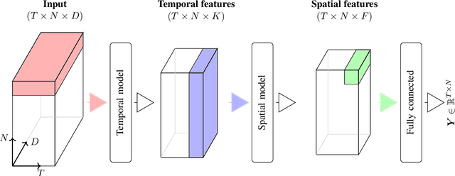
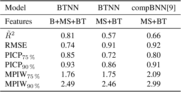
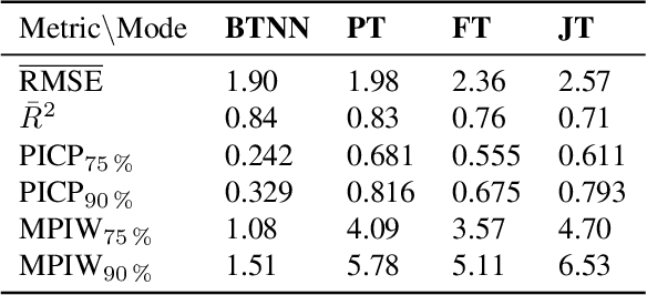

Abstract:Accurate lake temperature estimation is essential for numerous problems tackled in both hydrological and ecological domains. Nowadays physical models are developed to estimate lake dynamics; however, computations needed for accurate estimation of lake surface temperature can get prohibitively expensive. We propose to aggregate simulations of lake temperature at a certain depth together with a range of meteorological features to probabilistically estimate lake surface temperature. Accordingly, we introduce a spatio-temporal neural network that combines Bayesian recurrent neural networks and Bayesian graph convolutional neural networks. This work demonstrates that the proposed graphical model can deliver homogeneously good performance covering the whole lake surface despite having sparse training data available. Quantitative results are compared with a state-of-the-art Bayesian deep learning method. Code for the developed architectural layers, as well as demo scripts, are available on https://renkulab.io/projects/das/bstnn.
Integrated monitoring of ice in selected Swiss lakes. Final project report
Aug 02, 2020
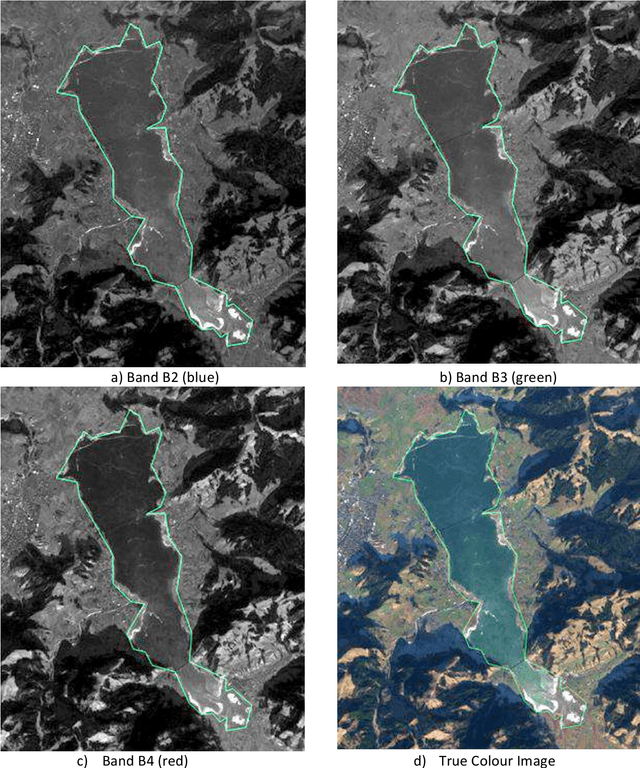

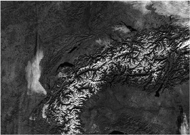
Abstract:Various lake observables, including lake ice, are related to climate and climate change and provide a good opportunity for long-term monitoring. Lakes (and as part of them lake ice) is therefore considered an Essential Climate Variable (ECV) of the Global Climate Observing System (GCOS). Following the need for an integrated multi-temporal monitoring of lake ice in Switzerland, MeteoSwiss in the framework of GCOS Switzerland supported this 2-year project to explore not only the use of satellite images but also the possibilities of Webcams and in-situ measurements. The aim of this project is to monitor some target lakes and detect the extent of ice and especially the ice-on/off dates, with focus on the integration of various input data and processing methods. The target lakes are: St. Moritz, Silvaplana, Sils, Sihl, Greifen and Aegeri, whereby only the first four were mainly frozen during the observation period and thus processed. The observation period was mainly the winter 2016-17. During the project, various approaches were developed, implemented, tested and compared. Firstly, low spatial resolution (250 - 1000 m) but high temporal resolution (1 day) satellite images from the optical sensors MODIS and VIIRS were used. Secondly, and as a pilot project, the use of existing public Webcams was investigated for (a) validation of results from satellite data, and (b) independent estimation of lake ice, especially for small lakes like St. Moritz, that could not be possibly monitored in the satellite images. Thirdly, in-situ measurements were made in order to characterize the development of the temperature profiles and partly pressure before freezing and under the ice-cover until melting. This report presents the results of the project work.
 Add to Chrome
 Add to Firefox
 Add to Edge