David Anastasiu
Synthetic Distracted Driving (SynDD1) dataset for analyzing distracted behaviors and various gaze zones of a driver
Apr 19, 2022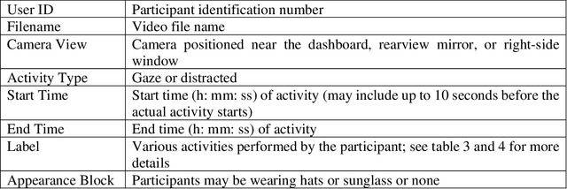
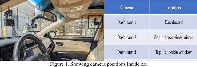

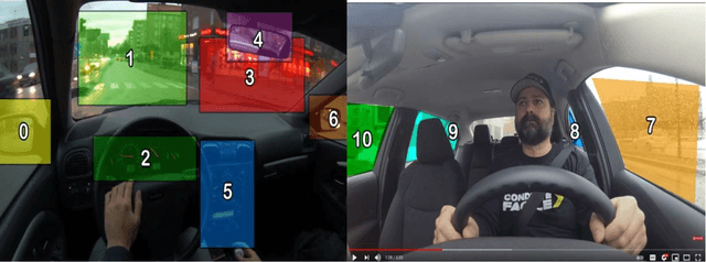
Abstract:This article presents a synthetic distracted driving (SynDD1) dataset for machine learning models to detect and analyze drivers' various distracted behavior and different gaze zones. We collected the data in a stationary vehicle using three in-vehicle cameras positioned at locations: on the dashboard, near the rearview mirror, and on the top right-side window corner. The dataset contains two activity types: distracted activities, and gaze zones for each participant and each activity type has two sets: without appearance blocks and with appearance blocks such as wearing a hat or sunglasses. The order and duration of each activity for each participant are random. In addition, the dataset contains manual annotations for each activity, having its start and end time annotated. Researchers could use this dataset to evaluate the performance of machine learning algorithms for the classification of various distracting activities and gaze zones of drivers.
The 4th AI City Challenge
Apr 30, 2020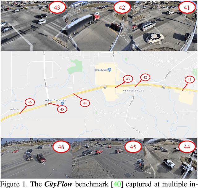
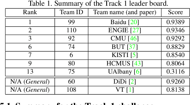
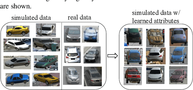
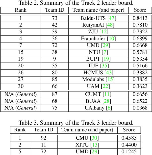
Abstract:The AI City Challenge was created to accelerate intelligent video analysis that helps make cities smarter and safer. Transportation is one of the largest segments that can benefit from actionable insights derived from data captured by sensors, where computer vision and deep learning have shown promise in achieving large-scale practical deployment. The 4th annual edition of the AI City Challenge has attracted 315 participating teams across 37 countries, who leveraged city-scale real traffic data and high-quality synthetic data to compete in four challenge tracks. Track 1 addressed video-based automatic vehicle counting, where the evaluation is conducted on both algorithmic effectiveness and computational efficiency. Track 2 addressed city-scale vehicle re-identification with augmented synthetic data to substantially increase the training set for the task. Track 3 addressed city-scale multi-target multi-camera vehicle tracking. Track 4 addressed traffic anomaly detection. The evaluation system shows two leader boards, in which a general leader board shows all submitted results, and a public leader board shows results limited to our contest participation rules, that teams are not allowed to use external data in their work. The public leader board shows results more close to real-world situations where annotated data are limited. Our results show promise that AI technology can enable smarter and safer transportation systems.
CityFlow: A City-Scale Benchmark for Multi-Target Multi-Camera Vehicle Tracking and Re-Identification
Apr 05, 2019


Abstract:Urban traffic optimization using traffic cameras as sensors is driving the need to advance state-of-the-art multi-target multi-camera (MTMC) tracking. This work introduces CityFlow, a city-scale traffic camera dataset consisting of more than 3 hours of synchronized HD videos from 40 cameras across 10 intersections, with the longest distance between two simultaneous cameras being 2.5 km. To the best of our knowledge, CityFlow is the largest-scale dataset in terms of spatial coverage and the number of cameras/videos in an urban environment. The dataset contains more than 200K annotated bounding boxes covering a wide range of scenes, viewing angles, vehicle models, and urban traffic flow conditions. Camera geometry and calibration information are provided to aid spatio-temporal analysis. In addition, a subset of the benchmark is made available for the task of image-based vehicle re-identification (ReID). We conducted an extensive experimental evaluation of baselines/state-of-the-art approaches in MTMC tracking, multi-target single-camera (MTSC) tracking, object detection, and image-based ReID on this dataset, analyzing the impact of different network architectures, loss functions, spatio-temporal models and their combinations on task effectiveness. An evaluation server is launched with the release of our benchmark at the 2019 AI City Challenge (https://www.aicitychallenge.org/) that allows researchers to compare the performance of their newest techniques. We expect this dataset to catalyze research in this field, propel the state-of-the-art forward, and lead to deployed traffic optimization(s) in the real world.
 Add to Chrome
 Add to Firefox
 Add to Edge