Miguel Mahecha
AI for Extreme Event Modeling and Understanding: Methodologies and Challenges
Jun 28, 2024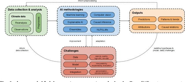

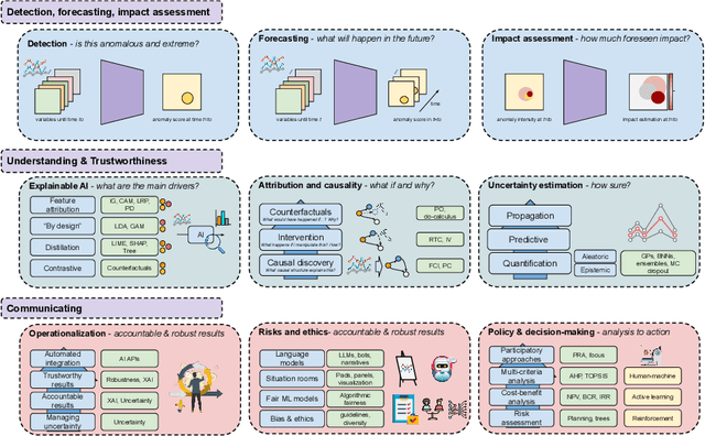

Abstract:In recent years, artificial intelligence (AI) has deeply impacted various fields, including Earth system sciences. Here, AI improved weather forecasting, model emulation, parameter estimation, and the prediction of extreme events. However, the latter comes with specific challenges, such as developing accurate predictors from noisy, heterogeneous and limited annotated data. This paper reviews how AI is being used to analyze extreme events (like floods, droughts, wildfires and heatwaves), highlighting the importance of creating accurate, transparent, and reliable AI models. We discuss the hurdles of dealing with limited data, integrating information in real-time, deploying models, and making them understandable, all crucial for gaining the trust of stakeholders and meeting regulatory needs. We provide an overview of how AI can help identify and explain extreme events more effectively, improving disaster response and communication. We emphasize the need for collaboration across different fields to create AI solutions that are practical, understandable, and trustworthy for analyzing and predicting extreme events. Such collaborative efforts aim to enhance disaster readiness and disaster risk reduction.
Predicting Landscapes from Environmental Conditions Using Generative Networks
Sep 23, 2019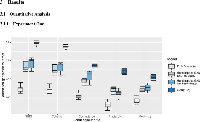

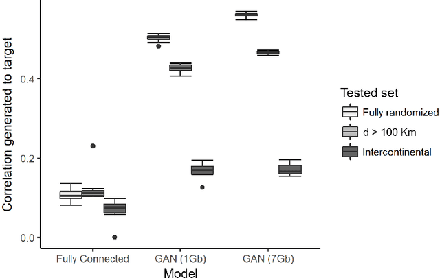
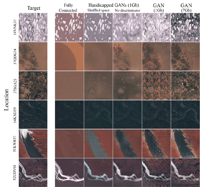
Abstract:Landscapes are meaningful ecological units that strongly depend on the environmental conditions. Such dependencies between landscapes and the environment have been noted since the beginning of Earth sciences and cast into conceptual models describing the interdependencies of climate, geology, vegetation and geomorphology. Here, we ask whether landscapes, as seen from space, can be statistically predicted from pertinent environmental conditions. To this end we adapted a deep learning generative model in order to establish the relationship between the environmental conditions and the view of landscapes from the Sentinel-2 satellite. We trained a conditional generative adversarial network to generate multispectral imagery given a set of climatic, terrain and anthropogenic predictors. The generated imagery of the landscapes share many characteristics with the real one. Results based on landscape patch metrics, indicative of landscape composition and structure, show that the proposed generative model creates landscapes that are more similar to the targets than the baseline models while overall reflectance and vegetation cover are predicted better. We demonstrate that for many purposes the generated landscapes behave as real with immediate application for global change studies. We envision the application of machine learning as a tool to forecast the effects of climate change on the spatial features of landscapes, while we assess its limitations and breaking points.
Maximally Divergent Intervals for Anomaly Detection
Oct 21, 2016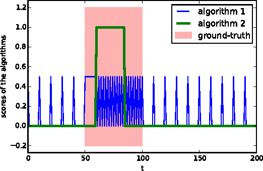
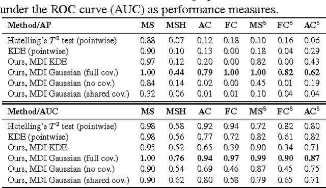
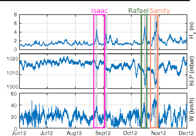
Abstract:We present new methods for batch anomaly detection in multivariate time series. Our methods are based on maximizing the Kullback-Leibler divergence between the data distribution within and outside an interval of the time series. An empirical analysis shows the benefits of our algorithms compared to methods that treat each time step independently from each other without optimizing with respect to all possible intervals.
 Add to Chrome
 Add to Firefox
 Add to Edge