Joëlle Hanna
Neural Plasticity-Inspired Foundation Model for Observing the Earth Crossing Modalities
Mar 22, 2024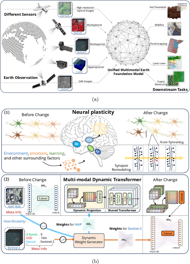
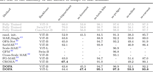
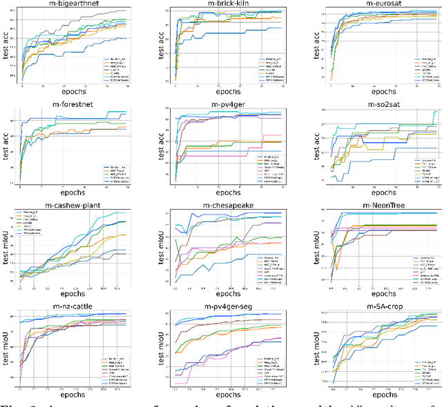
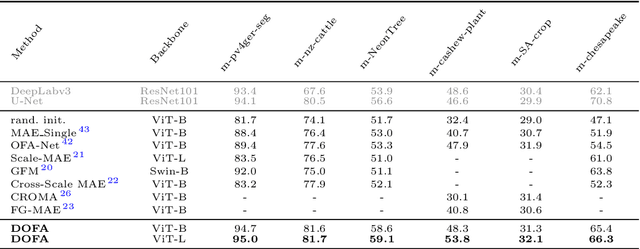
Abstract:The development of foundation models has revolutionized our ability to interpret the Earth's surface using satellite observational data. Traditional models have been siloed, tailored to specific sensors or data types like optical, radar, and hyperspectral, each with its own unique characteristics. This specialization hinders the potential for a holistic analysis that could benefit from the combined strengths of these diverse data sources. Our novel approach introduces the Dynamic One-For-All (DOFA) model, leveraging the concept of neural plasticity in brain science to integrate various data modalities into a single framework adaptively. This dynamic hypernetwork, adjusting to different wavelengths, enables a single versatile Transformer jointly trained on data from five sensors to excel across 12 distinct Earth observation tasks, including sensors never seen during pretraining. DOFA's innovative design offers a promising leap towards more accurate, efficient, and unified Earth observation analysis, showcasing remarkable adaptability and performance in harnessing the potential of multimodal Earth observation data.
Ben-ge: Extending BigEarthNet with Geographical and Environmental Data
Jul 04, 2023Abstract:Deep learning methods have proven to be a powerful tool in the analysis of large amounts of complex Earth observation data. However, while Earth observation data are multi-modal in most cases, only single or few modalities are typically considered. In this work, we present the ben-ge dataset, which supplements the BigEarthNet-MM dataset by compiling freely and globally available geographical and environmental data. Based on this dataset, we showcase the value of combining different data modalities for the downstream tasks of patch-based land-use/land-cover classification and land-use/land-cover segmentation. ben-ge is freely available and expected to serve as a test bed for fully supervised and self-supervised Earth observation applications.
Power Plant Classification from Remote Imaging with Deep Learning
Jul 22, 2021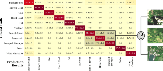

Abstract:Satellite remote imaging enables the detailed study of land use patterns on a global scale. We investigate the possibility to improve the information content of traditional land use classification by identifying the nature of industrial sites from medium-resolution remote sensing images. In this work, we focus on classifying different types of power plants from Sentinel-2 imaging data. Using a ResNet-50 deep learning model, we are able to achieve a mean accuracy of 90.0% in distinguishing 10 different power plant types and a background class. Furthermore, we are able to identify the cooling mechanisms utilized in thermal power plants with a mean accuracy of 87.5%. Our results enable us to qualitatively investigate the energy mix from Sentinel-2 imaging data, and prove the feasibility to classify industrial sites on a global scale from freely available satellite imagery.
 Add to Chrome
 Add to Firefox
 Add to Edge