 Add to Chrome
 Add to Firefox
 Add to Edge
A Survey on Video Analytics in Cloud-Edge-Terminal Collaborative Systems
Feb 10, 2025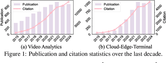
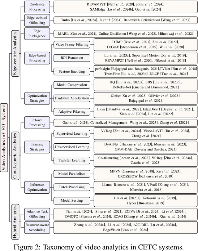
The explosive growth of video data has driven the development of distributed video analytics in cloud-edge-terminal collaborative (CETC) systems, enabling efficient video processing, real-time inference, and privacy-preserving analysis. Among multiple advantages, CETC systems can distribute video processing tasks and enable adaptive analytics across cloud, edge, and terminal devices, leading to breakthroughs in video surveillance, autonomous driving, and smart cities. In this survey, we first analyze fundamental architectural components, including hierarchical, distributed, and hybrid frameworks, alongside edge computing platforms and resource management mechanisms. Building upon these foundations, edge-centric approaches emphasize on-device processing, edge-assisted offloading, and edge intelligence, while cloud-centric methods leverage powerful computational capabilities for complex video understanding and model training. Our investigation also covers hybrid video analytics incorporating adaptive task offloading and resource-aware scheduling techniques that optimize performance across the entire system. Beyond conventional approaches, recent advances in large language models and multimodal integration reveal both opportunities and challenges in platform scalability, data protection, and system reliability. Future directions also encompass explainable systems, efficient processing mechanisms, and advanced video analytics, offering valuable insights for researchers and practitioners in this dynamic field.
U-net super-neural segmentation and similarity calculation to realize vegetation change assessment in satellite imagery
Sep 10, 2019

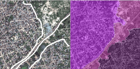
Vegetation is the natural linkage connecting soil, atmosphere and water. It can represent the change of land cover to a certain extent and serve as an indicator for global change research. Methods for measuring coverage can be divided into two types: surface measurement and remote sensing. Because vegetation cover has significant spatial and temporal differentiation characteristics, remote sensing has become an important technical means to estimate vegetation coverage. This paper firstly uses U-net to perform remote sensing image semantic segmentation training, then uses the result of semantic segmentation, and then uses the integral progressive method to calculate the forestland change rate, and finally realizes automated valuation of woodland change rate.