Yingjia Bu
LUAI Challenge 2021 on Learning to Understand Aerial Images
Aug 30, 2021


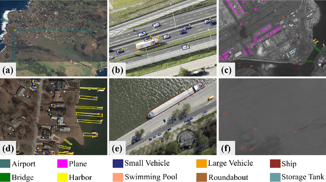
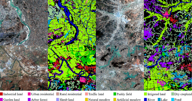
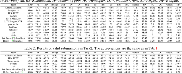
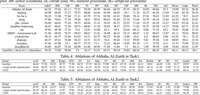
Abstract:This report summarizes the results of Learning to Understand Aerial Images (LUAI) 2021 challenge held on ICCV 2021, which focuses on object detection and semantic segmentation in aerial images. Using DOTA-v2.0 and GID-15 datasets, this challenge proposes three tasks for oriented object detection, horizontal object detection, and semantic segmentation of common categories in aerial images. This challenge received a total of 146 registrations on the three tasks. Through the challenge, we hope to draw attention from a wide range of communities and call for more efforts on the problems of learning to understand aerial images.
PolarDet: A Fast, More Precise Detector for Rotated Target in Aerial Images
Oct 17, 2020


Abstract:Fast and precise object detection for high-resolution aerial images has been a challenging task over the years. Due to the sharp variations on object scale, rotation, and aspect ratio, most existing methods are inefficient and imprecise. In this paper, we represent the oriented objects by polar method in polar coordinate and propose PolarDet, a fast and accurate one-stage object detector based on that representation. Our detector introduces a sub-pixel center semantic structure to further improve classifying veracity. PolarDet achieves nearly all SOTA performance in aerial object detection tasks with faster inference speed. In detail, our approach obtains the SOTA results on DOTA, UCAS-AOD, HRSC with 76.64\% mAP, 97.01\% mAP, and 90.46\% mAP respectively. Most noticeably, our PolarDet gets the best performance and reaches the fastest speed(32fps) at the UCAS-AOD dataset.
 Add to Chrome
 Add to Firefox
 Add to Edge