Xinglian Zhang
LiDAR-based HD Map Localization using Semantic Generalized ICP with Road Marking Detection
Jul 02, 2024Abstract:In GPS-denied scenarios, a robust environmental perception and localization system becomes crucial for autonomous driving. In this paper, a LiDAR-based online localization system is developed, incorporating road marking detection and registration on a high-definition (HD) map. Within our system, a road marking detection approach is proposed with real-time performance, in which an adaptive segmentation technique is first introduced to isolate high-reflectance points correlated with road markings, enhancing real-time efficiency. Then, a spatio-temporal probabilistic local map is formed by aggregating historical LiDAR scans, providing a dense point cloud. Finally, a LiDAR bird's-eye view (LiBEV) image is generated, and an instance segmentation network is applied to accurately label the road markings. For road marking registration, a semantic generalized iterative closest point (SG-ICP) algorithm is designed. Linear road markings are modeled as 1-manifolds embedded in 2D space, mitigating the influence of constraints along the linear direction, addressing the under-constrained problem and achieving a higher localization accuracy on HD maps than ICP. Extensive experiments are conducted in real-world scenarios, demonstrating the effectiveness and robustness of our system.
Automatic Vector-based Road Structure Mapping Using Multi-beam LiDAR
Jun 06, 2018

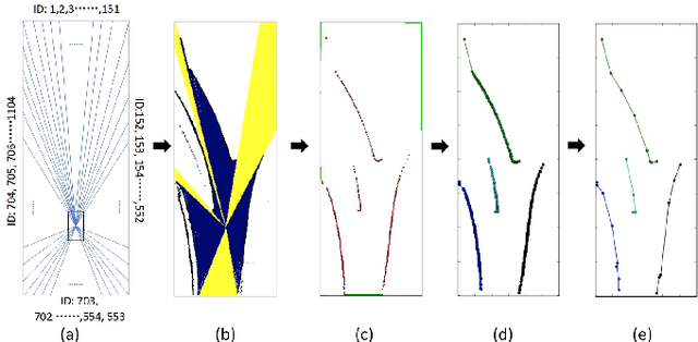
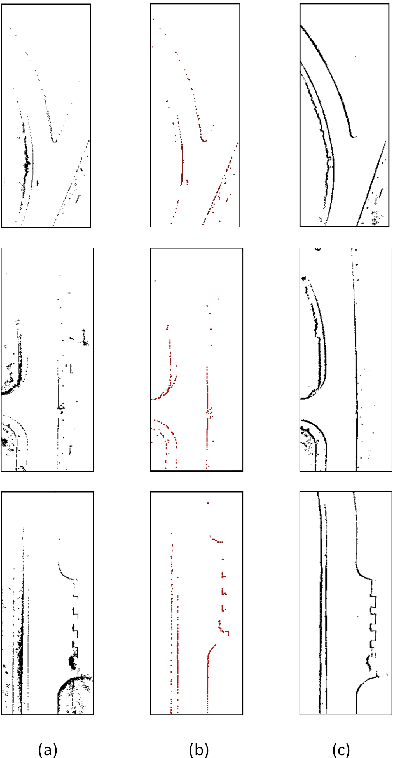
Abstract:In this paper, we studied a SLAM method for vector-based road structure mapping using multi-beam LiDAR. We propose to use the polyline as the primary mapping element instead of grid cell or point cloud, because the vector-based representation is precise and lightweight, and it can directly generate vector-based High-Definition (HD) driving map as demanded by autonomous driving systems. We explored: 1) the extraction and vectorization of road structures based on local probabilistic fusion. 2) the efficient vector-based matching between frames of road structures. 3) the loop closure and optimization based on the pose-graph. In this study, we took a specific road structure, the road boundary, as an example. We applied the proposed matching method in three different scenes and achieved the average absolute matching error of 0.07. We further applied the mapping system to the urban road with the length of 860 meters and achieved an average global accuracy of 0.466 m without the help of high precision GPS.
TiEV: The Tongji Intelligent Electric Vehicle in the Intelligent Vehicle Future Challenge of China
May 07, 2018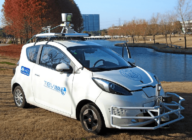
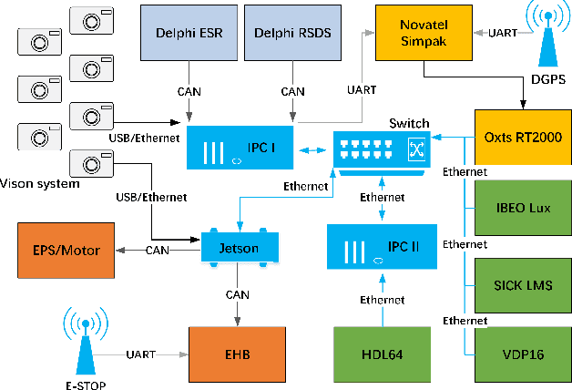
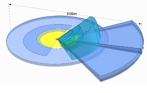
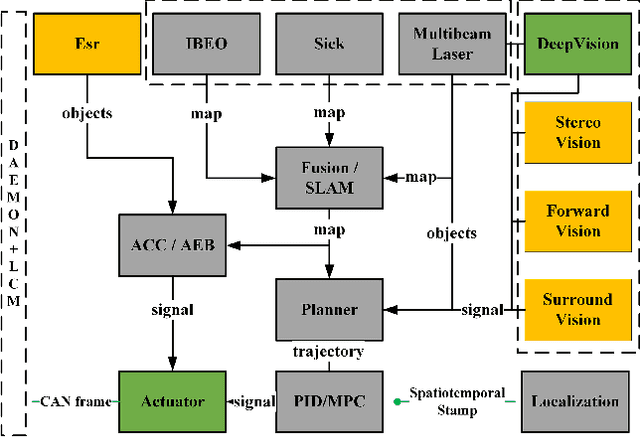
Abstract:TiEV is an autonomous driving platform implemented by Tongji University of China. The vehicle is drive-by-wire and is fully powered by electricity. We devised the software system of TiEV from scratch, which is capable of driving the vehicle autonomously in urban paths as well as on fast express roads. We describe our whole system, especially novel modules of probabilistic perception fusion, incremental mapping, the 1st and the 2nd planning and the overall safety concern. TiEV finished 2016 and 2017 Intelligent Vehicle Future Challenge of China held at Changshu. We show our experiences on the development of autonomous vehicles and future trends.
 Add to Chrome
 Add to Firefox
 Add to Edge