Stavya Datta
NEUSIS: A Compositional Neuro-Symbolic Framework for Autonomous Perception, Reasoning, and Planning in Complex UAV Search Missions
Sep 16, 2024


Abstract:This paper addresses the problem of autonomous UAV search missions, where a UAV must locate specific Entities of Interest (EOIs) within a time limit, based on brief descriptions in large, hazard-prone environments with keep-out zones. The UAV must perceive, reason, and make decisions with limited and uncertain information. We propose NEUSIS, a compositional neuro-symbolic system designed for interpretable UAV search and navigation in realistic scenarios. NEUSIS integrates neuro-symbolic visual perception, reasoning, and grounding (GRiD) to process raw sensory inputs, maintains a probabilistic world model for environment representation, and uses a hierarchical planning component (SNaC) for efficient path planning. Experimental results from simulated urban search missions using AirSim and Unreal Engine show that NEUSIS outperforms a state-of-the-art (SOTA) vision-language model and a SOTA search planning model in success rate, search efficiency, and 3D localization. These results demonstrate the effectiveness of our compositional neuro-symbolic approach in handling complex, real-world scenarios, making it a promising solution for autonomous UAV systems in search missions.
JRDB-PanoTrack: An Open-world Panoptic Segmentation and Tracking Robotic Dataset in Crowded Human Environments
Apr 02, 2024


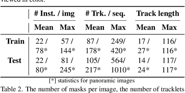
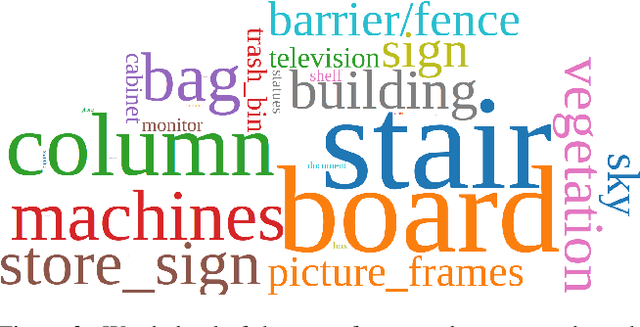
Abstract:Autonomous robot systems have attracted increasing research attention in recent years, where environment understanding is a crucial step for robot navigation, human-robot interaction, and decision. Real-world robot systems usually collect visual data from multiple sensors and are required to recognize numerous objects and their movements in complex human-crowded settings. Traditional benchmarks, with their reliance on single sensors and limited object classes and scenarios, fail to provide the comprehensive environmental understanding robots need for accurate navigation, interaction, and decision-making. As an extension of JRDB dataset, we unveil JRDB-PanoTrack, a novel open-world panoptic segmentation and tracking benchmark, towards more comprehensive environmental perception. JRDB-PanoTrack includes (1) various data involving indoor and outdoor crowded scenes, as well as comprehensive 2D and 3D synchronized data modalities; (2) high-quality 2D spatial panoptic segmentation and temporal tracking annotations, with additional 3D label projections for further spatial understanding; (3) diverse object classes for closed- and open-world recognition benchmarks, with OSPA-based metrics for evaluation. Extensive evaluation of leading methods shows significant challenges posed by our dataset.
 Add to Chrome
 Add to Firefox
 Add to Edge