Daniel Feldman
Snowpack Estimation in Key Mountainous Water Basins from Openly-Available, Multimodal Data Sources
Aug 08, 2022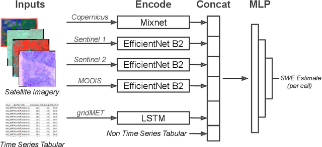
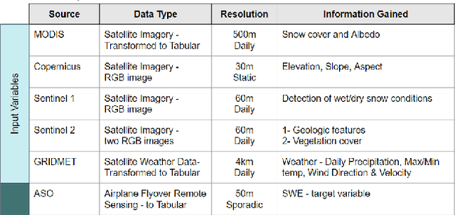
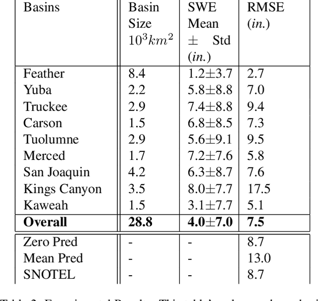
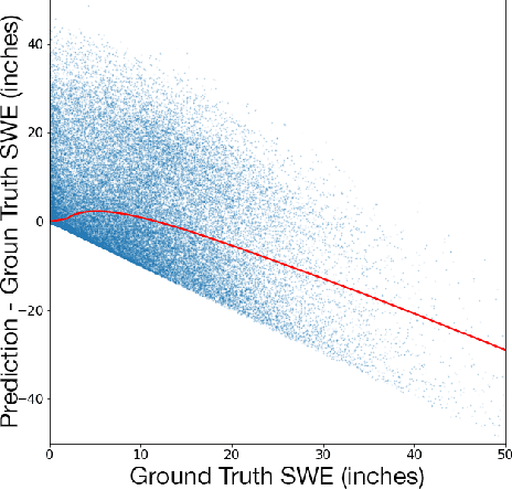
Abstract:Accurately estimating the snowpack in key mountainous basins is critical for water resource managers to make decisions that impact local and global economies, wildlife, and public policy. Currently, this estimation requires multiple LiDAR-equipped plane flights or in situ measurements, both of which are expensive, sparse, and biased towards accessible regions. In this paper, we demonstrate that fusing spatial and temporal information from multiple, openly-available satellite and weather data sources enables estimation of snowpack in key mountainous regions. Our multisource model outperforms single-source estimation by 5.0 inches RMSE, as well as outperforms sparse in situ measurements by 1.2 inches RMSE.
Data-Independent Structured Pruning of Neural Networks via Coresets
Aug 19, 2020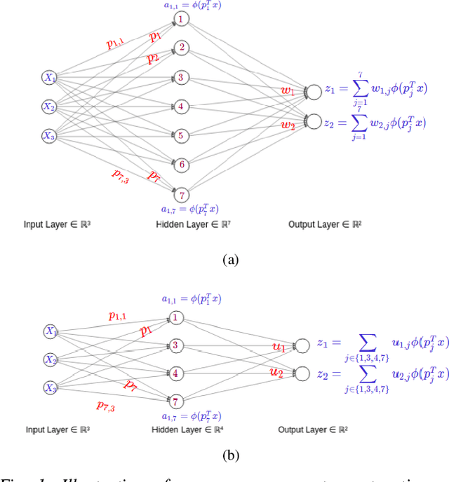
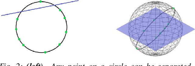
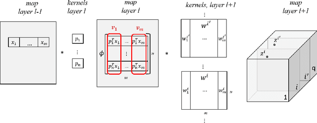

Abstract:Model compression is crucial for deployment of neural networks on devices with limited computational and memory resources. Many different methods show comparable accuracy of the compressed model and similar compression rates. However, the majority of the compression methods are based on heuristics and offer no worst-case guarantees on the trade-off between the compression rate and the approximation error for an arbitrarily new sample. We propose the first efficient structured pruning algorithm with a provable trade-off between its compression rate and the approximation error for any future test sample. Our method is based on the coreset framework and it approximates the output of a layer of neurons/filters by a coreset of neurons/filters in the previous layer and discards the rest. We apply this framework in a layer-by-layer fashion from the bottom to the top. Unlike previous works, our coreset is data independent, meaning that it provably guarantees the accuracy of the function for any input $x\in \mathbb{R}^d$, including an adversarial one.
 Add to Chrome
 Add to Firefox
 Add to Edge