Arun Narenthiran Sivakumar
CropNav: a Framework for Autonomous Navigation in Real Farms
Nov 17, 2024


Abstract:Small robots that can operate under the plant canopy can enable new possibilities in agriculture. However, unlike larger autonomous tractors, autonomous navigation for such under canopy robots remains an open challenge because Global Navigation Satellite System (GNSS) is unreliable under the plant canopy. We present a hybrid navigation system that autonomously switches between different sets of sensing modalities to enable full field navigation, both inside and outside of crop. By choosing the appropriate path reference source, the robot can accommodate for loss of GNSS signal quality and leverage row-crop structure to autonomously navigate. However, such switching can be tricky and difficult to execute over scale. Our system provides a solution by automatically switching between an exteroceptive sensing based system, such as Light Detection And Ranging (LiDAR) row-following navigation and waypoints path tracking. In addition, we show how our system can detect when the navigate fails and recover automatically extending the autonomous time and mitigating the necessity of human intervention. Our system shows an improvement of about 750 m per intervention over GNSS-based navigation and 500 m over row following navigation.
WayFASTER: a Self-Supervised Traversability Prediction for Increased Navigation Awareness
Feb 01, 2024Abstract:Accurate and robust navigation in unstructured environments requires fusing data from multiple sensors. Such fusion ensures that the robot is better aware of its surroundings, including areas of the environment that are not immediately visible, but were visible at a different time. To solve this problem, we propose a method for traversability prediction in challenging outdoor environments using a sequence of RGB and depth images fused with pose estimations. Our method, termed WayFASTER (Waypoints-Free Autonomous System for Traversability with Enhanced Robustness), uses experience data recorded from a receding horizon estimator to train a self-supervised neural network for traversability prediction, eliminating the need for heuristics. Our experiments demonstrate that our method excels at avoiding geometric obstacles, and correctly detects that traversable terrains, such as tall grass, can be navigable. By using a sequence of images, WayFASTER significantly enhances the robot's awareness of its surroundings, enabling it to predict the traversability of terrains that are not immediately visible. This enhanced awareness contributes to better navigation performance in environments where such predictive capabilities are essential.
Proactive Anomaly Detection for Robot Navigation with Multi-Sensor Fusion
Apr 03, 2022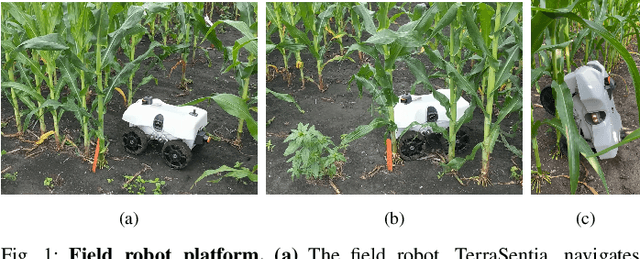
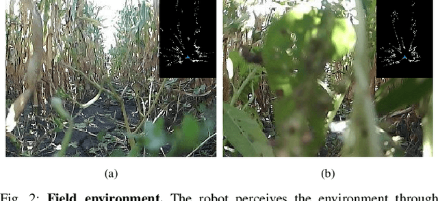
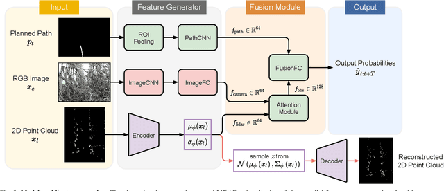
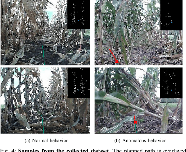
Abstract:Despite the rapid advancement of navigation algorithms, mobile robots often produce anomalous behaviors that can lead to navigation failures. The ability to detect such anomalous behaviors is a key component in modern robots to achieve high-levels of autonomy. Reactive anomaly detection methods identify anomalous task executions based on the current robot state and thus lack the ability to alert the robot before an actual failure occurs. Such an alert delay is undesirable due to the potential damage to both the robot and the surrounding objects. We propose a proactive anomaly detection network (PAAD) for robot navigation in unstructured and uncertain environments. PAAD predicts the probability of future failure based on the planned motions from the predictive controller and the current observation from the perception module. Multi-sensor signals are fused effectively to provide robust anomaly detection in the presence of sensor occlusion as seen in field environments. Our experiments on field robot data demonstrates superior failure identification performance than previous methods, and that our model can capture anomalous behaviors in real-time while maintaining a low false detection rate in cluttered fields. Code, dataset, and video are available at https://github.com/tianchenji/PAAD
WayFAST: Traversability Predictive Navigation for Field Robots
Mar 22, 2022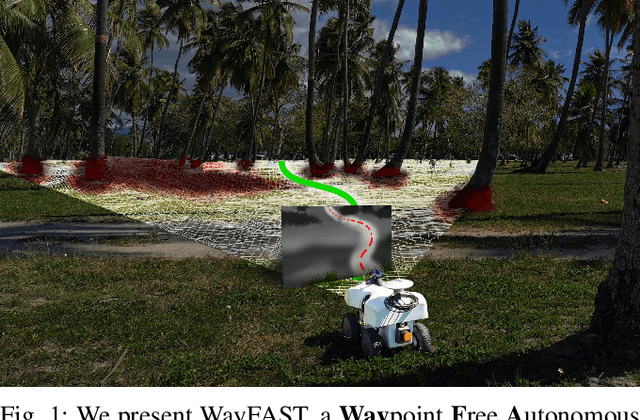
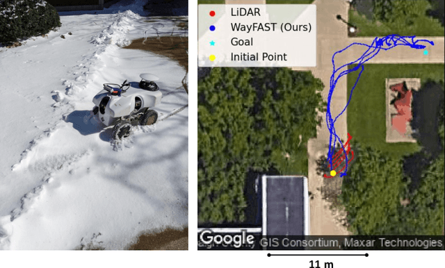
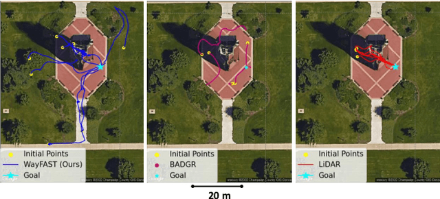
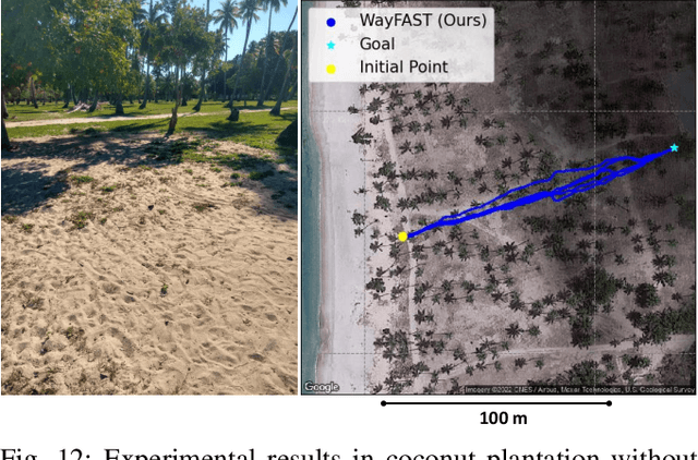
Abstract:We present a self-supervised approach for learning to predict traversable paths for wheeled mobile robots that require good traction to navigate. Our algorithm, termed WayFAST (Waypoint Free Autonomous Systems for Traversability), uses RGB and depth data, along with navigation experience, to autonomously generate traversable paths in outdoor unstructured environments. Our key inspiration is that traction can be estimated for rolling robots using kinodynamic models. Using traction estimates provided by an online receding horizon estimator, we are able to train a traversability prediction neural network in a self-supervised manner, without requiring heuristics utilized by previous methods. We demonstrate the effectiveness of WayFAST through extensive field testing in varying environments, ranging from sandy dry beaches to forest canopies and snow covered grass fields. Our results clearly demonstrate that WayFAST can learn to avoid geometric obstacles as well as untraversable terrain, such as snow, which would be difficult to avoid with sensors that provide only geometric data, such as LiDAR. Furthermore, we show that our training pipeline based on online traction estimates is more data-efficient than other heuristic-based methods.
Learned Visual Navigation for Under-Canopy Agricultural Robots
Jul 06, 2021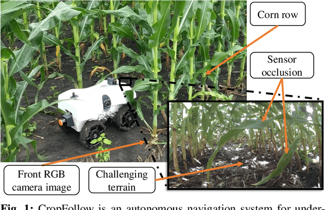
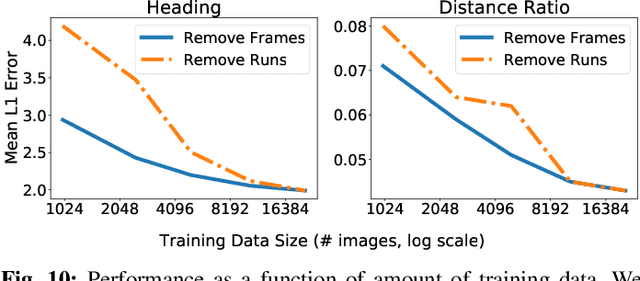
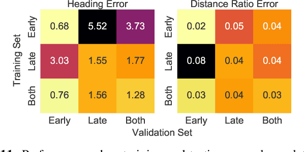

Abstract:We describe a system for visually guided autonomous navigation of under-canopy farm robots. Low-cost under-canopy robots can drive between crop rows under the plant canopy and accomplish tasks that are infeasible for over-the-canopy drones or larger agricultural equipment. However, autonomously navigating them under the canopy presents a number of challenges: unreliable GPS and LiDAR, high cost of sensing, challenging farm terrain, clutter due to leaves and weeds, and large variability in appearance over the season and across crop types. We address these challenges by building a modular system that leverages machine learning for robust and generalizable perception from monocular RGB images from low-cost cameras, and model predictive control for accurate control in challenging terrain. Our system, CropFollow, is able to autonomously drive 485 meters per intervention on average, outperforming a state-of-the-art LiDAR based system (286 meters per intervention) in extensive field testing spanning over 25 km.
Multi-Sensor Fusion based Robust Row Following for Compact Agricultural Robots
Jun 28, 2021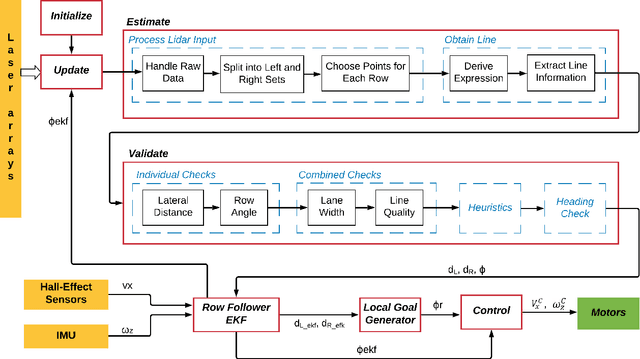
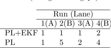
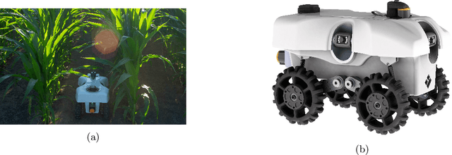

Abstract:This paper presents a state-of-the-art LiDAR based autonomous navigation system for under-canopy agricultural robots. Under-canopy agricultural navigation has been a challenging problem because GNSS and other positioning sensors are prone to significant errors due to attentuation and multi-path caused by crop leaves and stems. Reactive navigation by detecting crop rows using LiDAR measurements is a better alternative to GPS but suffers from challenges due to occlusion from leaves under the canopy. Our system addresses this challenge by fusing IMU and LiDAR measurements using an Extended Kalman Filter framework on low-cost hardwware. In addition, a local goal generator is introduced to provide locally optimal reference trajectories to the onboard controller. Our system is validated extensively in real-world field environments over a distance of 50.88~km on multiple robots in different field conditions across different locations. We report state-of-the-art distance between intervention results, showing that our system is able to safely navigate without interventions for 386.9~m on average in fields without significant gaps in the crop rows, 56.1~m in production fields and 47.5~m in fields with gaps (space of 1~m without plants in both sides of the row).
 Add to Chrome
 Add to Firefox
 Add to Edge