Tobias Tiecke
Sub-meter resolution canopy height maps using self-supervised learning and a vision transformer trained on Aerial and GEDI Lidar
Apr 17, 2023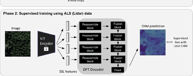

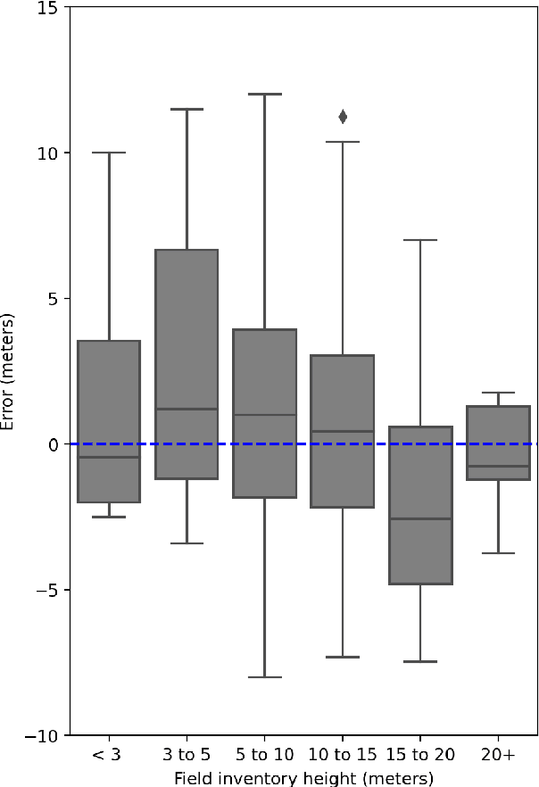
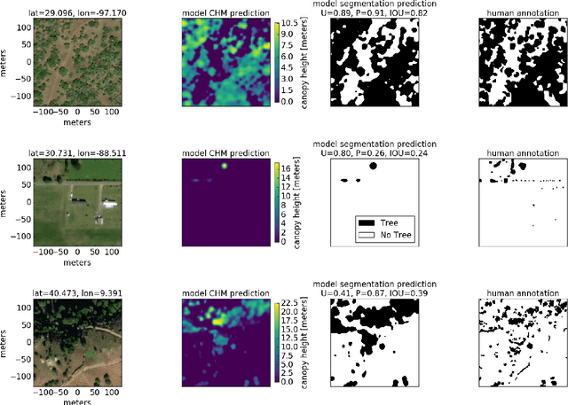
Abstract:Vegetation structure mapping is critical for understanding the global carbon cycle and monitoring nature-based approaches to climate adaptation and mitigation. Repeat measurements of these data allow for the observation of deforestation or degradation of existing forests, natural forest regeneration, and the implementation of sustainable agricultural practices like agroforestry. Assessments of tree canopy height and crown projected area at a high spatial resolution are also important for monitoring carbon fluxes and assessing tree-based land uses, since forest structures can be highly spatially heterogeneous, especially in agroforestry systems. Very high resolution satellite imagery (less than one meter (1m) ground sample distance) makes it possible to extract information at the tree level while allowing monitoring at a very large scale. This paper presents the first high-resolution canopy height map concurrently produced for multiple sub-national jurisdictions. Specifically, we produce canopy height maps for the states of California and S\~{a}o Paolo, at sub-meter resolution, a significant improvement over the ten meter (10m) resolution of previous Sentinel / GEDI based worldwide maps of canopy height. The maps are generated by applying a vision transformer to features extracted from a self-supervised model in Maxar imagery from 2017 to 2020, and are trained against aerial lidar and GEDI observations. We evaluate the proposed maps with set-aside validation lidar data as well as by comparing with other remotely sensed maps and field-collected data, and find our model produces an average Mean Absolute Error (MAE) within set-aside validation areas of 3.0 meters.
Building Detection from Satellite Images on a Global Scale
Jul 27, 2017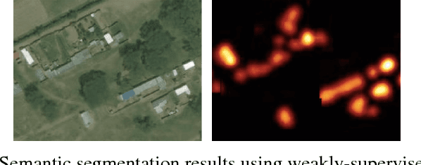
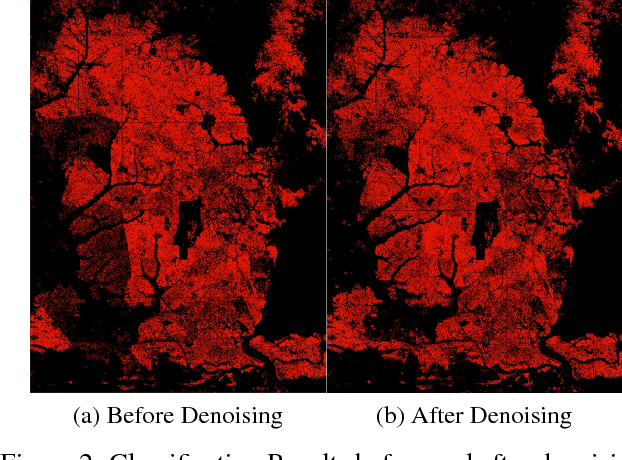
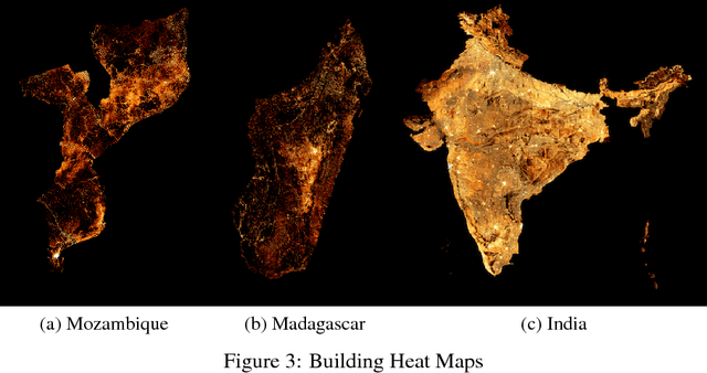
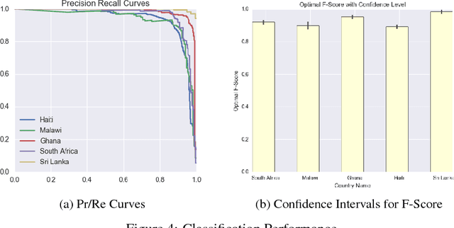
Abstract:In the last several years, remote sensing technology has opened up the possibility of performing large scale building detection from satellite imagery. Our work is some of the first to create population density maps from building detection on a large scale. The scale of our work on population density estimation via high resolution satellite images raises many issues, that we will address in this paper. The first was data acquisition. Labeling buildings from satellite images is a hard problem, one where we found our labelers to only be about 85% accurate at. There is a tradeoff of quantity vs. quality of labels, so we designed two separate policies for labels meant for training sets and those meant for test sets, since our requirements of the two set types are quite different. We also trained weakly supervised footprint detection models with the classification labels, and semi-supervised approaches with a small number of pixel-level labels, which are very expensive to procure.
Feedback Neural Network for Weakly Supervised Geo-Semantic Segmentation
Dec 08, 2016
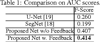
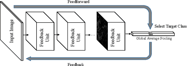

Abstract:Learning from weakly-supervised data is one of the main challenges in machine learning and computer vision, especially for tasks such as image semantic segmentation where labeling is extremely expensive and subjective. In this paper, we propose a novel neural network architecture to perform weakly-supervised learning by suppressing irrelevant neuron activations. It localizes objects of interest by learning from image-level categorical labels in an end-to-end manner. We apply this algorithm to a practical challenge of transforming satellite images into a map of settlements and individual buildings. Experimental results show that the proposed algorithm achieves superior performance and efficiency when compared with various baseline models.
 Add to Chrome
 Add to Firefox
 Add to Edge