Tanya Birch
A community palm model
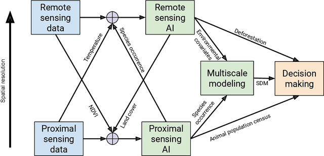
May 01, 2024Abstract:Palm oil production has been identified as one of the major drivers of deforestation for tropical countries. To meet supply chain objectives, commodity producers and other stakeholders need timely information of land cover dynamics in their supply shed. However, such data are difficult to obtain from suppliers who may lack digital geographic representations of their supply sheds and production locations. Here we present a "community model," a machine learning model trained on pooled data sourced from many different stakeholders, to develop a specific land cover probability map, in this case a semi-global oil palm map. An advantage of this method is the inclusion of varied inputs, the ability to easily update the model as new training data becomes available and run the model on any year that input imagery is available. Inclusion of diverse data sources into one probability map can help establish a shared understanding across stakeholders on the presence and absence of a land cover or commodity (in this case oil palm). The model predictors are annual composites built from publicly available satellite imagery provided by Sentinel-1, Sentinel-2, and ALOS DSM. We provide map outputs as the probability of palm in a given pixel, to reflect the uncertainty of the underlying state (palm or not palm). The initial version of this model provides global accuracy estimated to be approximately 90% (at 0.5 probability threshold) from spatially partitioned test data. This model, and resulting oil palm probability map products are useful for accurately identifying the geographic footprint of palm cultivation. Used in conjunction with timely deforestation information, this palm model is useful for understanding the risk of continued oil palm plantation expansion in sensitive forest areas.
Reflections from the Workshop on AI-Assisted Decision Making for Conservation
Jul 17, 2023


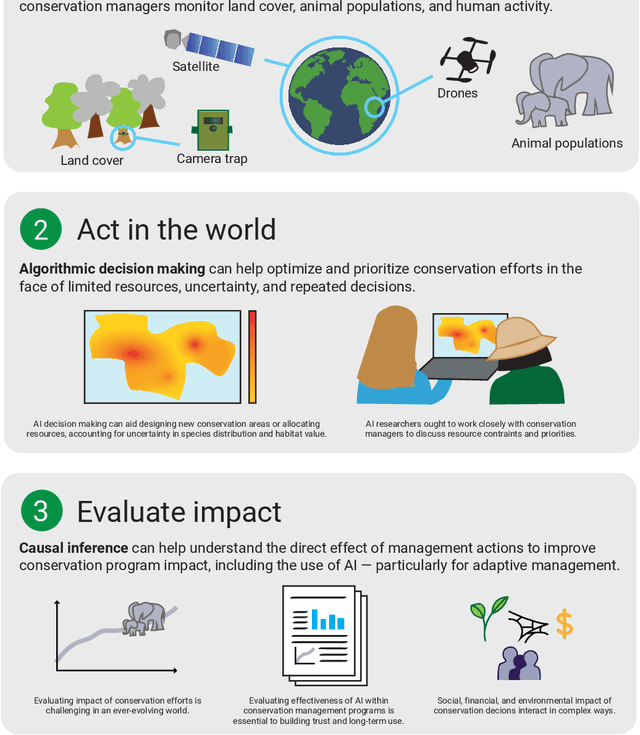
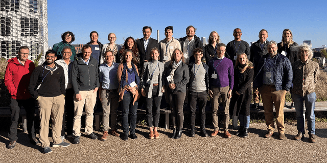
Abstract:In this white paper, we synthesize key points made during presentations and discussions from the AI-Assisted Decision Making for Conservation workshop, hosted by the Center for Research on Computation and Society at Harvard University on October 20-21, 2022. We identify key open research questions in resource allocation, planning, and interventions for biodiversity conservation, highlighting conservation challenges that not only require AI solutions, but also require novel methodological advances. In addition to providing a summary of the workshop talks and discussions, we hope this document serves as a call-to-action to orient the expansion of algorithmic decision-making approaches to prioritize real-world conservation challenges, through collaborative efforts of ecologists, conservation decision-makers, and AI researchers.
Unifying data for fine-grained visual species classification
Sep 24, 2020
Abstract:Wildlife monitoring is crucial to nature conservation and has been done by manual observations from motion-triggered camera traps deployed in the field. Widespread adoption of such in-situ sensors has resulted in unprecedented data volumes being collected over the last decade. A significant challenge exists to process and reliably identify what is in these images efficiently. Advances in computer vision are poised to provide effective solutions with custom AI models built to automatically identify images of interest and label the species in them. Here we outline the data unification effort for the Wildlife Insights platform from various conservation partners, and the challenges involved. Then we present an initial deep convolutional neural network model, trained on 2.9M images across 465 fine-grained species, with a goal to reduce the load on human experts to classify species in images manually. The long-term goal is to enable scientists to make conservation recommendations from near real-time analysis of species abundance and population health.
 Add to Chrome
 Add to Firefox
 Add to Edge