Qiumin Zhu
IMOST: Incremental Memory Mechanism with Online Self-Supervision for Continual Traversability Learning
Sep 21, 2024


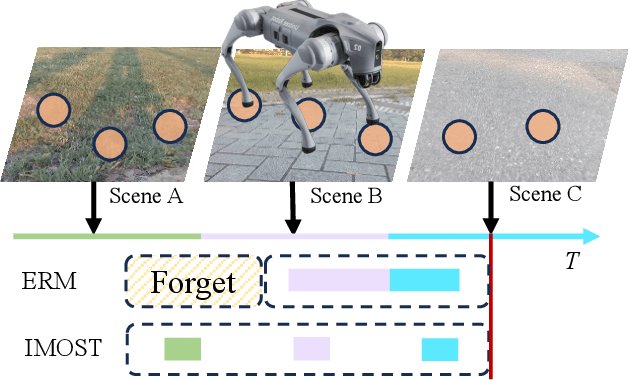
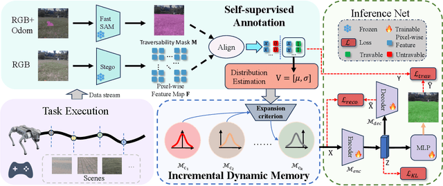
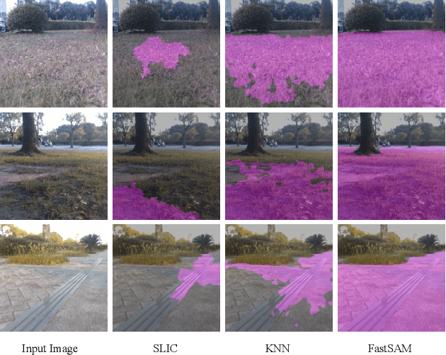
Abstract:Traversability estimation is the foundation of path planning for a general navigation system. However, complex and dynamic environments pose challenges for the latest methods using self-supervised learning (SSL) technique. Firstly, existing SSL-based methods generate sparse annotations lacking detailed boundary information. Secondly, their strategies focus on hard samples for rapid adaptation, leading to forgetting and biased predictions. In this work, we propose IMOST, a continual traversability learning framework composed of two key modules: incremental dynamic memory (IDM) and self-supervised annotation (SSA). By mimicking human memory mechanisms, IDM allocates novel data samples to new clusters according to information expansion criterion. It also updates clusters based on diversity rule, ensuring a representative characterization of new scene. This mechanism enhances scene-aware knowledge diversity while maintaining a compact memory capacity. The SSA module, integrating FastSAM, utilizes point prompts to generate complete annotations in real time which reduces training complexity. Furthermore, IMOST has been successfully deployed on the quadruped robot, with performance evaluated during the online learning process. Experimental results on both public and self-collected datasets demonstrate that our IMOST outperforms current state-of-the-art method, maintains robust recognition capabilities and adaptability across various scenarios. The code is available at https://github.com/SJTU-MKH/OCLTrav.
Learning-based Traversability Costmap for Autonomous Off-road Navigation
Jun 12, 2024


Abstract:Traversability estimation in off-road terrains is an essential procedure for autonomous navigation. However, creating reliable labels for complex interactions between the robot and the surface is still a challenging problem in learning-based costmap generation. To address this, we propose a method that predicts traversability costmaps by leveraging both visual and geometric information of the environment. To quantify the surface properties like roughness and bumpiness, we introduce a novel way of risk-aware labelling with proprioceptive information for network training. We validate our method in costmap prediction and navigation tasks for complex off-road scenarios. Our results demonstrate that our costmap prediction method excels in terms of average accuracy and MSE. The navigation results indicate that using our learned costmaps leads to safer and smoother driving, outperforming previous methods in terms of the highest success rate, lowest normalized trajectory length, lowest time cost, and highest mean stability across two scenarios.
 Add to Chrome
 Add to Firefox
 Add to Edge