Haitao Liao
S3Former: Self-supervised High-resolution Transformer for Solar PV Profiling
May 07, 2024Abstract:As the impact of climate change escalates, the global necessity to transition to sustainable energy sources becomes increasingly evident. Renewable energies have emerged as a viable solution for users, with Photovoltaic energy being a favored choice for small installations due to its reliability and efficiency. Accurate mapping of PV installations is crucial for understanding the extension of its adoption and informing energy policy. To meet this need, we introduce S3Former, designed to segment solar panels from aerial imagery and provide size and location information critical for analyzing the impact of such installations on the grid. Solar panel identification is challenging due to factors such as varying weather conditions, roof characteristics, Ground Sampling Distance variations and lack of appropriate initialization weights for optimized training. To tackle these complexities, S3Former features a Masked Attention Mask Transformer incorporating a self-supervised learning pretrained backbone. Specifically, our model leverages low-level and high-level features extracted from the backbone and incorporates an instance query mechanism incorporated on the Transformer architecture to enhance the localization of solar PV installations. We introduce a self-supervised learning phase (pretext task) to improve the initialization weights on the backbone of S3Former. We evaluated S3Former using diverse datasets, demonstrate improvement state-of-the-art models.
AerialFormer: Multi-resolution Transformer for Aerial Image Segmentation
Jun 12, 2023Abstract:Aerial Image Segmentation is a top-down perspective semantic segmentation and has several challenging characteristics such as strong imbalance in the foreground-background distribution, complex background, intra-class heterogeneity, inter-class homogeneity, and tiny objects. To handle these problems, we inherit the advantages of Transformers and propose AerialFormer, which unifies Transformers at the contracting path with lightweight Multi-Dilated Convolutional Neural Networks (MD-CNNs) at the expanding path. Our AerialFormer is designed as a hierarchical structure, in which Transformer encoder outputs multi-scale features and MD-CNNs decoder aggregates information from the multi-scales. Thus, it takes both local and global contexts into consideration to render powerful representations and high-resolution segmentation. We have benchmarked AerialFormer on three common datasets including iSAID, LoveDA, and Potsdam. Comprehensive experiments and extensive ablation studies show that our proposed AerialFormer outperforms previous state-of-the-art methods with remarkable performance. Our source code will be publicly available upon acceptance.
Physics-Informed Statistical Modeling for Wildfire Aerosols Process Using Multi-Source Geostationary Satellite Remote-Sensing Data Streams
Jun 23, 2022


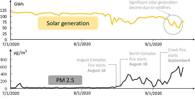
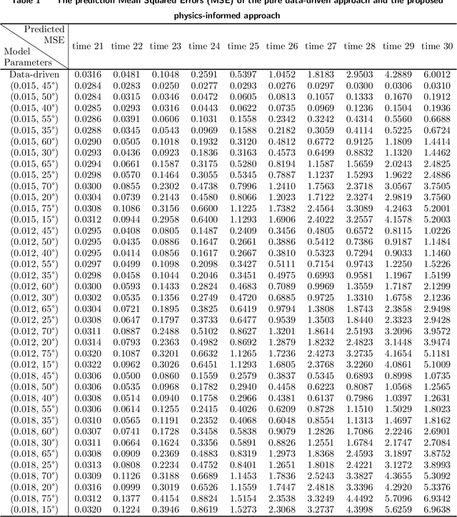
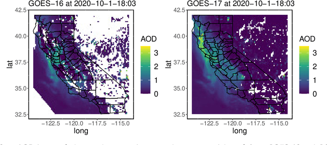
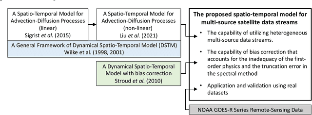
Abstract:Increasingly frequent wildfires significantly affect solar energy production as the atmospheric aerosols generated by wildfires diminish the incoming solar radiation to the earth. Atmospheric aerosols are measured by Aerosol Optical Depth (AOD), and AOD data streams can be retrieved and monitored by geostationary satellites. However, multi-source remote-sensing data streams often present heterogeneous characteristics, including different data missing rates, measurement errors, systematic biases, and so on. To accurately estimate and predict the underlying AOD propagation process, there exist practical needs and theoretical interests to propose a physics-informed statistical approach for modeling wildfire AOD propagation by simultaneously utilizing, or fusing, multi-source heterogeneous satellite remote-sensing data streams. Leveraging a spectral approach, the proposed approach integrates multi-source satellite data streams with a fundamental advection-diffusion equation that governs the AOD propagation process. A bias correction process is included in the statistical model to account for the bias of the physics model and the truncation error of the Fourier series. The proposed approach is applied to California wildfires AOD data streams obtained from the National Oceanic and Atmospheric Administration. Comprehensive numerical examples are provided to demonstrate the predictive capabilities and model interpretability of the proposed approach. Computer code has been made available on GitHub.
 Add to Chrome
 Add to Firefox
 Add to Edge