Francesca Razzano
Assessment of Spectral based Solutions for the Detection of Floating Marine Debris
Aug 19, 2024Abstract:Typically, the detection of marine debris relies on in-situ campaigns that are characterized by huge human effort and limited spatial coverage. Following the need of a rapid solution for the detection of floating plastic, methods based on remote sensing data have been proposed recently. Their main limitation is represented by the lack of a general reference for evaluating performance. Recently, the Marine Debris Archive (MARIDA) has been released as a standard dataset to develop and evaluate Machine Learning (ML) algorithms for detection of Marine Plastic Debris. The MARIDA dataset has been created for simplifying the comparison between detection solutions with the aim of stimulating the research in the field of marine environment preservation. In this work, an assessment of spectral based solutions is proposed by evaluating performance on MARIDA dataset. The outcome highlights the need of precise reference for fair evaluation.
AI techniques for near real-time monitoring of contaminants in coastal waters on board future Phisat-2 mission
Apr 30, 2024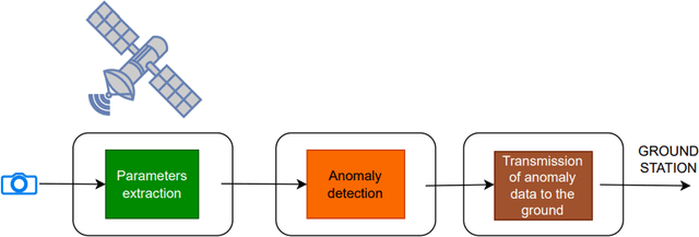
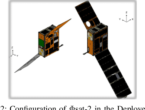
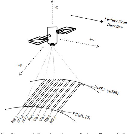
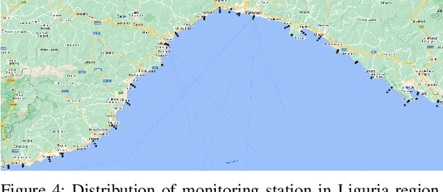
Abstract:Differently from conventional procedures, the proposed solution advocates for a groundbreaking paradigm in water quality monitoring through the integration of satellite Remote Sensing (RS) data, Artificial Intelligence (AI) techniques, and onboard processing. The objective is to offer nearly real-time detection of contaminants in coastal waters addressing a significant gap in the existing literature. Moreover, the expected outcomes include substantial advancements in environmental monitoring, public health protection, and resource conservation. The specific focus of our study is on the estimation of Turbidity and pH parameters, for their implications on human and aquatic health. Nevertheless, the designed framework can be extended to include other parameters of interest in the water environment and beyond. Originating from our participation in the European Space Agency (ESA) OrbitalAI Challenge, this article describes the distinctive opportunities and issues for the contaminants monitoring on the Phisat-2 mission. The specific characteristics of this mission, with the tools made available, will be presented, with the methodology proposed by the authors for the onboard monitoring of water contaminants in near real-time. Preliminary promising results are discussed and in progress and future work introduced.
Monitoring water contaminants in coastal areas through ML algorithms leveraging atmospherically corrected Sentinel-2 data
Jan 08, 2024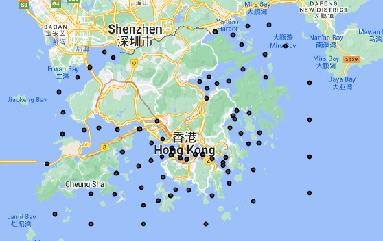

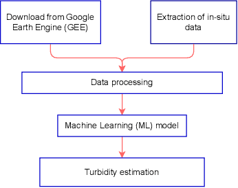

Abstract:Monitoring water contaminants is of paramount importance, ensuring public health and environmental well-being. Turbidity, a key parameter, poses a significant problem, affecting water quality. Its accurate assessment is crucial for safeguarding ecosystems and human consumption, demanding meticulous attention and action. For this, our study pioneers a novel approach to monitor the Turbidity contaminant, integrating CatBoost Machine Learning (ML) with high-resolution data from Sentinel-2 Level-2A. Traditional methods are labor-intensive while CatBoost offers an efficient solution, excelling in predictive accuracy. Leveraging atmospherically corrected Sentinel-2 data through the Google Earth Engine (GEE), our study contributes to scalable and precise Turbidity monitoring. A specific tabular dataset derived from Hong Kong contaminants monitoring stations enriches our study, providing region-specific insights. Results showcase the viability of this integrated approach, laying the foundation for adopting advanced techniques in global water quality management.
Integration of Sentinel-1 and Sentinel-2 data for Earth surface classification using Machine Learning algorithms implemented on Google Earth Engine
Aug 22, 2023Abstract:In this study, Synthetic Aperture Radar (SAR) and optical data are both considered for Earth surface classification. Specifically, the integration of Sentinel-1 (S-1) and Sentinel-2 (S-2) data is carried out through supervised Machine Learning (ML) algorithms implemented on the Google Earth Engine (GEE) platform for the classification of a particular region of interest. Achieved results demonstrate how in this case radar and optical remote detection provide complementary information, benefiting surface cover classification and generally leading to increased mapping accuracy. In addition, this paper works in the direction of proving the emerging role of GEE as an effective cloud-based tool for handling large amounts of satellite data.
Multitemporal analysis in Google Earth Engine for detecting urban changes using optical data and machine learning algorithms
Aug 22, 2023Abstract:The aim of this work is to perform a multitemporal analysis using the Google Earth Engine (GEE) platform for the detection of changes in urban areas using optical data and specific machine learning (ML) algorithms. As a case study, Cairo City has been identified, in Egypt country, as one of the five most populous megacities of the last decade in the world. Classification and change detection analysis of the region of interest (ROI) have been carried out from July 2013 to July 2021. Results demonstrate the validity of the proposed method in identifying changed and unchanged urban areas over the selected period. Furthermore, this work aims to evidence the growing significance of GEE as an efficient cloud-based solution for managing large quantities of satellite data.
 Add to Chrome
 Add to Firefox
 Add to Edge