Gilda Schirinzi
An Efficient Machine Learning Framework for Forest Height Estimation from Multi-Polarimetric Multi-Baseline SAR data
Jul 28, 2025Abstract:Accurate forest height estimation is crucial for climate change monitoring and carbon cycle assessment. Synthetic Aperture Radar (SAR), particularly in multi-channel configurations, has provided support for a long time in 3D forest structure reconstruction through model-based techniques. More recently, data-driven approaches using Machine Learning (ML) and Deep Learning (DL) have enabled new opportunities for forest parameter retrieval. This paper introduces FGump, a forest height estimation framework by gradient boosting using multi-channel SAR processing with LiDAR profiles as Ground Truth(GT). Unlike typical ML and DL approaches that require large datasets and complex architectures, FGump ensures a strong balance between accuracy and computational efficiency, using a limited set of hand-designed features and avoiding heavy preprocessing (e.g., calibration and/or quantization). Evaluated under both classification and regression paradigms, the proposed framework demonstrates that the regression formulation enables fine-grained, continuous estimations and avoids quantization artifacts by resulting in more precise measurements without rounding. Experimental results confirm that FGump outperforms State-of-the-Art (SOTA) AI-based and classical methods, achieving higher accuracy and significantly lower training and inference times, as demonstrated in our results.
Assessment of Spectral based Solutions for the Detection of Floating Marine Debris
Aug 19, 2024Abstract:Typically, the detection of marine debris relies on in-situ campaigns that are characterized by huge human effort and limited spatial coverage. Following the need of a rapid solution for the detection of floating plastic, methods based on remote sensing data have been proposed recently. Their main limitation is represented by the lack of a general reference for evaluating performance. Recently, the Marine Debris Archive (MARIDA) has been released as a standard dataset to develop and evaluate Machine Learning (ML) algorithms for detection of Marine Plastic Debris. The MARIDA dataset has been created for simplifying the comparison between detection solutions with the aim of stimulating the research in the field of marine environment preservation. In this work, an assessment of spectral based solutions is proposed by evaluating performance on MARIDA dataset. The outcome highlights the need of precise reference for fair evaluation.
AI techniques for near real-time monitoring of contaminants in coastal waters on board future Phisat-2 mission
Apr 30, 2024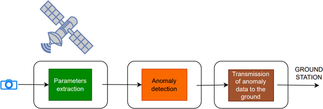
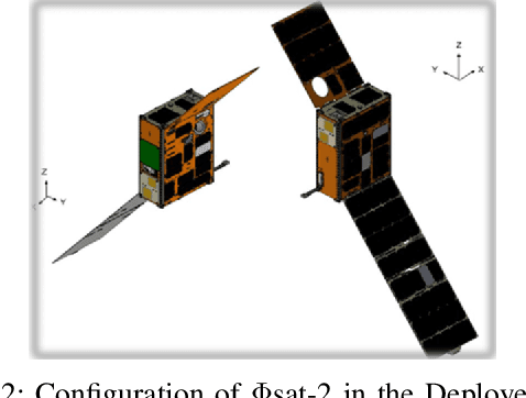
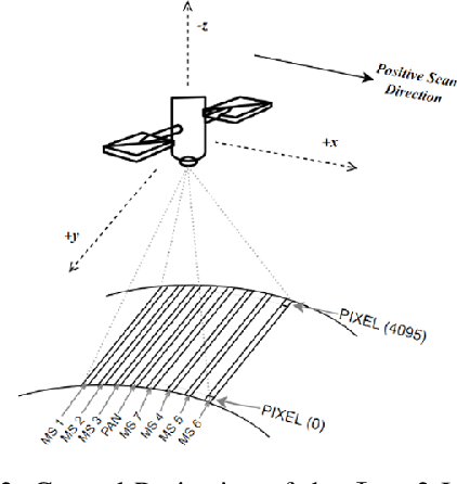
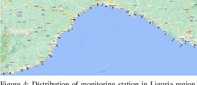
Abstract:Differently from conventional procedures, the proposed solution advocates for a groundbreaking paradigm in water quality monitoring through the integration of satellite Remote Sensing (RS) data, Artificial Intelligence (AI) techniques, and onboard processing. The objective is to offer nearly real-time detection of contaminants in coastal waters addressing a significant gap in the existing literature. Moreover, the expected outcomes include substantial advancements in environmental monitoring, public health protection, and resource conservation. The specific focus of our study is on the estimation of Turbidity and pH parameters, for their implications on human and aquatic health. Nevertheless, the designed framework can be extended to include other parameters of interest in the water environment and beyond. Originating from our participation in the European Space Agency (ESA) OrbitalAI Challenge, this article describes the distinctive opportunities and issues for the contaminants monitoring on the Phisat-2 mission. The specific characteristics of this mission, with the tools made available, will be presented, with the methodology proposed by the authors for the onboard monitoring of water contaminants in near real-time. Preliminary promising results are discussed and in progress and future work introduced.
CATSNet: a context-aware network for Height Estimation in a Forested Area based on Pol-TomoSAR data
Mar 29, 2024


Abstract:Tropical forests are a key component of the global carbon cycle. With plans for upcoming space-borne missions like BIOMASS to monitor forestry, several airborne missions, including TropiSAR and AfriSAR campaigns, have been successfully launched and experimented. Typical Synthetic Aperture Radar Tomography (TomoSAR) methods involve complex models with low accuracy and high computation costs. In recent years, deep learning methods have also gained attention in the TomoSAR framework, showing interesting performance. Recently, a solution based on a fully connected Tomographic Neural Network (TSNN) has demonstrated its effectiveness in accurately estimating forest and ground heights by exploiting the pixel-wise elements of the covariance matrix derived from TomoSAR data. This work instead goes beyond the pixel-wise approach to define a context-aware deep learning-based solution named CATSNet. A convolutional neural network is considered to leverage patch-based information and extract features from a neighborhood rather than focus on a single pixel. The training is conducted by considering TomoSAR data as the input and Light Detection and Ranging (LiDAR) values as the ground truth. The experimental results show striking advantages in both performance and generalization ability by leveraging context information within Multiple Baselines (MB) TomoSAR data across different polarimetric modalities, surpassing existing techniques.
Monitoring water contaminants in coastal areas through ML algorithms leveraging atmospherically corrected Sentinel-2 data
Jan 08, 2024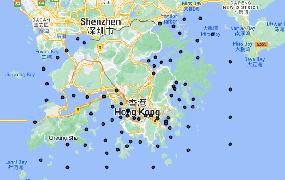

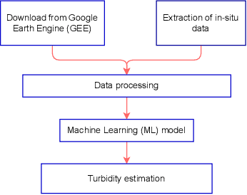

Abstract:Monitoring water contaminants is of paramount importance, ensuring public health and environmental well-being. Turbidity, a key parameter, poses a significant problem, affecting water quality. Its accurate assessment is crucial for safeguarding ecosystems and human consumption, demanding meticulous attention and action. For this, our study pioneers a novel approach to monitor the Turbidity contaminant, integrating CatBoost Machine Learning (ML) with high-resolution data from Sentinel-2 Level-2A. Traditional methods are labor-intensive while CatBoost offers an efficient solution, excelling in predictive accuracy. Leveraging atmospherically corrected Sentinel-2 data through the Google Earth Engine (GEE), our study contributes to scalable and precise Turbidity monitoring. A specific tabular dataset derived from Hong Kong contaminants monitoring stations enriches our study, providing region-specific insights. Results showcase the viability of this integrated approach, laying the foundation for adopting advanced techniques in global water quality management.
 Add to Chrome
 Add to Firefox
 Add to Edge