Silvia L. Ullo
From Graphs to Qubits: A Critical Review of Quantum Graph Neural Networks
Aug 12, 2024


Abstract:Quantum Graph Neural Networks (QGNNs) represent a novel fusion of quantum computing and Graph Neural Networks (GNNs), aimed at overcoming the computational and scalability challenges inherent in classical GNNs that are powerful tools for analyzing data with complex relational structures but suffer from limitations such as high computational complexity and over-smoothing in large-scale applications. Quantum computing, leveraging principles like superposition and entanglement, offers a pathway to enhanced computational capabilities. This paper critically reviews the state-of-the-art in QGNNs, exploring various architectures. We discuss their applications across diverse fields such as high-energy physics, molecular chemistry, finance and earth sciences, highlighting the potential for quantum advantage. Additionally, we address the significant challenges faced by QGNNs, including noise, decoherence, and scalability issues, proposing potential strategies to mitigate these problems. This comprehensive review aims to provide a foundational understanding of QGNNs, fostering further research and development in this promising interdisciplinary field.
AI techniques for near real-time monitoring of contaminants in coastal waters on board future Phisat-2 mission
Apr 30, 2024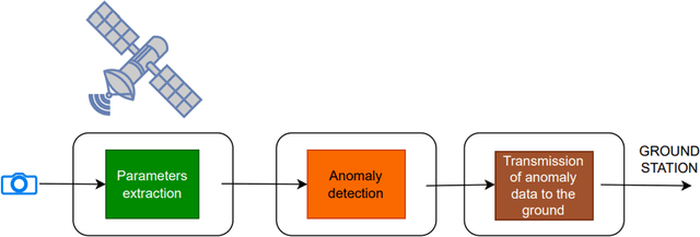
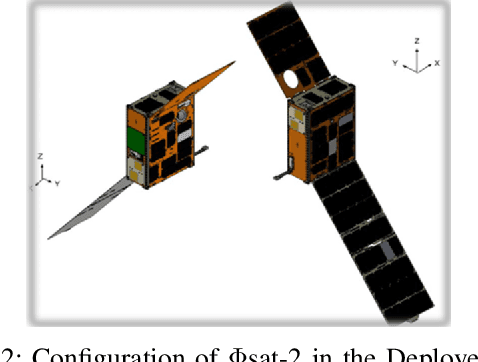
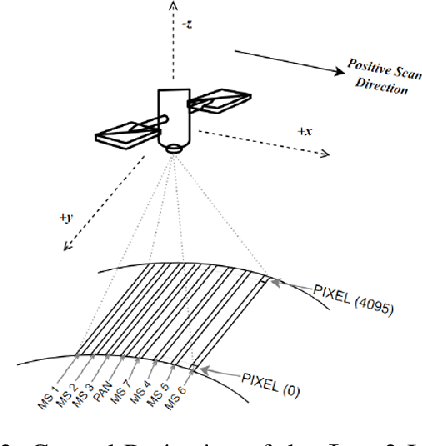
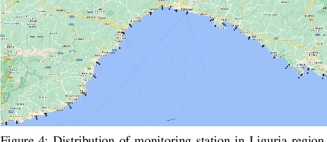
Abstract:Differently from conventional procedures, the proposed solution advocates for a groundbreaking paradigm in water quality monitoring through the integration of satellite Remote Sensing (RS) data, Artificial Intelligence (AI) techniques, and onboard processing. The objective is to offer nearly real-time detection of contaminants in coastal waters addressing a significant gap in the existing literature. Moreover, the expected outcomes include substantial advancements in environmental monitoring, public health protection, and resource conservation. The specific focus of our study is on the estimation of Turbidity and pH parameters, for their implications on human and aquatic health. Nevertheless, the designed framework can be extended to include other parameters of interest in the water environment and beyond. Originating from our participation in the European Space Agency (ESA) OrbitalAI Challenge, this article describes the distinctive opportunities and issues for the contaminants monitoring on the Phisat-2 mission. The specific characteristics of this mission, with the tools made available, will be presented, with the methodology proposed by the authors for the onboard monitoring of water contaminants in near real-time. Preliminary promising results are discussed and in progress and future work introduced.
Landslide Geohazard Assessment With Convolutional Neural Networks Using Sentinel-2 Imagery Data
Jun 10, 2019


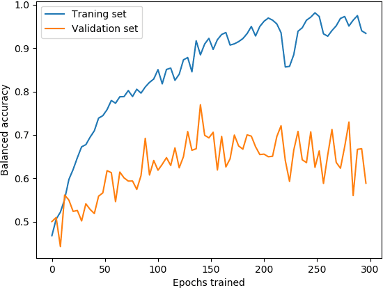
Abstract:In this paper, the authors aim to combine the latest state of the art models in image recognition with the best publicly available satellite images to create a system for landslide risk mitigation. We focus first on landslide detection and further propose a similar system to be used for prediction. Such models are valuable as they could easily be scaled up to provide data for hazard evaluation, as satellite imagery becomes increasingly available. The goal is to use satellite images and correlated data to enrich the public repository of data and guide disaster relief efforts for locating precise areas where landslides have occurred. Different image augmentation methods are used to increase diversity in the chosen dataset and create more robust classification. The resulting outputs are then fed into variants of 3-D convolutional neural networks. A review of the current literature indicates there is no research using CNNs (Convolutional Neural Networks) and freely available satellite imagery for classifying landslide risk. The model has shown to be ultimately able to achieve a significantly better than baseline accuracy.
 Add to Chrome
 Add to Firefox
 Add to Edge