Devansh Dhrafani
FIReStereo: Forest InfraRed Stereo Dataset for UAS Depth Perception in Visually Degraded Environments
Sep 12, 2024


Abstract:Robust depth perception in visually-degraded environments is crucial for autonomous aerial systems. Thermal imaging cameras, which capture infrared radiation, are robust to visual degradation. However, due to lack of a large-scale dataset, the use of thermal cameras for unmanned aerial system (UAS) depth perception has remained largely unexplored. This paper presents a stereo thermal depth perception dataset for autonomous aerial perception applications. The dataset consists of stereo thermal images, LiDAR, IMU and ground truth depth maps captured in urban and forest settings under diverse conditions like day, night, rain, and smoke. We benchmark representative stereo depth estimation algorithms, offering insights into their performance in degraded conditions. Models trained on our dataset generalize well to unseen smoky conditions, highlighting the robustness of stereo thermal imaging for depth perception. We aim for this work to enhance robotic perception in disaster scenarios, allowing for exploration and operations in previously unreachable areas. The dataset and source code are available at https://firestereo.github.io.
WIT-UAS: A Wildland-fire Infrared Thermal Dataset to Detect Crew Assets From Aerial Views
Dec 14, 2023


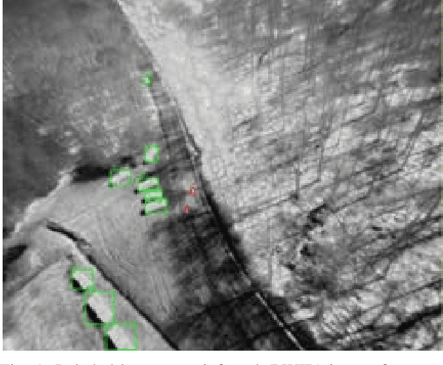
Abstract:We present the Wildland-fire Infrared Thermal (WIT-UAS) dataset for long-wave infrared sensing of crew and vehicle assets amidst prescribed wildland fire environments. While such a dataset is crucial for safety monitoring in wildland fire applications, to the authors' awareness, no such dataset focusing on assets near fire is publicly available. Presumably, this is due to the barrier to entry of collaborating with fire management personnel. We present two related data subsets: WIT-UAS-ROS consists of full ROS bag files containing sensor and robot data of UAS flight over the fire, and WIT-UAS-Image contains hand-labeled long-wave infrared (LWIR) images extracted from WIT-UAS-ROS. Our dataset is the first to focus on asset detection in a wildland fire environment. We show that thermal detection models trained without fire data frequently detect false positives by classifying fire as people. By adding our dataset to training, we show that the false positive rate is reduced significantly. Yet asset detection in wildland fire environments is still significantly more challenging than detection in urban environments, due to dense obscuring trees, greater heat variation, and overbearing thermal signal of the fire. We publicize this dataset to encourage the community to study more advanced models to tackle this challenging environment. The dataset, code and pretrained models are available at \url{https://github.com/castacks/WIT-UAS-Dataset}.
 Add to Chrome
 Add to Firefox
 Add to Edge