Simone Fontana
A comparison of uncertainty estimation approaches for DNN-based camera localization
Nov 02, 2022


Abstract:Camera localization, i.e., camera pose regression, represents a very important task in computer vision, since it has many practical applications, such as autonomous driving. A reliable estimation of the uncertainties in camera localization is also important, as it would allow to intercept localization failures, which would be dangerous. Even though the literature presents some uncertainty estimation methods, to the best of our knowledge their effectiveness has not been thoroughly examined. This work compares the performances of three consolidated epistemic uncertainty estimation methods: Monte Carlo Dropout (MCD), Deep Ensemble (DE), and Deep Evidential Regression (DER), in the specific context of camera localization. We exploited CMRNet, a DNN approach for multi-modal image to LiDAR map registration, by modifying its internal configuration to allow for an extensive experimental activity with the three methods on the KITTI dataset. Particularly significant has been the application of DER. We achieve accurate camera localization and a calibrated uncertainty, to the point that some method can be used for detecting localization failures.
A Termination Criterion for Probabilistic PointClouds Registration
Oct 10, 2020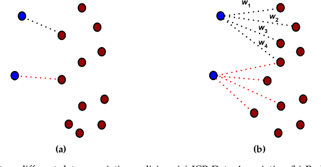
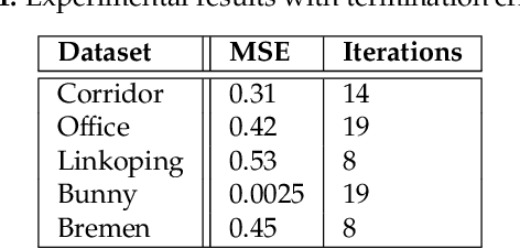

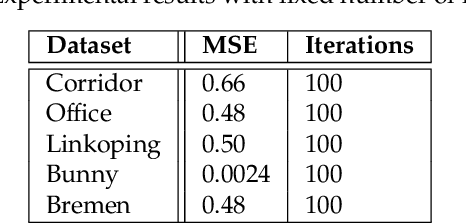
Abstract:Probabilistic Point Clouds Registration (PPCR) is an algorithm that, in its multi-iteration version, outperformed state of the art algorithms for local point clouds registration. However, its performances have been tested using a fixed high number of iterations. To be of practical usefulness, we think that the algorithm should decide by itself when to stop, to avoid an excessive number of iterations and, therefore, wasting computational time. With this work, we compare different termination criterion on several datasets and prove that the chosen one produce very good results that are comparable to those obtained using a very high number of iterations while saving computational time.
A Benchmark for Point Clouds Registration Algorithms
Apr 06, 2020

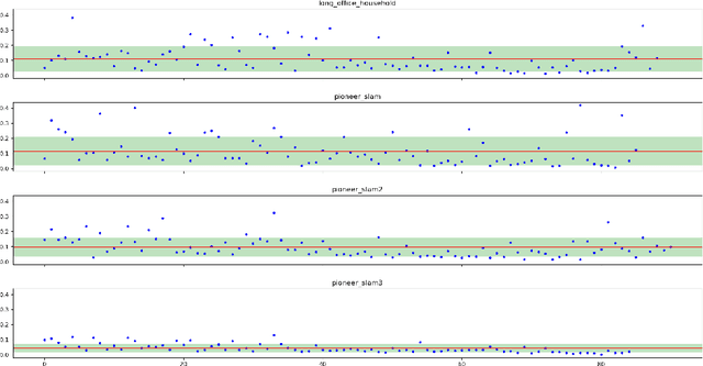

Abstract:Point clouds registration is a fundamental step of many point clouds processing pipelines; however, most algorithms are tested on data collected ad-hoc and not shared with the research community. These data often cover only a very limited set of use cases; therefore, the results cannot be generalised. Public datasets proposed until now, taken individually, cover only a few kinds of environment and mostly a single sensor. For these reasons, we developed a benchmark, for localization and mapping applications, using multiple publicly available datasets. In this way, we have been able to cover many kinds of environments and many kinds of sensor that can produce point clouds. Furthermore, the ground truth has been thoroughly inspected and evaluated to ensure its quality. For some of the datasets, the accuracy of the ground truth system was not reported by the original authors, therefore we estimated it with our own novel method, based on an iterative registration algorithm. Along with the data, we provide a broad set of registration problems, chosen to cover different types of initial misalignment, various degrees of overlap, and different kinds of registration problems. Lastly, we propose a metric to measure the performances of registration algorithms: it combines the commonly used rotation and translation errors together, to allow an objective comparison of the alignments. This work aims at encouraging authors to use a public and shared benchmark, instead than data collected ad-hoc, to ensure objectivity and repeatability, two fundamental characteristics in any scientific field.
Global visual localization in LiDAR-maps through shared 2D-3D embedding space
Oct 02, 2019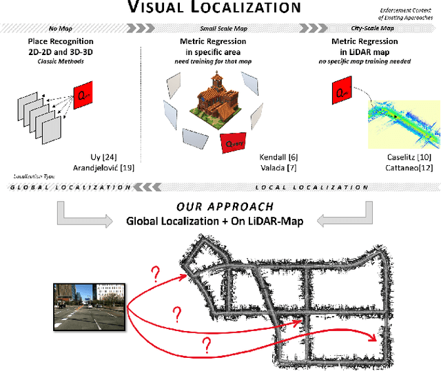
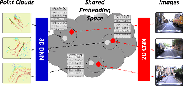
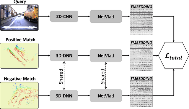
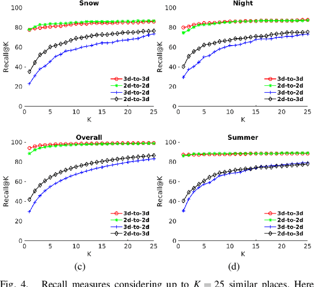
Abstract:Global localization is an important and widely studied problem for many robotic applications. Place recognition approaches can be exploited to solve this task, e.g., in the autonomous driving field. While most vision-based approaches match an image w.r.t an image database, global visual localization within LiDAR-maps remains fairly unexplored, even though the path toward high definition 3D maps, produced mainly from LiDARs, is clear. In this work we leverage DNN approaches to create a shared embedding space between images and LiDAR-maps, allowing for image to 3D-LiDAR place recognition. We trained a 2D and a 3D Deep Neural Networks (DNNs) that create embeddings, respectively from images and from point clouds, that are close to each other whether they refer to the same place. An extensive experimental activity is presented to assess the effectiveness of the approach w.r.t. different learning methods, network architectures, and loss functions. All the evaluations have been performed using the Oxford Robotcar Dataset, which encompasses a wide range of weather and light conditions.
CMRNet: Camera to LiDAR-Map Registration
Jul 17, 2019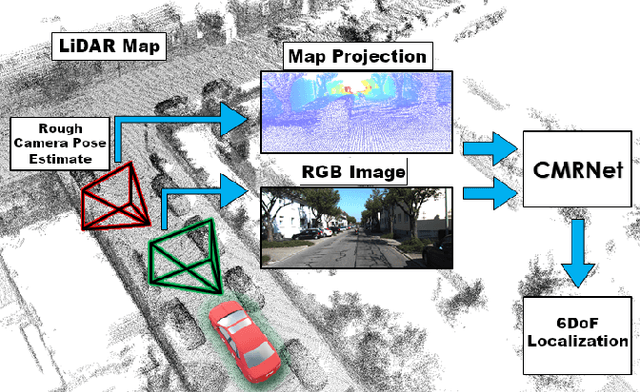
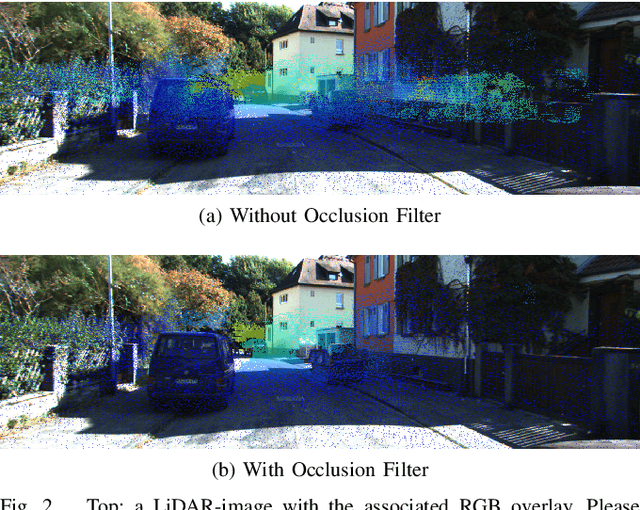
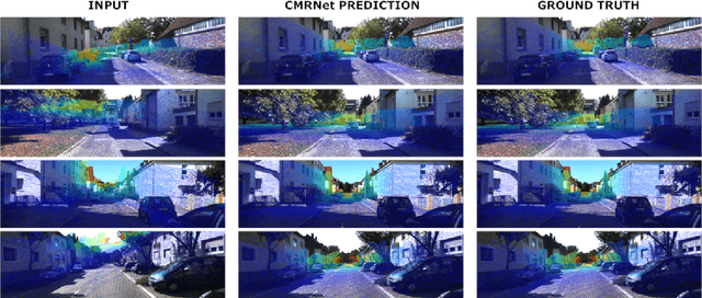
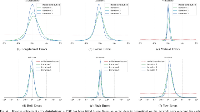
Abstract:In this paper we present CMRNet, a realtime approach based on a Convolutional Neural Network to localize an RGB image of a scene in a map built from LiDAR data. Our network is not trained in the working area, i.e. CMRNet does not learn the map. Instead it learns to match an image to the map. We validate our approach on the KITTI dataset, processing each frame independently without any tracking procedure. CMRNet achieves 0.27m and 1.07deg median localization accuracy on the sequence 00 of the odometry dataset, starting from a rough pose estimate displaced up to 3.5m and 17deg. To the best of our knowledge this is the first CNN-based approach that learns to match images from a monocular camera to a given, preexisting 3D LiDAR-map.
ira_laser_tools: a ROS LaserScan manipulation toolbox
Nov 04, 2014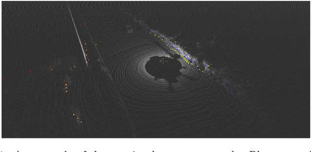
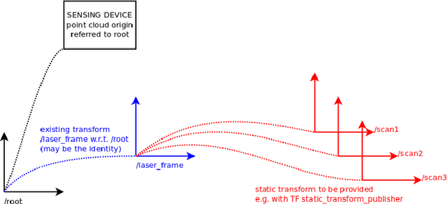

Abstract:Laser scanners are sensors of widespread use in robotic applications. Under the Robot Operating System (ROS) the information generated by laser scanners can be conveyed by either LaserScan messages or in the form of PointClouds. Many publicly available algorithms (mapping, localization, navigation, etc.) rely on LaserScan messages, yet a tool for handling multiple lasers, merging their measurements, or to generate generic LaserScan messages from PointClouds, is not available. This report describes two tools, in the form of ROS nodes, which we release as open source under the BSD license, which allow to either merge multiple single-plane laser scans or to generate virtual laser scans from a point cloud. A short tutorial, along with the main advantages and limitations of these tools are presented.
 Add to Chrome
 Add to Firefox
 Add to Edge