Pyo-Woong Son
Enhancing eLoran Timing Accuracy via Machine Learning with Meteorological and Terrain Data
Jun 18, 2025Abstract:The vulnerabilities of global navigation satellite systems (GNSS) to signal interference have increased the demand for complementary positioning, navigation, and timing (PNT) systems. To address this, South Korea has decided to deploy an enhanced long-range navigation (eLoran) system as a complementary PNT solution. Similar to GNSS, eLoran provides highly accurate timing information, which is essential for applications such as telecommunications, financial systems, and power distribution. However, the primary sources of error for GNSS and eLoran differ. For eLoran, the main source of error is signal propagation delay over land, known as the additional secondary factor (ASF). This delay, influenced by ground conductivity and weather conditions along the signal path, is challenging to predict and mitigate. In this paper, we measure the time difference (TD) between GPS and eLoran using a time interval counter and analyze the correlations between eLoran/GPS TD and eleven meteorological factors. Accurate estimation of eLoran/GPS TD could enable eLoran to achieve timing accuracy comparable to that of GPS. We propose two estimation models for eLoran/GPS TD and compare their performance with existing TD estimation methods. The proposed WLR-AGRNN model captures the linear relationships between meteorological factors and eLoran/GPS TD using weighted linear regression (WLR) and models nonlinear relationships between outputs from expert networks through an anisotropic general regression neural network (AGRNN). The model incorporates terrain elevation to appropriately weight meteorological data, as elevation influences signal propagation delay. Experimental results based on four months of data demonstrate that the WLR-AGRNN model outperforms other models, highlighting its effectiveness in improving eLoran/GPS TD estimation accuracy.
Ground Truth Generation Algorithm for Medium-Frequency R-Mode Skywave Detection
Sep 04, 2023


Abstract:With the advancement of transportation vehicles, the importance and utility of navigation systems providing positioning, navigation, and timing (PNT) information have been increasing. Global navigation satellite systems (GNSS) are widely used navigation systems, but they are vulnerable to radio frequency interference (RFI), resulting in disruptions of satellite navigation signals. Recognizing this limitation, extensive research is being conducted on alternative navigation systems. In the maritime industry, ongoing research focuses on a groundbased integrated navigation system called R-Mode. R-Mode utilizes medium frequency (MF) differential GNSS (DGNSS) and very high-frequency data exchange system (VDES) signals as ranging signals for positioning and incorporates the existing ground-based navigation system known as enhanced long-range navigation (eLoran). However, MF R-Mode, which uses MF DGNSS signals for positioning, exhibits significant performance differences between daytime and nighttime due to skywave interference caused by signals reflecting off the ionosphere. In this study, we propose a skywave ground truth generation algorithm that is crucial for studying mitigation methods for MF R-Mode skywave interference. Furthermore, we demonstrate the proposed algorithm using field-test data.
Empirical Modeling of Variance in Medium Frequency R-Mode Time-of-Arrival Measurements
Sep 01, 2023Abstract:The R-Mode system, an advanced terrestrial integrated navigation system, is designed to address the vulnerabilities of global navigation satellite systems (GNSS) and explore the potential of a complementary navigation system. This study aims to enhance the accuracy of performance simulation for the medium frequency (MF) R-Mode system by modeling the variance of time-of-arrival (TOA) measurements based on actual data. Drawing inspiration from the method used to calculate the standard deviation of time-of-reception (TOR) measurements in Loran, we adapted and applied this approach to the MF R-Mode system. Data were collected from transmitters in Palmi and Chungju, South Korea, and the parameters for modeling the variance of TOA were estimated.
Preliminary Analysis of Skywave Effects on MF DGNSS R-Mode Signals During Daytime and Nighttime
Sep 30, 2022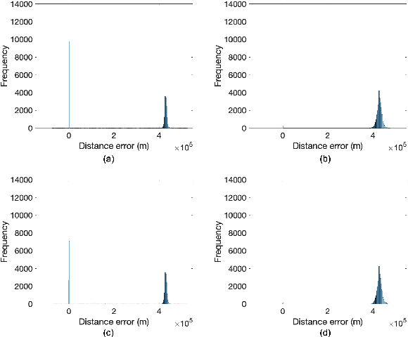

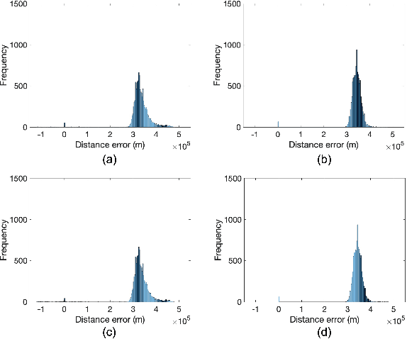

Abstract:Accurate positioning, navigation, and timing (PNT) performance are prerequisites for several technologies today. In a marine environment, it is difficult to visually identify one's position accurately, leading to safety concerns. Currently, PNT information is provided mainly from Global Navigation Satellite Systems (GNSS); however, it is vulnerable to radio frequency interference, spoofing, and ionospheric anomaly. Therefore, research on a backup system is needed. Ranging Mode (R-Mode), a terrestrial integrated navigation system, is being investigated for use in a marine environment. R-Mode is a positioning technology that integrates terrestrial signals of opportunity such as medium frequency (MF) differential GNSS (DGNSS), very high frequency (VHF) automatic identification system (AIS), and enhanced long-range navigation (eLoran) signals. Previous studies in Europe show that signals in the MF band differ greatly in accuracy between daytime and nighttime. This difference is primarily caused by skywave. In this study, the MF DGNSS R-Mode signal transmitted from Chungju, Korea was received in Daesan and Daejeon, Korea. The skywave effect during daytime and nighttime was compared and investigated. In addition, the continuous wave intensity of the R-Mode signal was increased during the nighttime to compare its effect on the measurement accuracy.
First Demonstration of the Korean eLoran Accuracy in a Narrow Waterway Using Improved ASF Maps
Sep 28, 2021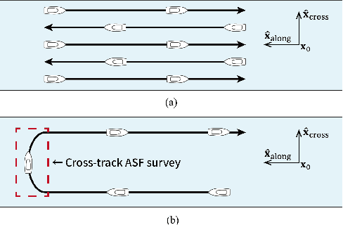
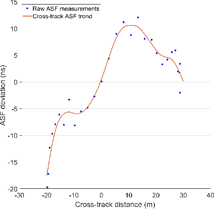
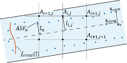
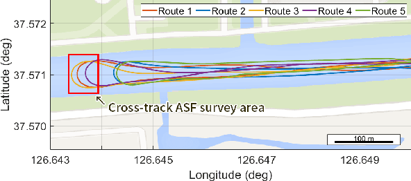
Abstract:The vulnerabilities of global navigation satellite systems (GNSSs) to radio frequency jamming and spoofing have attracted significant research attention. In particular, the large-scale jamming incidents that occurred in South Korea substantiate the practical importance of implementing a complementary navigation system. This letter briefly summarizes the efforts of South Korea to deploy an enhanced long-range navigation (eLoran) system, which is a terrestrial low-frequency radio navigation system that can complement GNSSs. After four years of research and development, the Korean eLoran testbed system has been recently deployed and is operational since June 1, 2021. Although its initial performance at sea is satisfactory, navigation through a narrow waterway is still challenging because a complete survey of the additional secondary factor (ASF), which is the largest source of error for eLoran, is practically difficult in a narrow waterway. This letter proposes an alternative way to survey the ASF in a narrow waterway and improve the ASF map generation methods. Moreover, the performance of the proposed approach was validated experimentally.
Development of an R-Mode Simulator Using MF DGNSS Signals
Aug 30, 2021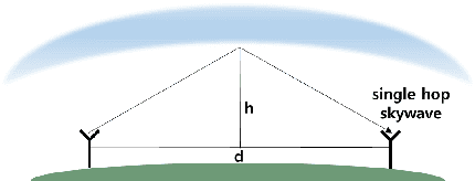
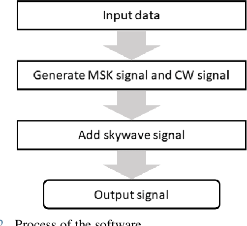
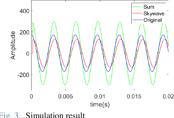
Abstract:With the development of positioning, navigation, and timing (PNT) information-based industries, PNT information is becoming increasingly important. Therefore, various navigation studies have been actively conducted to back up global positioning system (GPS) in scenarios in which it is disabled. Ranging using signals of opportunity (SoOP) has the advantage of infrastructure already being in place. Among them, the ranging mode (R-Mode) is a technology that uses available SoOPs such as a medium frequency (MF) differential global navigation satellite System (DGNSS) signal that has recently been recognized for its potential for navigation and is currently under research. In this study, we developed a signal simulator that considers the characteristics of MF DGNSS signals and skywaves used in R-Mode.
Enhanced Accuracy Simulator for a Future Korean Nationwide eLoran System
Aug 13, 2021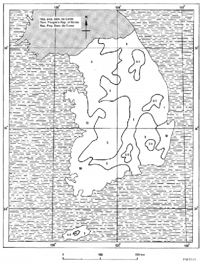
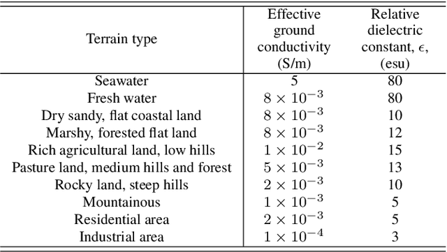
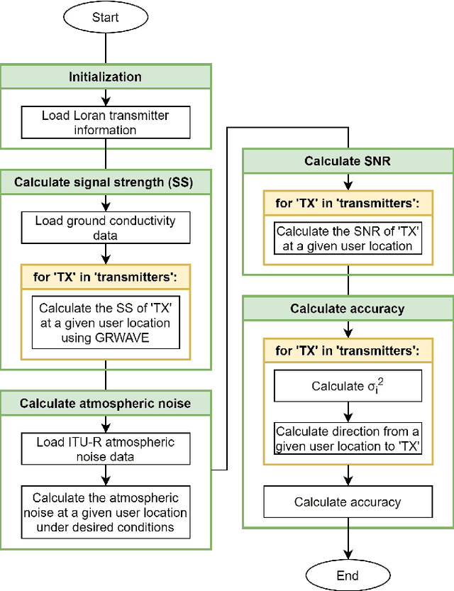

Abstract:The Global Positioning System (GPS) has become the most widely used positioning, navigation, and timing system. However, the vulnerability of GPS to radio frequency interference has attracted significant attention. After experiencing several incidents of intentional high-power GPS jamming trials by North Korea, South Korea decided to deploy the enhanced long-range navigation (eLoran) system, which is a high-power terrestrial radio-navigation system that can complement GPS. As the first phase of the South Korean eLoran program, an eLoran testbed system was recently developed and declared operational on June 1, 2021. Once its operational performance is determined to be satisfactory, South Korea plans to move to the second phase of the program, which is a nationwide eLoran system. For the optimal deployment of additional eLoran transmitters in a nationwide system, it is necessary to properly simulate the expected positioning accuracy of the said future system. In this study, we propose enhanced eLoran accuracy simulation methods based on a land cover map and transmitter jitter estimation. Using actual measurements over the country, the simulation accuracy of the proposed methods was confirmed to be approximately 10%-91% better than that of the existing Loran (i.e., Loran-C and eLoran) positioning accuracy simulators depending on the test locations.
 Add to Chrome
 Add to Firefox
 Add to Edge