Martin Fritzsche
UNIFY: Multi-Belief Bayesian Grid Framework based on Automotive Radar
Apr 24, 2021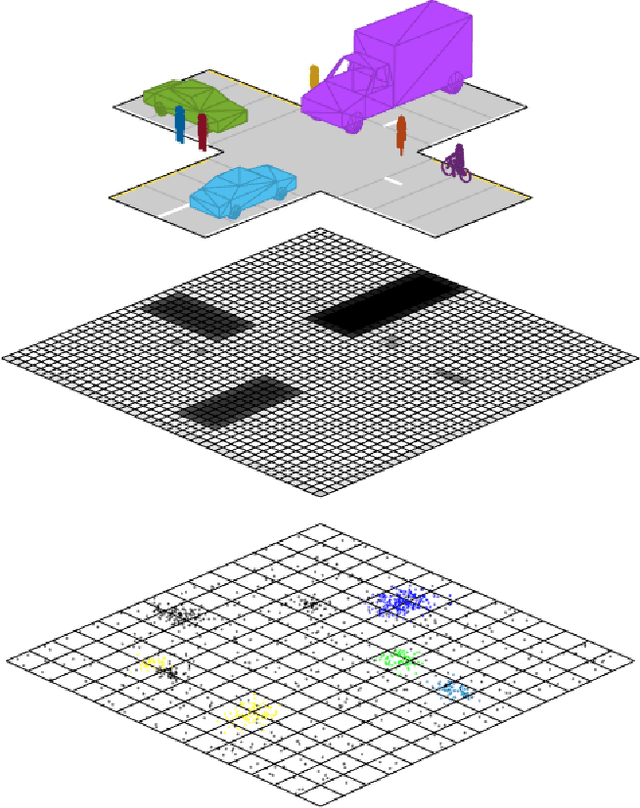
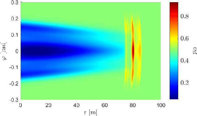


Abstract:Grid maps are widely established for the representation of static objects in robotics and automotive applications. Though, incorporating velocity information is still widely examined because of the increased complexity of dynamic grids concerning both velocity measurement models for radar sensors and the representation of velocity in a grid framework. In this paper, both issues are addressed: sensor models and an efficient grid framework, which are required to ensure efficient and robust environment perception with radar. To that, we introduce new inverse radar sensor models covering radar sensor artifacts such as measurement ambiguities to integrate automotive radar sensors for improved velocity estimation. Furthermore, we introduce UNIFY, a multiple belief Bayesian grid map framework for static occupancy and velocity estimation with independent layers. The proposed UNIFY framework utilizes a grid-cell-based layer to provide occupancy information and a particle-based velocity layer for motion state estimation in an autonomous vehicle's environment. Each UNIFY layer allows individual execution as well as simultaneous execution of both layers for optimal adaption to varying environments in autonomous driving applications. UNIFY was tested and evaluated in terms of plausibility and efficiency on a large real-world radar data-set in challenging traffic scenarios covering different densities in urban and rural sceneries.
Automated Ground Truth Estimation For Automotive Radar Tracking Applications With Portable GNSS And IMU Devices
Jun 03, 2019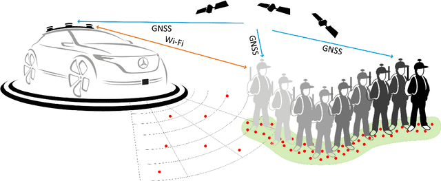
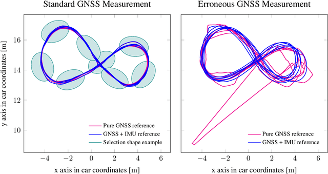

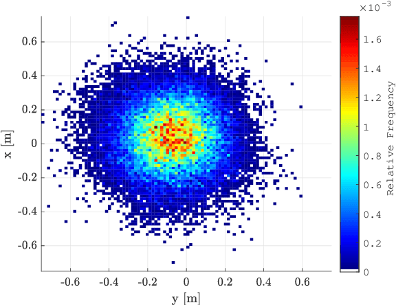
Abstract:Baseline generation for tracking applications is a difficult task when working with real world radar data. Data sparsity usually only allows an indirect way of estimating the original tracks as most objects' centers are not represented in the data. This article proposes an automated way of acquiring reference trajectories by using a highly accurate hand-held global navigation satellite system (GNSS). An embedded inertial measurement unit (IMU) is used for estimating orientation and motion behavior. This article contains two major contributions. A method for associating radar data to vulnerable road user (VRU) tracks is described. It is evaluated how accurate the system performs under different GNSS reception conditions and how carrying a reference system alters radar measurements. Second, the system is used to track pedestrians and cyclists over many measurement cycles in order to generate object centered occupancy grid maps. The reference system allows to much more precisely generate real world radar data distributions of VRUs than compared to conventional methods. Hereby, an important step towards radar-based VRU tracking is accomplished.
BMXNet: An Open-Source Binary Neural Network Implementation Based on MXNet
May 27, 2017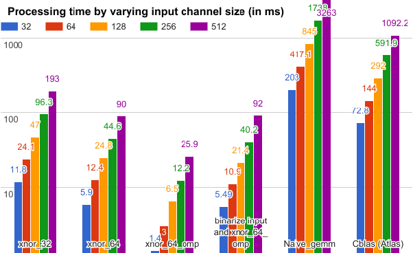

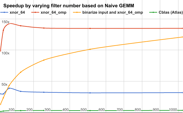
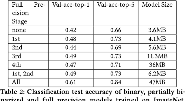
Abstract:Binary Neural Networks (BNNs) can drastically reduce memory size and accesses by applying bit-wise operations instead of standard arithmetic operations. Therefore it could significantly improve the efficiency and lower the energy consumption at runtime, which enables the application of state-of-the-art deep learning models on low power devices. BMXNet is an open-source BNN library based on MXNet, which supports both XNOR-Networks and Quantized Neural Networks. The developed BNN layers can be seamlessly applied with other standard library components and work in both GPU and CPU mode. BMXNet is maintained and developed by the multimedia research group at Hasso Plattner Institute and released under Apache license. Extensive experiments validate the efficiency and effectiveness of our implementation. The BMXNet library, several sample projects, and a collection of pre-trained binary deep models are available for download at https://github.com/hpi-xnor
 Add to Chrome
 Add to Firefox
 Add to Edge