Lukas Kondmann
DynamicEarthNet: Daily Multi-Spectral Satellite Dataset for Semantic Change Segmentation
Mar 23, 2022
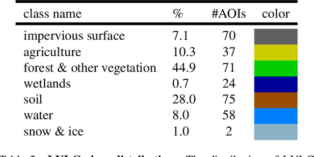
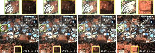

Abstract:Earth observation is a fundamental tool for monitoring the evolution of land use in specific areas of interest. Observing and precisely defining change, in this context, requires both time-series data and pixel-wise segmentations. To that end, we propose the DynamicEarthNet dataset that consists of daily, multi-spectral satellite observations of 75 selected areas of interest distributed over the globe with imagery from Planet Labs. These observations are paired with pixel-wise monthly semantic segmentation labels of 7 land use and land cover (LULC) classes. DynamicEarthNet is the first dataset that provides this unique combination of daily measurements and high-quality labels. In our experiments, we compare several established baselines that either utilize the daily observations as additional training data (semi-supervised learning) or multiple observations at once (spatio-temporal learning) as a point of reference for future research. Finally, we propose a new evaluation metric SCS that addresses the specific challenges associated with time-series semantic change segmentation. The data is available at: https://mediatum.ub.tum.de/1650201.
Spatial Context Awareness for Unsupervised Change Detection in Optical Satellite Images
Oct 05, 2021
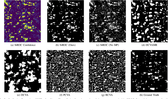
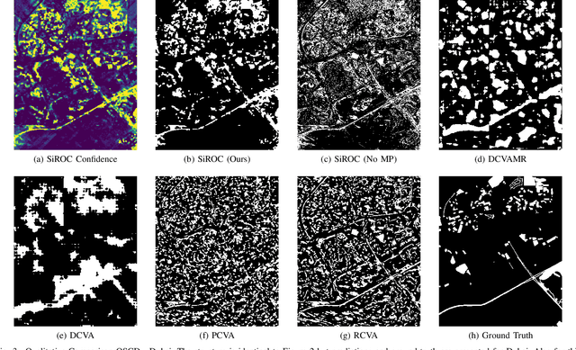
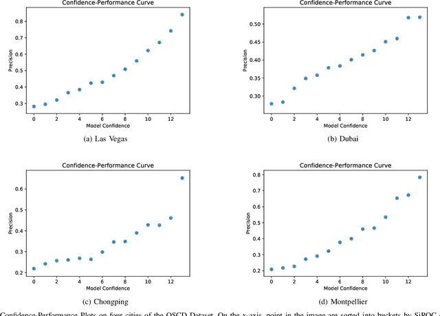
Abstract:Detecting changes on the ground in multitemporal Earth observation data is one of the key problems in remote sensing. In this paper, we introduce Sibling Regression for Optical Change detection (SiROC), an unsupervised method for change detection in optical satellite images with medium and high resolution. SiROC is a spatial context-based method that models a pixel as a linear combination of its distant neighbors. It uses this model to analyze differences in the pixel and its spatial context-based predictions in subsequent time periods for change detection. We combine this spatial context-based change detection with ensembling over mutually exclusive neighborhoods and transitioning from pixel to object-level changes with morphological operations. SiROC achieves competitive performance for change detection with medium-resolution Sentinel-2 and high-resolution Planetscope imagery on four datasets. Besides accurate predictions without the need for training, SiROC also provides a well-calibrated uncertainty of its predictions. This makes the method especially useful in conjunction with deep-learning based methods for applications such as pseudo-labeling.
Under the Radar -- Auditing Fairness in ML for Humanitarian Mapping
Aug 04, 2021


Abstract:Humanitarian mapping from space with machine learning helps policy-makers to timely and accurately identify people in need. However, recent concerns around fairness and transparency of algorithmic decision-making are a significant obstacle for applying these methods in practice. In this paper, we study if humanitarian mapping approaches from space are prone to bias in their predictions. We map village-level poverty and electricity rates in India based on nighttime lights (NTLs) with linear regression and random forest and analyze if the predictions systematically show prejudice against scheduled caste or tribe communities. To achieve this, we design a causal approach to measure counterfactual fairness based on propensity score matching. This allows to compare villages within a community of interest to synthetic counterfactuals. Our findings indicate that poverty is systematically overestimated and electricity systematically underestimated for scheduled tribes in comparison to a synthetic counterfactual group of villages. The effects have the opposite direction for scheduled castes where poverty is underestimated and electrification overestimated. These results are a warning sign for a variety of applications in humanitarian mapping where fairness issues would compromise policy goals.
 Add to Chrome
 Add to Firefox
 Add to Edge