Kevin Köser
Relative Illumination Fields: Learning Medium and Light Independent Underwater Scenes
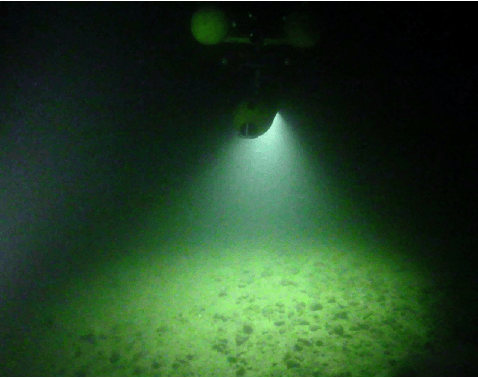
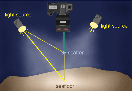
Apr 14, 2025Abstract:We address the challenge of constructing a consistent and photorealistic Neural Radiance Field in inhomogeneously illuminated, scattering environments with unknown, co-moving light sources. While most existing works on underwater scene representation focus on a static homogeneous illumination, limited attention has been paid to scenarios such as when a robot explores water deeper than a few tens of meters, where sunlight becomes insufficient. To address this, we propose a novel illumination field locally attached to the camera, enabling the capture of uneven lighting effects within the viewing frustum. We combine this with a volumetric medium representation to an overall method that effectively handles interaction between dynamic illumination field and static scattering medium. Evaluation results demonstrate the effectiveness and flexibility of our approach.
A Calibration Tool for Refractive Underwater Vision
May 28, 2024


Abstract:Many underwater robotic applications relying on vision sensors require proper camera calibration, i.e. knowing the incoming light ray for each pixel in the image. While for the ideal pinhole camera model all viewing rays intersect in a single 3D point, underwater cameras suffer from - possibly multiple - refractions of light rays at the interfaces of water, glass and air. These changes of direction depend on the position and orientation of the camera inside the water-proof housing, as well as on the shape and properties of the optical window, the port, itself. In recent years explicit models for underwater vision behind common ports such as flat or dome port have been proposed, but the underwater community is still lacking a calibration tool which can determine port parameters through refractive calibration. With this work we provide the first open source implementation of an underwater refractive camera calibration toolbox. It allows end-to-end calibration of underwater vision systems, including camera, stereo and housing calibration for systems with dome or flat ports. The implementation is verified using rendered datasets and real-world experiments.
Refractive COLMAP: Refractive Structure-from-Motion Revisited
Mar 13, 2024Abstract:In this paper, we present a complete refractive Structure-from-Motion (RSfM) framework for underwater 3D reconstruction using refractive camera setups (for both, flat- and dome-port underwater housings). Despite notable achievements in refractive multi-view geometry over the past decade, a robust, complete and publicly available solution for such tasks is not available at present, and often practical applications have to resort to approximating refraction effects by the intrinsic (distortion) parameters of a pinhole camera model. To fill this gap, we have integrated refraction considerations throughout the entire SfM process within the state-of-the-art, open-source SfM framework COLMAP. Numerical simulations and reconstruction results on synthetically generated but photo-realistic images with ground truth validate that enabling refraction does not compromise accuracy or robustness as compared to in-air reconstructions. Finally, we demonstrate the capability of our approach for large-scale refractive scenarios using a dataset consisting of nearly 6000 images. The implementation is released as open-source at: https://cau-git.rz.uni-kiel.de/inf-ag-koeser/colmap_underwater.
Visual Tomography: Physically Faithful Volumetric Models of Partially Translucent Objects
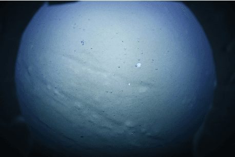
Dec 21, 2023Abstract:When created faithfully from real-world data, Digital 3D representations of objects can be useful for human or computer-assisted analysis. Such models can also serve for generating training data for machine learning approaches in settings where data is difficult to obtain or where too few training data exists, e.g. by providing novel views or images in varying conditions. While the vast amount of visual 3D reconstruction approaches focus on non-physical models, textured object surfaces or shapes, in this contribution we propose a volumetric reconstruction approach that obtains a physical model including the interior of partially translucent objects such as plankton or insects. Our technique photographs the object under different poses in front of a bright white light source and computes absorption and scattering per voxel. It can be interpreted as visual tomography that we solve by inverse raytracing. We additionally suggest a method to convert non-physical NeRF media into a physically-based volumetric grid for initialization and illustrate the usefulness of the approach using two real-world plankton validation sets, the lab-scanned models being finally also relighted and virtually submerged in a scenario with augmented medium and illumination conditions. Please visit the project homepage at www.marine.informatik.uni-kiel.de/go/vito
Advanced Underwater Image Restoration in Complex Illumination Conditions
Sep 05, 2023


Abstract:Underwater image restoration has been a challenging problem for decades since the advent of underwater photography. Most solutions focus on shallow water scenarios, where the scene is uniformly illuminated by the sunlight. However, the vast majority of uncharted underwater terrain is located beyond 200 meters depth where natural light is scarce and artificial illumination is needed. In such cases, light sources co-moving with the camera, dynamically change the scene appearance, which make shallow water restoration methods inadequate. In particular for multi-light source systems (composed of dozens of LEDs nowadays), calibrating each light is time-consuming, error-prone and tedious, and we observe that only the integrated illumination within the viewing volume of the camera is critical, rather than the individual light sources. The key idea of this paper is therefore to exploit the appearance changes of objects or the seafloor, when traversing the viewing frustum of the camera. Through new constraints assuming Lambertian surfaces, corresponding image pixels constrain the light field in front of the camera, and for each voxel a signal factor and a backscatter value are stored in a volumetric grid that can be used for very efficient image restoration of camera-light platforms, which facilitates consistently texturing large 3D models and maps that would otherwise be dominated by lighting and medium artifacts. To validate the effectiveness of our approach, we conducted extensive experiments on simulated and real-world datasets. The results of these experiments demonstrate the robustness of our approach in restoring the true albedo of objects, while mitigating the influence of lighting and medium effects. Furthermore, we demonstrate our approach can be readily extended to other scenarios, including in-air imaging with artificial illumination or other similar cases.
Efficient Large-scale AUV-based Visual Seafloor Mapping
Aug 11, 2023Abstract:Driven by the increasing number of marine data science applications, there is a growing interest in surveying and exploring the vast, uncharted terrain of the deep sea with robotic platforms. Despite impressive results achieved by many on-land visual mapping algorithms in the past decades, transferring these methods from land to the deep sea remains a challenge due to harsh environmental conditions. Typically, deep-sea exploration involves the use of autonomous underwater vehicles (AUVs) equipped with high-resolution cameras and artificial illumination systems. However, images obtained in this manner often suffer from heterogeneous illumination and quality degradation due to attenuation and scattering, on top of refraction of light rays. All of this together often lets on-land SLAM approaches fail underwater or makes Structure-from-Motion approaches drift or omit difficult images, resulting in gaps, jumps or weakly registered areas. In this work, we present a system that incorporates recent developments in underwater imaging and visual mapping to facilitate automated robotic 3D reconstruction of hectares of seafloor. Our approach is efficient in that it detects and reconsiders difficult, weakly registered areas, to avoid omitting images and to make better use of limited dive time; on the other hand it is computationally efficient; leveraging a hybrid approach combining benefits from SLAM and Structure-from-Motion that runs much faster than incremental reconstructions while achieving at least on-par performance. The proposed system has been extensively tested and evaluated during several research cruises, demonstrating its robustness and practicality in real-world conditions.
Investigation of the Challenges of Underwater-Visual-Monocular-SLAM
Jun 14, 2023Abstract:In this paper, we present a comprehensive investigation of the challenges of Monocular Visual Simultaneous Localization and Mapping (vSLAM) methods for underwater robots. While significant progress has been made in state estimation methods that utilize visual data in the past decade, most evaluations have been limited to controlled indoor and urban environments, where impressive performance was demonstrated. However, these techniques have not been extensively tested in extremely challenging conditions, such as underwater scenarios where factors such as water and light conditions, robot path, and depth can greatly impact algorithm performance. Hence, our evaluation is conducted in real-world AUV scenarios as well as laboratory settings which provide precise external reference. A focus is laid on understanding the impact of environmental conditions, such as optical properties of the water and illumination scenarios, on the performance of monocular vSLAM methods. To this end, we first show that all methods perform very well in in-air settings and subsequently show the degradation of their performance in challenging underwater environments. The final goal of this study is to identify techniques that can improve accuracy and robustness of SLAM methods in such conditions. To achieve this goal, we investigate the potential of image enhancement techniques to improve the quality of input images used by the SLAM methods, specifically in low visibility and extreme lighting scenarios in scattering media. We present a first evaluation on calibration maneuvers and simple image restoration techniques to determine their ability to enable or enhance the performance of monocular SLAM methods in underwater environments.
Design, Implementation and Evaluation of an External Pose-Tracking System for Underwater Cameras
May 07, 2023


Abstract:In order to advance underwater computer vision and robotics from lab environments and clear water scenarios to the deep dark ocean or murky coastal waters, representative benchmarks and realistic datasets with ground truth information are required. In particular, determining the camera pose is essential for many underwater robotic or photogrammetric applications and known ground truth is mandatory to evaluate the performance of e.g., simultaneous localization and mapping approaches in such extreme environments. This paper presents the conception, calibration and implementation of an external reference system for determining the underwater camera pose in real-time. The approach, based on an HTC Vive tracking system in air, calculates the underwater camera pose by fusing the poses of two controllers tracked above the water surface of a tank. It is shown that the mean deviation of this approach to an optical marker based reference in air is less than 3 mm and 0.3{\deg}. Finally, the usability of the system for underwater applications is demonstrated.
Deep Sea Bubble Stream Characterization Using Wide-Baseline Stereo Photogrammetry
Dec 21, 2021


Abstract:Reliable quantification of natural and anthropogenic gas release (e.g.\ CO$_2$, methane) from the seafloor into the ocean, and ultimately, the atmosphere, is a challenging task. While ship-based echo sounders allow detection of free gas in the water even from a larger distance, exact quantification requires parameters such as rise speed and bubble size distribution not obtainable by such sensors. Optical methods are complementary in the sense that they can provide high temporal and spatial resolution of single bubbles or bubble streams from close distance. In this contribution we introduce a complete instrument and evaluation method for optical bubble stream characterization. The dedicated instrument employs a high-speed deep sea stereo camera system that can record terabytes of bubble imagery when deployed at a seep site for later automated analysis. Bubble characteristics can be obtained for short sequences of few minutes, then relocating the instrument to other locations, or in autonomous mode of intervals up to several days, in order to capture variations due to current and pressure changes and across tidal cycles. Beside reporting the steps to make bubble characterization robust and autonomous, we carefully evaluate the reachable accuracy and propose a novel calibration procedure that, due to the lack of point correspondences, uses only the silhouettes of bubbles. The system has been operated successfully in up to 1000m water depth in the Pacific Ocean to assess methane fluxes. Besides sample results we also report failure cases and lessons learnt during development.
Robustly Removing Deep Sea Lighting Effects for Visual Mapping of Abyssal Plains
Oct 01, 2021


Abstract:The majority of Earth's surface lies deep in the oceans, where no surface light reaches. Robots diving down to great depths must bring light sources that create moving illumination patterns in the darkness, such that the same 3D point appears with different color in each image. On top, scattering and attenuation of light in the water makes images appear foggy and typically blueish, the degradation depending on each pixel's distance to its observed seafloor patch, on the local composition of the water and the relative poses and cones of the light sources. Consequently, visual mapping, including image matching and surface albedo estimation, severely suffers from the effects that co-moving light sources produce, and larger mosaic maps from photos are often dominated by lighting effects that obscure the actual seafloor structure. In this contribution a practical approach to estimating and compensating these lighting effects on predominantly homogeneous, flat seafloor regions, as can be found in the Abyssal plains of our oceans, is presented. The method is essentially parameter-free and intended as a preprocessing step to facilitate visual mapping, but already produces convincing lighting artefact compensation up to a global white balance factor. It does not require to be trained beforehand on huge sets of annotated images, which are not available for the deep sea. Rather, we motivate our work by physical models of light propagation, perform robust statistics-based estimates of additive and multiplicative nuisances that avoid explicit parameters for light, camera, water or scene, discuss the breakdown point of the algorithms and show results on imagery captured by robots in several kilometer water depth.
 Add to Chrome
 Add to Firefox
 Add to Edge