George Azzari
Semi-Supervised Multitask Learning on Multispectral Satellite Images Using Wasserstein Generative Adversarial Networks (GANs) for Predicting Poverty
Feb 13, 2019


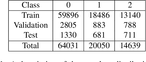
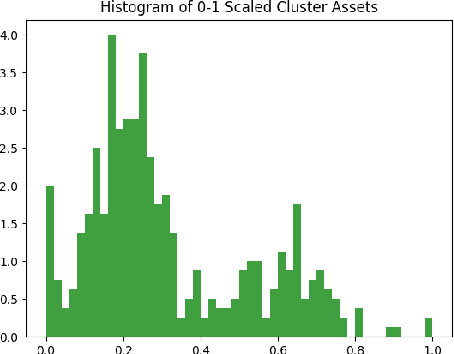
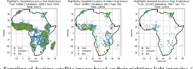
Abstract:Obtaining reliable data describing local poverty metrics at a granularity that is informative to policy-makers requires expensive and logistically difficult surveys, particularly in the developing world. Not surprisingly, the poverty stricken regions are also the ones which have a high probability of being a war zone, have poor infrastructure and sometimes have governments that do not cooperate with internationally funded development efforts. We train a CNN on free and publicly available daytime satellite images of the African continent from Landsat 7 to build a model for predicting local economic livelihoods. Only 5% of the satellite images can be associated with labels (which are obtained from DHS Surveys) and thus a semi-supervised approach using a GAN (similar to the approach of Salimans, et al. (2016)), albeit with a more stable-to-train flavor of GANs called the Wasserstein GAN regularized with gradient penalty(Gulrajani, et al. (2017)) is used. The method of multitask learning is employed to regularize the network and also create an end-to-end model for the prediction of multiple poverty metrics.
Tile2Vec: Unsupervised representation learning for spatially distributed data
May 30, 2018


Abstract:Geospatial analysis lacks methods like the word vector representations and pre-trained networks that significantly boost performance across a wide range of natural language and computer vision tasks. To fill this gap, we introduce Tile2Vec, an unsupervised representation learning algorithm that extends the distributional hypothesis from natural language -- words appearing in similar contexts tend to have similar meanings -- to spatially distributed data. We demonstrate empirically that Tile2Vec learns semantically meaningful representations on three datasets. Our learned representations significantly improve performance in downstream classification tasks and, similar to word vectors, visual analogies can be obtained via simple arithmetic in the latent space.
Poverty Prediction with Public Landsat 7 Satellite Imagery and Machine Learning
Nov 10, 2017


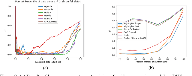
Abstract:Obtaining detailed and reliable data about local economic livelihoods in developing countries is expensive, and data are consequently scarce. Previous work has shown that it is possible to measure local-level economic livelihoods using high-resolution satellite imagery. However, such imagery is relatively expensive to acquire, often not updated frequently, and is mainly available for recent years. We train CNN models on free and publicly available multispectral daytime satellite images of the African continent from the Landsat 7 satellite, which has collected imagery with global coverage for almost two decades. We show that despite these images' lower resolution, we can achieve accuracies that exceed previous benchmarks.
 Add to Chrome
 Add to Firefox
 Add to Edge