Felipe Gonzalez
Reducing Object Detection Uncertainty from RGB and Thermal Data for UAV Outdoor Surveillance
Aug 21, 2023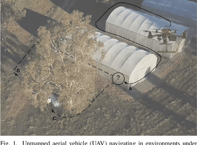
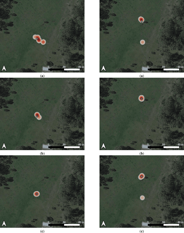
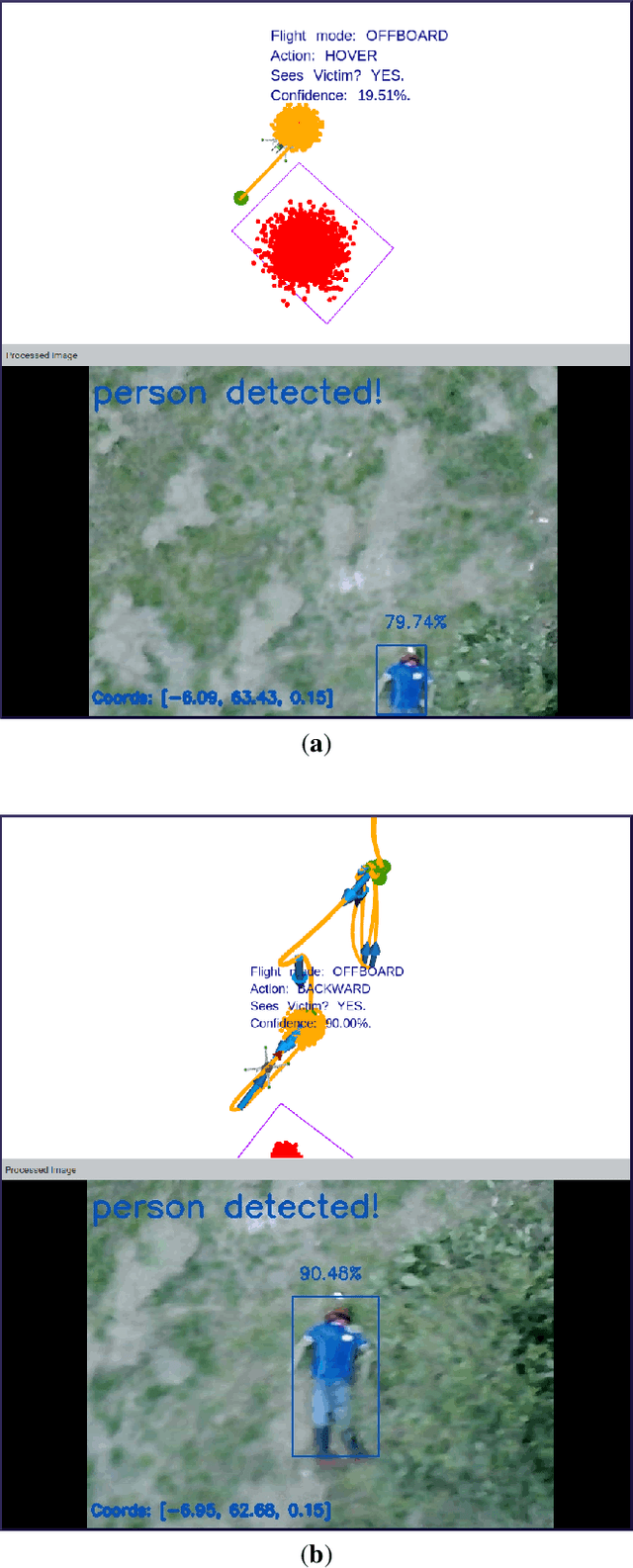
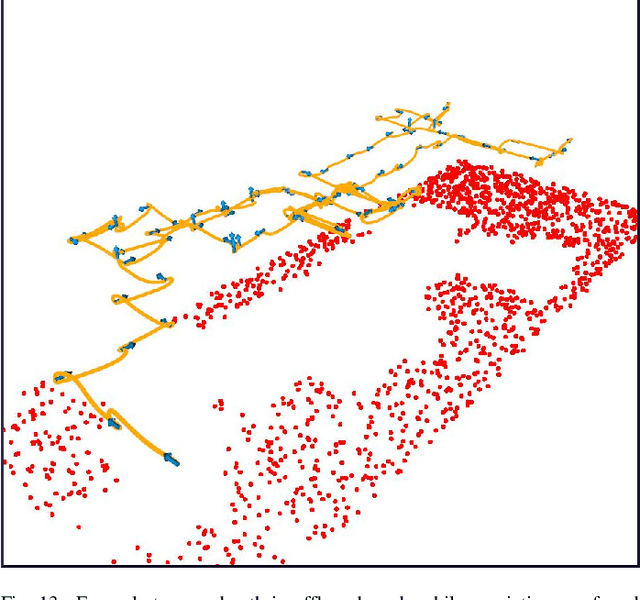
Abstract:Recent advances in Unmanned Aerial Vehicles (UAVs) have resulted in their quick adoption for wide a range of civilian applications, including precision agriculture, biosecurity, disaster monitoring and surveillance. UAVs offer low-cost platforms with flexible hardware configurations, as well as an increasing number of autonomous capabilities, including take-off, landing, object tracking and obstacle avoidance. However, little attention has been paid to how UAVs deal with object detection uncertainties caused by false readings from vision-based detectors, data noise, vibrations, and occlusion. In most situations, the relevance and understanding of these detections are delegated to human operators, as many UAVs have limited cognition power to interact autonomously with the environment. This paper presents a framework for autonomous navigation under uncertainty in outdoor scenarios for small UAVs using a probabilistic-based motion planner. The framework is evaluated with real flight tests using a sub 2 kg quadrotor UAV and illustrated in victim finding Search and Rescue (SAR) case study in a forest/bushland. The navigation problem is modelled using a Partially Observable Markov Decision Process (POMDP), and solved in real time onboard the small UAV using Augmented Belief Trees (ABT) and the TAPIR toolkit. Results from experiments using colour and thermal imagery show that the proposed motion planner provides accurate victim localisation coordinates, as the UAV has the flexibility to interact with the environment and obtain clearer visualisations of any potential victims compared to the baseline motion planner. Incorporating this system allows optimised UAV surveillance operations by diminishing false positive readings from vision-based object detectors.
Schmidt or Compressed filtering for Visual-Inertial SLAM?
Sep 29, 2021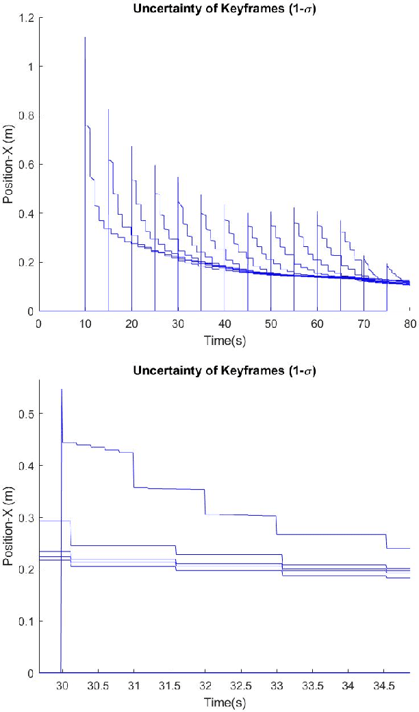
Abstract:Visual-inertial SLAM has been studied widely due to the advantage of its lightweight, cost-effectiveness, and rich information compared to other sensors. A multi-state constrained filter (MSCKF) and its Schmidt version have been developed to address the computational cost, which treats keyframes as static nuisance parameters, leading to sub-optimal performance. We propose a new Compressed-MSCKF which can achieve improved accuracy with moderate computational costs. By keeping the information gain with compressed form, it can limit to $\mathcal{O}(L)$ with $L$ being the number of local keyframes. The performance of the proposed system has been evaluated using a MATLAB simulator.
A Multi-UAV System for Exploration and Target Finding in Cluttered and GPS-Denied Environments
Jul 19, 2021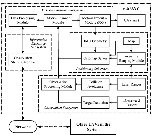
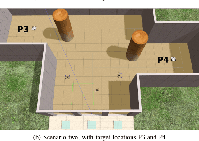
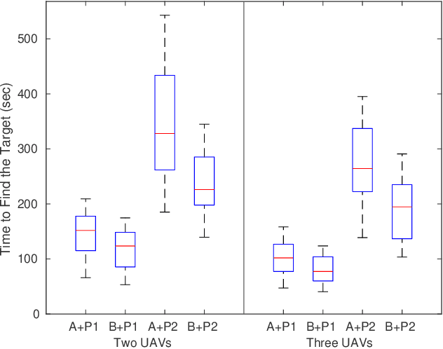
Abstract:The use of multi-rotor Unmanned Aerial Vehicles (UAVs) for search and rescue as well as remote sensing is rapidly increasing. Multi-rotor UAVs, however, have limited endurance. The range of UAV applications can be widened if teams of multiple UAVs are used. We propose a framework for a team of UAVs to cooperatively explore and find a target in complex GPS-denied environments with obstacles. The team of UAVs autonomously navigates, explores, detects, and finds the target in a cluttered environment with a known map. Examples of such environments include indoor scenarios, urban or natural canyons, caves, and tunnels, where the GPS signal is limited or blocked. The framework is based on a probabilistic decentralised Partially Observable Markov Decision Process which accounts for the uncertainties in sensing and the environment. The team can cooperate efficiently, with each UAV sharing only limited processed observations and their locations during the mission. The system is simulated using the Robotic Operating System and Gazebo. Performance of the system with an increasing number of UAVs in several indoor scenarios with obstacles is tested. Results indicate that the proposed multi-UAV system has improvements in terms of time-cost, the proportion of search area surveyed, as well as successful rates for search and rescue missions.
 Add to Chrome
 Add to Firefox
 Add to Edge