Edward Beighley
Department of CEE, Northeastern University
Online Fusion of Multi-resolution Multispectral Images with Weakly Supervised Temporal Dynamics
Jan 06, 2023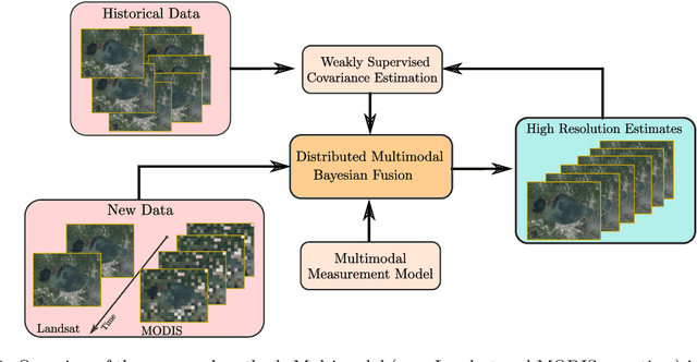

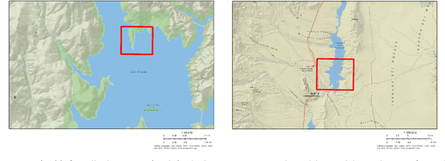

Abstract:Real-time satellite imaging has a central role in monitoring, detecting and estimating the intensity of key natural phenomena such as floods, earthquakes, etc. One important constraint of satellite imaging is the trade-off between spatial/spectral resolution and their revisiting time, a consequence of design and physical constraints imposed by satellite orbit among other technical limitations. In this paper, we focus on fusing multi-temporal, multi-spectral images where data acquired from different instruments with different spatial resolutions is used. We leverage the spatial relationship between images at multiple modalities to generate high-resolution image sequences at higher revisiting rates. To achieve this goal, we formulate the fusion method as a recursive state estimation problem and study its performance in filtering and smoothing contexts. Furthermore, a calibration strategy is proposed to estimate the time-varying temporal dynamics of the image sequence using only a small amount of historical image data. Differently from the training process in traditional machine learning algorithms, which usually require large datasets and computation times, the parameters of the temporal dynamical model are calibrated based on an analytical expression that uses only two of the images in the historical dataset. A distributed version of the Bayesian filtering and smoothing strategies is also proposed to reduce its computational complexity. To evaluate the proposed methodology we consider a water mapping task where real data acquired by the Landsat and MODIS instruments are fused generating high spatial-temporal resolution image estimates. Our experiments show that the proposed methodology outperforms the competing methods in both estimation accuracy and water mapping tasks.
Recursive classification of satellite imaging time-series: An application to water and land cover mapping
Jan 04, 2023

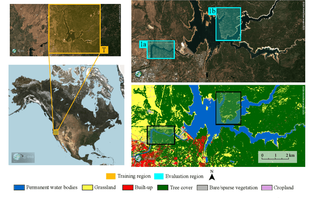
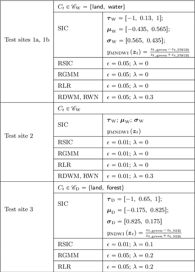
Abstract:A wide variety of applications of fundamental importance for security, environmental protection and urban development need access to accurate land cover monitoring and water mapping, for which the analysis of optical remote sensing imagery is key. Classification of time-series images, particularly with recursive methods, is of increasing interest in the current literature. Nevertheless, existing recursive approaches typically require large amounts of training data. This paper introduces a recursive classification framework that provides high accuracy while requiring low computational cost and minimal supervision. The proposed approach transforms a static classifier into a recursive one using a probabilistic framework that is robust to non-informative image variations. A water mapping and a land cover experiment are conducted analyzing Sentinel-2 satellite data covering two areas in the United States. The performance of three static classification algorithms and their recursive versions is compared, including a Gaussian Mixture Model (GMM), Logistic Regression (LR) and Spectral Index Classifiers (SICs). SICs consist in a new approach that we introduce to convert the Modified Normalized Difference Water Index (MNDWI) and the Normalized Difference Vegetation Index (NDVI) into probabilistic classification results. Two state-of-the-art deep learning-based classifiers are also used as benchmark models. Results show that the proposed method significantly increases the robustness of existing static classifiers in multitemporal settings. Our method also improves the performance of deep learning-based classifiers without the need of additional training data.
Online multi-resolution fusion of space-borne multispectral images
Apr 26, 2022


Abstract:Satellite imaging has a central role in monitoring, detecting and estimating the intensity of key natural phenomena. One important feature of satellite images is the trade-off between spatial/spectral resolution and their revisiting time, a consequence of design and physical constraints imposed by satellite orbit among other technical limitations. In this paper, we focus on fusing multi-temporal, multi-spectral images where data acquired from different instruments with different spatial resolutions is used. We leverage the spatial relationship between images at multiple modalities to generate high-resolution image sequences at higher revisiting rates. To achieve this goal, we formulate the fusion method as a recursive state estimation problem and study its performance in filtering and smoothing contexts. The proposed strategy clearly outperforms competing methodologies, which is shown in the paper for real data acquired by the Landsat and MODIS instruments.
 Add to Chrome
 Add to Firefox
 Add to Edge