Xiaming Yuan
Improving transferability of 3D adversarial attacks with scale and shear transformations
Nov 02, 2022


Abstract:Previous work has shown that 3D point cloud classifiers can be vulnerable to adversarial examples. However, most of the existing methods are aimed at white-box attacks, where the parameters and other information of the classifiers are known in the attack, which is unrealistic for real-world applications. In order to improve the attack performance of the black-box classifiers, the research community generally uses the transfer-based black-box attack. However, the transferability of current 3D attacks is still relatively low. To this end, this paper proposes Scale and Shear (SS) Attack to generate 3D adversarial examples with strong transferability. Specifically, we randomly scale or shear the input point cloud, so that the attack will not overfit the white-box model, thereby improving the transferability of the attack. Extensive experiments show that the SS attack proposed in this paper can be seamlessly combined with the existing state-of-the-art (SOTA) 3D point cloud attack methods to form more powerful attack methods, and the SS attack improves the transferability over 3.6 times compare to the baseline. Moreover, while substantially outperforming the baseline methods, the SS attack achieves SOTA transferability under various defenses. Our code will be available online at https://github.com/cuge1995/SS-attack
Robust Autonomous Landing of UAV in Non-Cooperative Environments based on Dynamic Time Camera-LiDAR Fusion
Nov 27, 2020


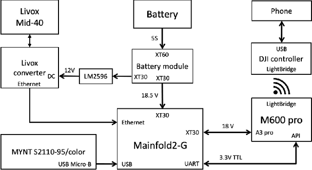
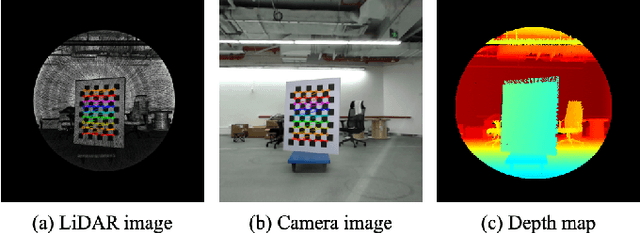
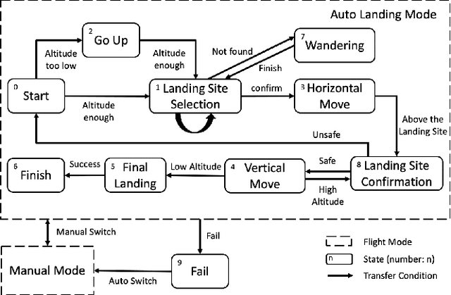
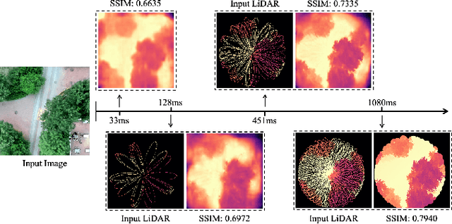
Abstract:Selecting safe landing sites in non-cooperative environments is a key step towards the full autonomy of UAVs. However, the existing methods have the common problems of poor generalization ability and robustness. Their performance in unknown environments is significantly degraded and the error cannot be self-detected and corrected. In this paper, we construct a UAV system equipped with low-cost LiDAR and binocular cameras to realize autonomous landing in non-cooperative environments by detecting the flat and safe ground area. Taking advantage of the non-repetitive scanning and high FOV coverage characteristics of LiDAR, we come up with a dynamic time depth completion algorithm. In conjunction with the proposed self-evaluation method of the depth map, our model can dynamically select the LiDAR accumulation time at the inference phase to ensure an accurate prediction result. Based on the depth map, the high-level terrain information such as slope, roughness, and the size of the safe area are derived. We have conducted extensive autonomous landing experiments in a variety of familiar or completely unknown environments, verifying that our model can adaptively balance the accuracy and speed, and the UAV can robustly select a safe landing site.
 Add to Chrome
 Add to Firefox
 Add to Edge