Samuel Hibbard
Use-Inspired Mobile Robot to Improve Safety of Building Retrofit Workforce in Constrained Spaces
Nov 25, 2024


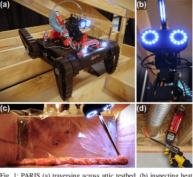
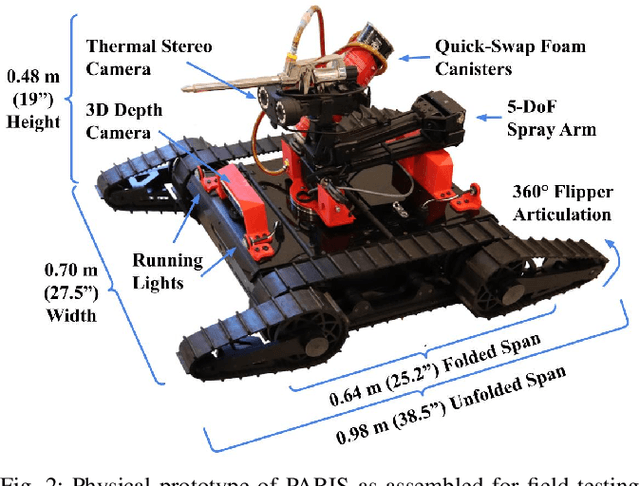
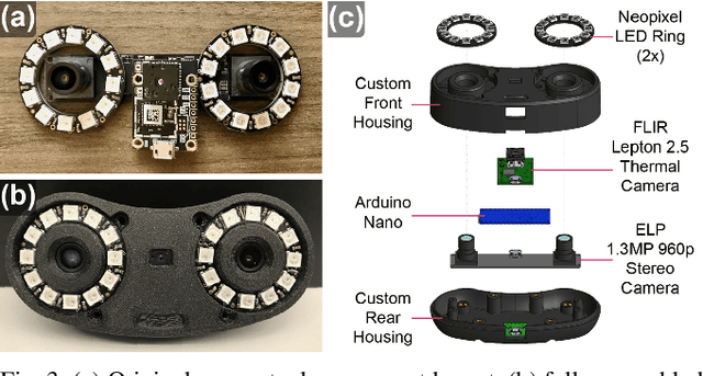
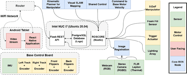
Abstract:The inspection of confined critical infrastructure such as attics or crawlspaces is challenging for human operators due to insufficient task space, limited visibility, and the presence of hazardous materials. This paper introduces a prototype of PARIS (Precision Application Robot for Inaccessible Spaces): a use-inspired teleoperated mobile robot manipulator system that was conceived, developed, and tested for and selected as a Phase I winner of the U.S. Department of Energy's E-ROBOT Prize. To improve the thermal efficiency of buildings, the PARIS platform supports: 1) teleoperated mapping and navigation, enabling the human operator to explore compact spaces; 2) inspection and sensing, facilitating the identification and localization of under-insulated areas; and 3) air-sealing targeted gaps and cracks through which thermal energy is lost. The resulting versatile platform can also be tailored for targeted application of treatments and remediation in constrained spaces.
PROSPECT: Precision Robot Spectroscopy Exploration and Characterization Tool
Mar 25, 2024


Abstract:Near Infrared (NIR) spectroscopy is widely used in industrial quality control and automation to test the purity and material quality of items. In this research, we propose a novel sensorized end effector and acquisition strategy to capture spectral signatures from objects and register them with a 3D point cloud. Our methodology first takes a 3D scan of an object generated by a time-of-flight depth camera and decomposes the object into a series of planned viewpoints covering the surface. We generate motion plans for a robot manipulator and end-effector to visit these viewpoints while maintaining a fixed distance and surface normal to ensure maximal spectral signal quality enabled by the spherical motion of the end-effector. By continuously acquiring surface reflectance values as the end-effector scans the target object, the autonomous system develops a four-dimensional model of the target object: position in an R^3 coordinate frame, and a wavelength vector denoting the associated spectral signature. We demonstrate this system in building spectral-spatial object profiles of increasingly complex geometries. As a point of comparison, we show our proposed system and spectral acquisition planning yields more consistent signal signals than naive point scanning strategies for capturing spectral information over complex surface geometries. Our work represents a significant step towards high-resolution spectral-spatial sensor fusion for automated quality assessment.
Hyper-Drive: Visible-Short Wave Infrared Hyperspectral Imaging Datasets for Robots in Unstructured Environments
Aug 15, 2023Abstract:Hyperspectral sensors have enjoyed widespread use in the realm of remote sensing; however, they must be adapted to a format in which they can be operated onboard mobile robots. In this work, we introduce a first-of-its-kind system architecture with snapshot hyperspectral cameras and point spectrometers to efficiently generate composite datacubes from a robotic base. Our system collects and registers datacubes spanning the visible to shortwave infrared (660-1700 nm) spectrum while simultaneously capturing the ambient solar spectrum reflected off a white reference tile. We collect and disseminate a large dataset of more than 500 labeled datacubes from on-road and off-road terrain compliant with the ATLAS ontology to further the integration and demonstration of hyperspectral imaging (HSI) as beneficial in terrain class separability. Our analysis of this data demonstrates that HSI is a significant opportunity to increase understanding of scene composition from a robot-centric context. All code and data are open source online: https://river-lab.github.io/hyper_drive_data
 Add to Chrome
 Add to Firefox
 Add to Edge