Ron Hagensieker
Formatting the Landscape: Spatial conditional GAN for varying population in satellite imagery
Dec 08, 2020
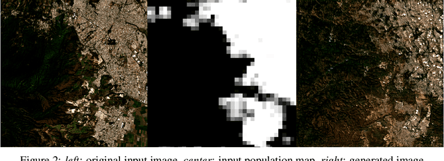
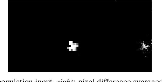
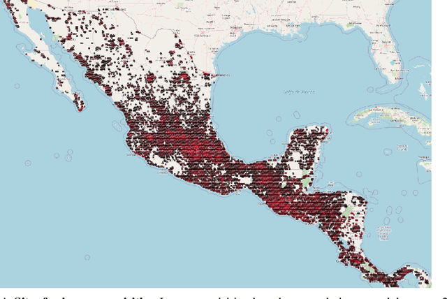
Abstract:Climate change is expected to reshuffle the settlement landscape: forcing people in affected areas to migrate, to change their lifeways, and continuing to affect demographic change throughout the world. Changes to the geographic distribution of population will have dramatic impacts on land use and land cover and thus constitute one of the major challenges of planning for climate change scenarios. In this paper, we explore a generative model framework for generating satellite imagery conditional on gridded population distributions. We make additions to the existing ALAE architecture, creating a spatially conditional version: SCALAE. This method allows us to explicitly disentangle population from the model's latent space and thus input custom population forecasts into the generated imagery. We postulate that such imagery could then be directly used for land cover and land use change estimation using existing frameworks, as well as for realistic visualisation of expected local change. We evaluate the model by comparing pixel and semantic reconstructions, as well as calculate the standard FID metric. The results suggest the model captures population distributions accurately and delivers a controllable method to generate realistic satellite imagery.
Pix2Streams: Dynamic Hydrology Maps from Satellite-LiDAR Fusion
Nov 15, 2020


Abstract:Where are the Earth's streams flowing right now? Inland surface waters expand with floods and contract with droughts, so there is no one map of our streams. Current satellite approaches are limited to monthly observations that map only the widest streams. These are fed by smaller tributaries that make up much of the dendritic surface network but whose flow is unobserved. A complete map of our daily waters can give us an early warning for where droughts are born: the receding tips of the flowing network. Mapping them over years can give us a map of impermanence of our waters, showing where to expect water, and where not to. To that end, we feed the latest high-res sensor data to multiple deep learning models in order to map these flowing networks every day, stacking the times series maps over many years. Specifically, i) we enhance water segmentation to $50$ cm/pixel resolution, a 60$\times$ improvement over previous state-of-the-art results. Our U-Net trained on 30-40cm WorldView3 images can detect streams as narrow as 1-3m (30-60$\times$ over SOTA). Our multi-sensor, multi-res variant, WasserNetz, fuses a multi-day window of 3m PlanetScope imagery with 1m LiDAR data, to detect streams 5-7m wide. Both U-Nets produce a water probability map at the pixel-level. ii) We integrate this water map over a DEM-derived synthetic valley network map to produce a snapshot of flow at the stream level. iii) We apply this pipeline, which we call Pix2Streams, to a 2-year daily PlanetScope time-series of three watersheds in the US to produce the first high-fidelity dynamic map of stream flow frequency. The end result is a new map that, if applied at the national scale, could fundamentally improve how we manage our water resources around the world.
Tropical Land Use Land Cover Mapping in Pará using Discriminative Markov Random Fields and Multi-temporal TerraSAR-X Data
Sep 22, 2017
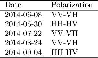
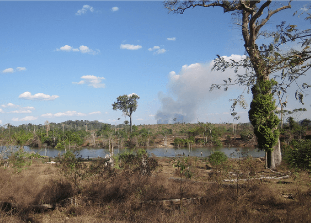
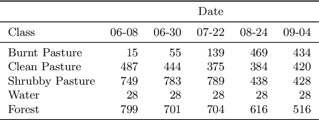
Abstract:Remote sensing satellite data offer the unique possibility to map land use land cover transformations by providing spatially explicit information. However, detection of short-term processes and land use patterns of high spatial-temporal variability is a challenging task. We present a novel framework using multi-temporal TerraSAR-X data and machine learning techniques, namely Discriminative Markov Random Fields with spatio-temporal priors, and Import Vector Machines, in order to advance the mapping of land cover characterized by short-term changes. Our study region covers a current deforestation frontier in the Brazilian state Par\'{a} with land cover dominated by primary forests, different types of pasture land and secondary vegetation, and land use dominated by short-term processes such as slash-and-burn activities. The data set comprises multi-temporal TerraSAR-X imagery acquired over the course of the 2014 dry season, as well as optical data (RapidEye, Landsat) for reference. Results show that land use land cover is reliably mapped, resulting in spatially adjusted overall accuracies of up to $79\%$ in a five class setting, yet limitations for the differentiation of different pasture types remain. The proposed method is applicable on multi-temporal data sets, and constitutes a feasible approach to map land use land cover in regions that are affected by high-frequent temporal changes.
 Add to Chrome
 Add to Firefox
 Add to Edge