Qiqi Zhu
Multimodal Urban Areas of Interest Generation via Remote Sensing Imagery and Geographical Prior
Jan 31, 2024


Abstract:Urban area-of-interest (AOI) refers to an integrated urban functional zone with defined boundaries. The rapid development of urban commerce has resulted in an increased demand for more precise requirements in defining AOIs. However, existing research primarily concentrates on broad AOI mining for urban planning or regional economic analysis, failing to cater to the precise requirements of mobile Internet online-to-offline businesses. These businesses necessitate accuracy down to a specific community, school, or hospital. In this paper, we propose an end-to-end multimodal deep learning algorithm for detecting AOI fence polygon using remote sensing images and multi-semantics reference information. We then evaluate its timeliness through a cascaded module that incorporates dynamic human mobility and logistics address information. Specifically, we begin by selecting a point-of-interest (POI) of specific category, and use it to recall corresponding remote sensing images, nearby POIs, road nodes, human mobility, and logistics addresses to build a multimodal detection model based on transformer encoder-decoder architecture, titled AOITR. In the model, in addition to the remote sensing images, multi-semantic information including core POI and road nodes is embedded and reorganized as the query content part for the transformer decoder to generate the AOI polygon. Meanwhile, relatively dynamic distribution features of human mobility, nearby POIs, and logistics addresses are used for AOI reliability evaluation through a cascaded feedforward network. The experimental results demonstrate that our algorithm significantly outperforms two existing methods.
A Spectral-Spatial-Dependent Global Learning Framework for Insufficient and Imbalanced Hyperspectral Image Classification
May 29, 2021


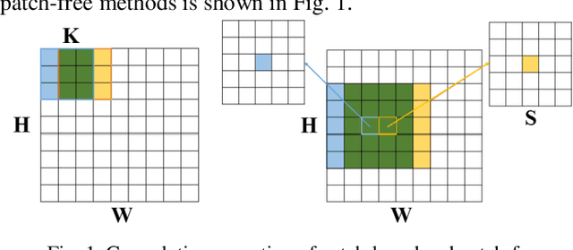
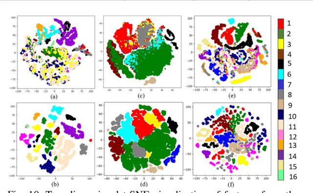
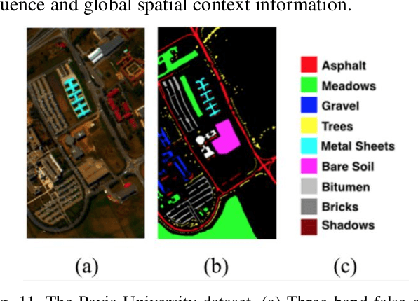
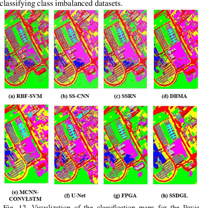
Abstract:Deep learning techniques have been widely applied to hyperspectral image (HSI) classification and have achieved great success. However, the deep neural network model has a large parameter space and requires a large number of labeled data. Deep learning methods for HSI classification usually follow a patchwise learning framework. Recently, a fast patch-free global learning (FPGA) architecture was proposed for HSI classification according to global spatial context information. However, FPGA has difficulty extracting the most discriminative features when the sample data is imbalanced. In this paper, a spectral-spatial dependent global learning (SSDGL) framework based on global convolutional long short-term memory (GCL) and global joint attention mechanism (GJAM) is proposed for insufficient and imbalanced HSI classification. In SSDGL, the hierarchically balanced (H-B) sampling strategy and the weighted softmax loss are proposed to address the imbalanced sample problem. To effectively distinguish similar spectral characteristics of land cover types, the GCL module is introduced to extract the long short-term dependency of spectral features. To learn the most discriminative feature representations, the GJAM module is proposed to extract attention areas. The experimental results obtained with three public HSI datasets show that the SSDGL has powerful performance in insufficient and imbalanced sample problems and is superior to other state-of-the-art methods. Code can be obtained at: https://github.com/dengweihuan/SSDGL.
 Add to Chrome
 Add to Firefox
 Add to Edge