Pierre Philippe Mathieu
An Interpretable Deep Semantic Segmentation Method for Earth Observation
Oct 23, 2022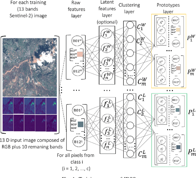
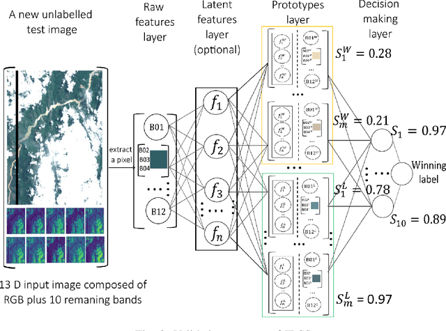
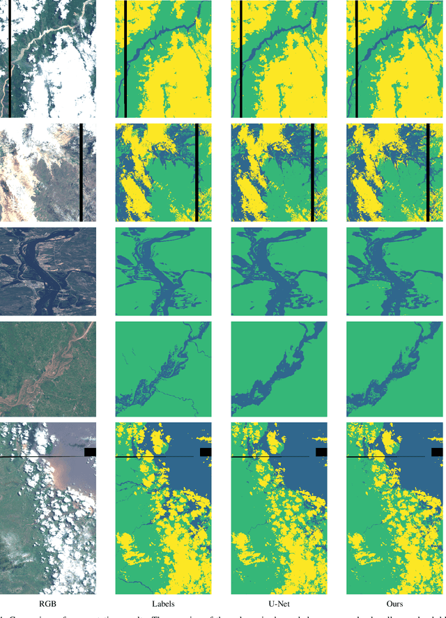
Abstract:Earth observation is fundamental for a range of human activities including flood response as it offers vital information to decision makers. Semantic segmentation plays a key role in mapping the raw hyper-spectral data coming from the satellites into a human understandable form assigning class labels to each pixel. In this paper, we introduce a prototype-based interpretable deep semantic segmentation (IDSS) method, which is highly accurate as well as interpretable. Its parameters are in orders of magnitude less than the number of parameters used by deep networks such as U-Net and are clearly interpretable by humans. The proposed here IDSS offers a transparent structure that allows users to inspect and audit the algorithm's decision. Results have demonstrated that IDSS could surpass other algorithms, including U-Net, in terms of IoU (Intersection over Union) total water and Recall total water. We used WorldFloods data set for our experiments and plan to use the semantic segmentation results combined with masks for permanent water to detect flood events.
On Board Volcanic Eruption Detection through CNNs and Satellite Multispectral Imagery
Jul 28, 2021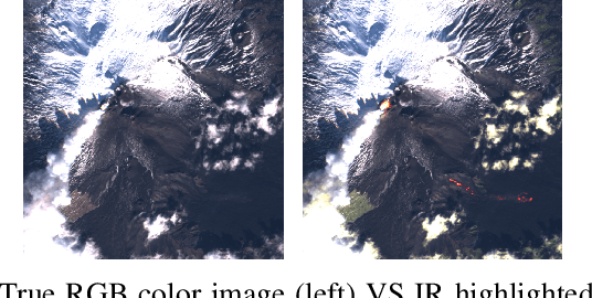
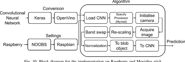

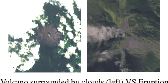
Abstract:In recent years, the growth of Machine Learning (ML) algorithms has raised the number of studies including their applicability in a variety of different scenarios. Among all, one of the hardest ones is the aerospace, due to its peculiar physical requirements. In this context, a feasibility study and a first prototype for an Artificial Intelligence (AI) model to be deployed on board satellites are presented in this work. As a case study, the detection of volcanic eruptions has been investigated as a method to swiftly produce alerts and allow immediate interventions. Two Convolutional Neural Networks (CNNs) have been proposed and designed, showing how to efficiently implement them for identifying the eruptions and at the same time adapting their complexity in order to fit on board requirements.
Sentinel-1 and Sentinel-2 Spatio-Temporal Data Fusion for Clouds Removal
Jun 23, 2021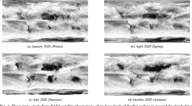
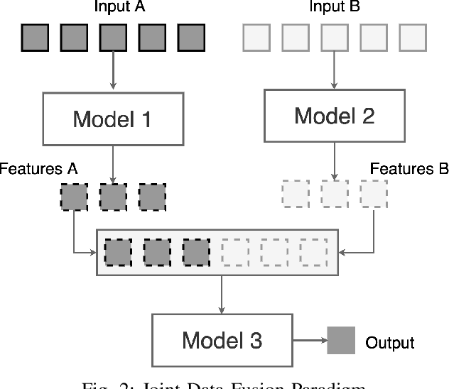
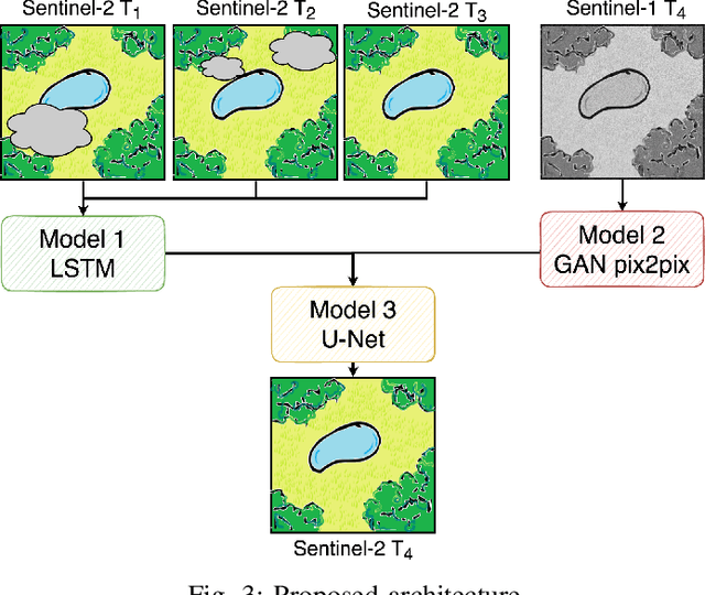
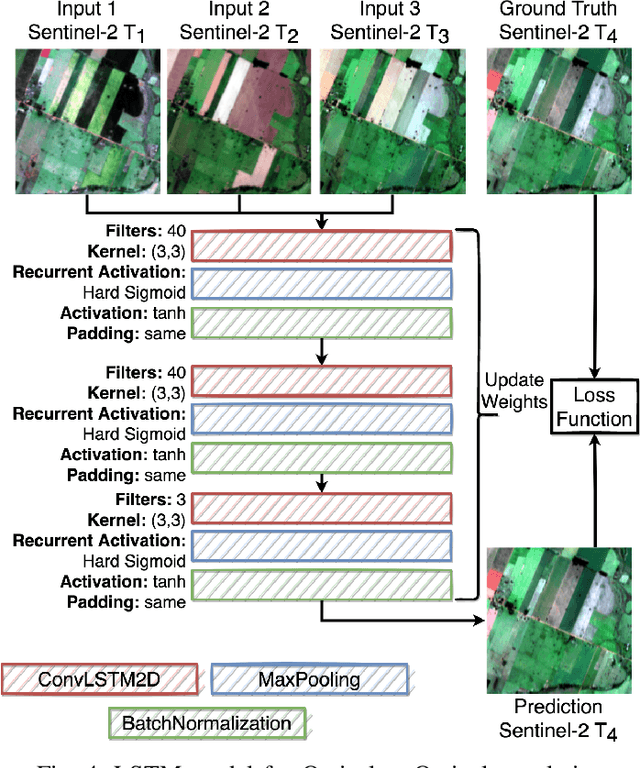
Abstract:The abundance of clouds, located both spatially and temporally, often makes remote sensing applications with optical images difficult or even impossible. In this manuscript, a novel method for clouds-corrupted optical image restoration has been presented and developed, based on a joint data fusion paradigm, where three deep neural networks have been combined in order to fuse spatio-temporal features extracted from Sentinel-1 and Sentinel-2 time-series of data. It is worth highlighting that both the code and the dataset have been implemented from scratch and made available to interested research for further analysis and investigation.
Paradigm selection for Data Fusion of SAR and Multispectral Sentinel data applied to Land-Cover Classification
Jun 18, 2021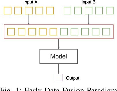
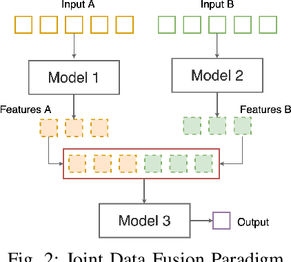
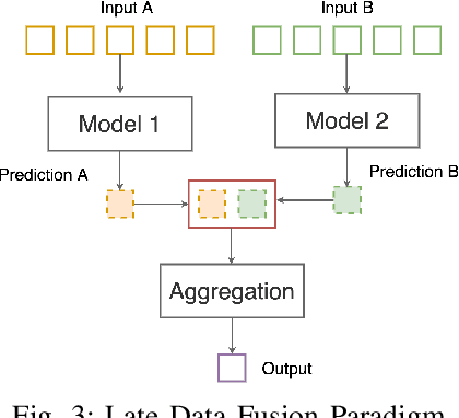
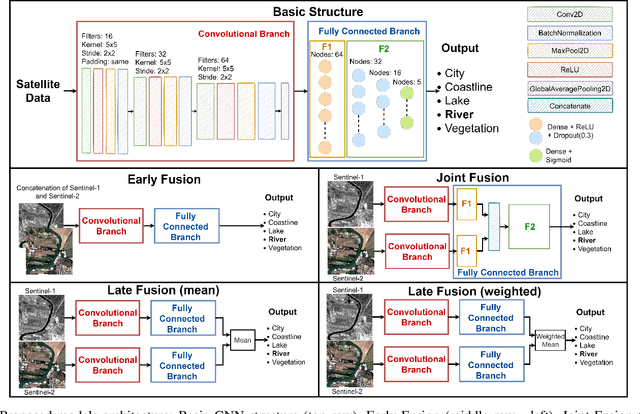
Abstract:Data fusion is a well-known technique, becoming more and more popular in the Artificial Intelligence for Earth Observation (AI4EO) domain mainly due to its ability of reinforcing AI4EO applications by combining multiple data sources and thus bringing better results. On the other hand, like other methods for satellite data analysis, data fusion itself is also benefiting and evolving thanks to the integration of Artificial Intelligence (AI). In this letter, four data fusion paradigms, based on Convolutional Neural Networks (CNNs), are analyzed and implemented. The goals are to provide a systematic procedure for choosing the best data fusion framework, resulting in the best classification results, once the basic structure for the CNN has been defined, and to help interested researchers in their work when data fusion applied to remote sensing is involved. The procedure has been validated for land-cover classification but it can be transferred to other cases.
 Add to Chrome
 Add to Firefox
 Add to Edge