Levente J. Klein
Aboveground carbon biomass estimate with Physics-informed deep network
Oct 25, 2022Abstract:The global carbon cycle is a key process to understand how our climate is changing. However, monitoring the dynamics is difficult because a high-resolution robust measurement of key state parameters including the aboveground carbon biomass (AGB) is required. Here, we use deep neural network to generate a wall-to-wall map of AGB within the Continental USA (CONUS) with 30-meter spatial resolution for the year 2021. We combine radar and optical hyperspectral imagery, with a physical climate parameter of SIF-based GPP. Validation results show that a masked variation of UNet has the lowest validation RMSE of 37.93 $\pm$ 1.36 Mg C/ha, as compared to 52.30 $\pm$ 0.03 Mg C/ha for random forest algorithm. Furthermore, models that learn from SIF-based GPP in addition to radar and optical imagery reduce validation RMSE by almost 10% and the standard deviation by 40%. Finally, we apply our model to measure losses in AGB from the recent 2021 Caldor wildfire in California, and validate our analysis with Sentinel-based burn index.
S3RP: Self-Supervised Super-Resolution and Prediction for Advection-Diffusion Process
Nov 08, 2021


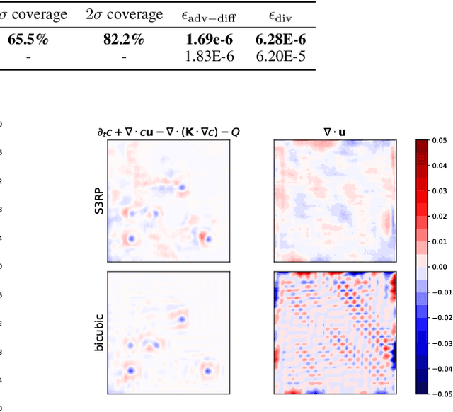
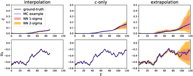
Abstract:We present a super-resolution model for an advection-diffusion process with limited information. While most of the super-resolution models assume high-resolution (HR) ground-truth data in the training, in many cases such HR dataset is not readily accessible. Here, we show that a Recurrent Convolutional Network trained with physics-based regularizations is able to reconstruct the HR information without having the HR ground-truth data. Moreover, considering the ill-posed nature of a super-resolution problem, we employ the Recurrent Wasserstein Autoencoder to model the uncertainty.
PAIRS AutoGeo: an Automated Machine Learning Framework for Massive Geospatial Data
Dec 12, 2020


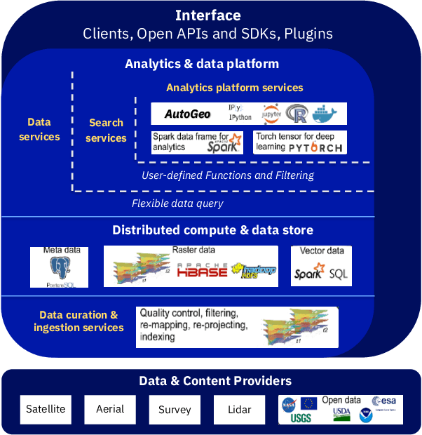
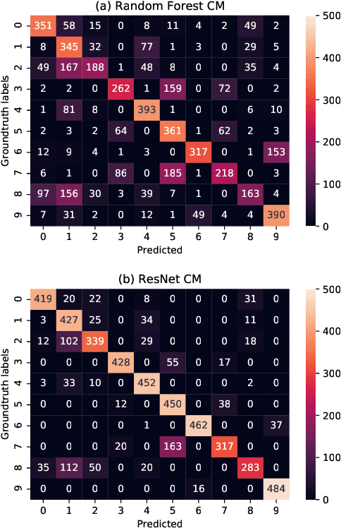
Abstract:An automated machine learning framework for geospatial data named PAIRS AutoGeo is introduced on IBM PAIRS Geoscope big data and analytics platform. The framework simplifies the development of industrial machine learning solutions leveraging geospatial data to the extent that the user inputs are minimized to merely a text file containing labeled GPS coordinates. PAIRS AutoGeo automatically gathers required data at the location coordinates, assembles the training data, performs quality check, and trains multiple machine learning models for subsequent deployment. The framework is validated using a realistic industrial use case of tree species classification. Open-source tree species data are used as the input to train a random forest classifier and a modified ResNet model for 10-way tree species classification based on aerial imagery, which leads to an accuracy of $59.8\%$ and $81.4\%$, respectively. This use case exemplifies how PAIRS AutoGeo enables users to leverage machine learning without extensive geospatial expertise.
 Add to Chrome
 Add to Firefox
 Add to Edge