Han Lin Aung
Bridging the gap between prostate radiology and pathology through machine learning
Dec 03, 2021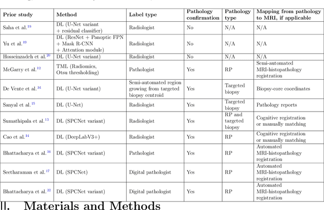
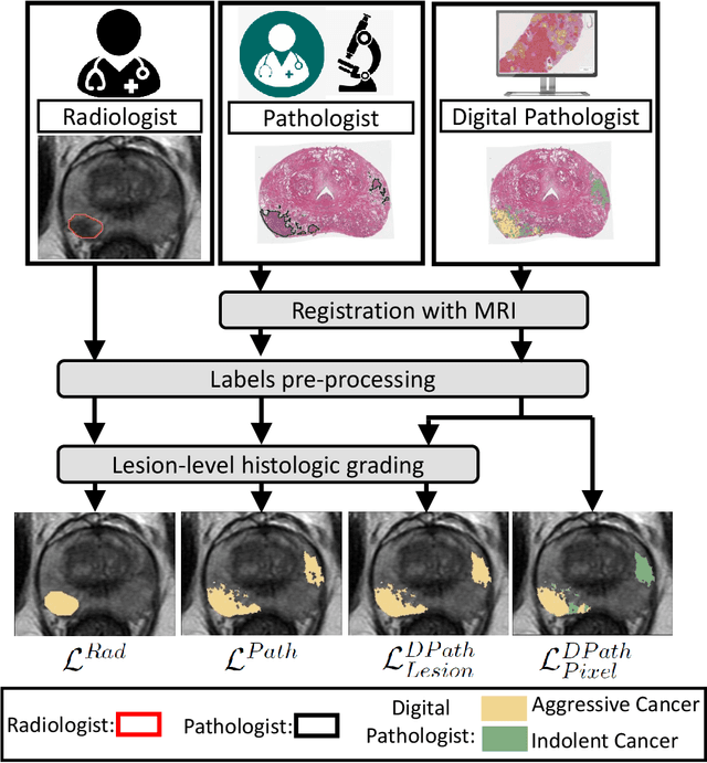
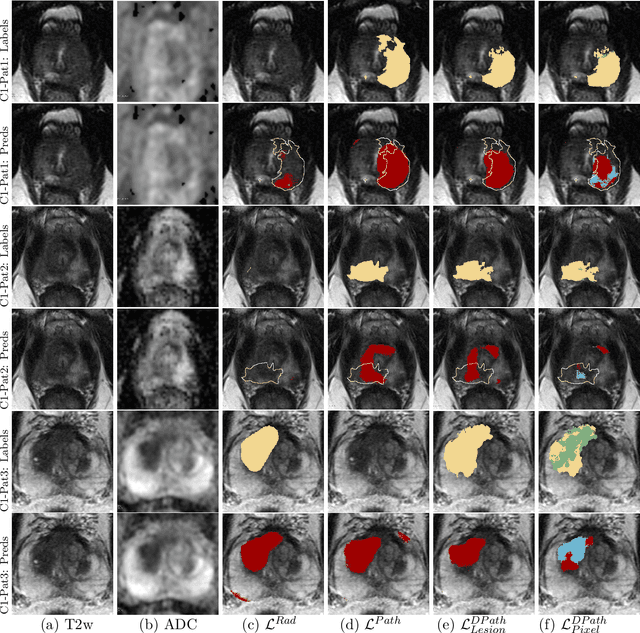
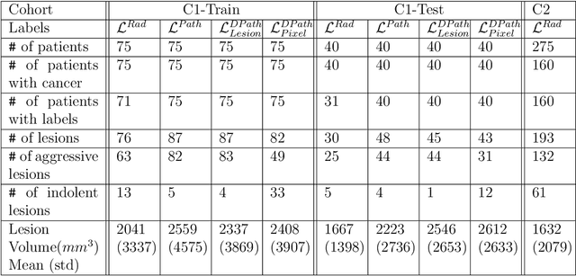
Abstract:Prostate cancer is the second deadliest cancer for American men. While Magnetic Resonance Imaging (MRI) is increasingly used to guide targeted biopsies for prostate cancer diagnosis, its utility remains limited due to high rates of false positives and false negatives as well as low inter-reader agreements. Machine learning methods to detect and localize cancer on prostate MRI can help standardize radiologist interpretations. However, existing machine learning methods vary not only in model architecture, but also in the ground truth labeling strategies used for model training. In this study, we compare different labeling strategies, namely, pathology-confirmed radiologist labels, pathologist labels on whole-mount histopathology images, and lesion-level and pixel-level digital pathologist labels (previously validated deep learning algorithm on histopathology images to predict pixel-level Gleason patterns) on whole-mount histopathology images. We analyse the effects these labels have on the performance of the trained machine learning models. Our experiments show that (1) radiologist labels and models trained with them can miss cancers, or underestimate cancer extent, (2) digital pathologist labels and models trained with them have high concordance with pathologist labels, and (3) models trained with digital pathologist labels achieve the best performance in prostate cancer detection in two different cohorts with different disease distributions, irrespective of the model architecture used. Digital pathologist labels can reduce challenges associated with human annotations, including labor, time, inter- and intra-reader variability, and can help bridge the gap between prostate radiology and pathology by enabling the training of reliable machine learning models to detect and localize prostate cancer on MRI.
Farmland Parcel Delineation Using Spatio-temporal Convolutional Networks
Apr 20, 2020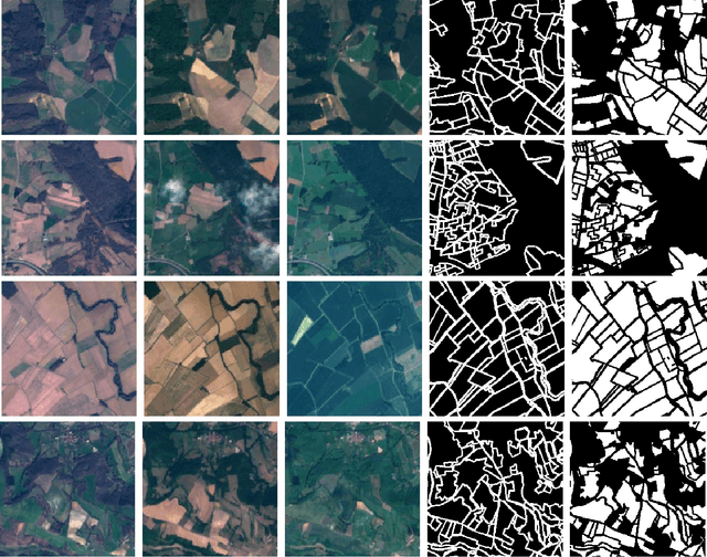

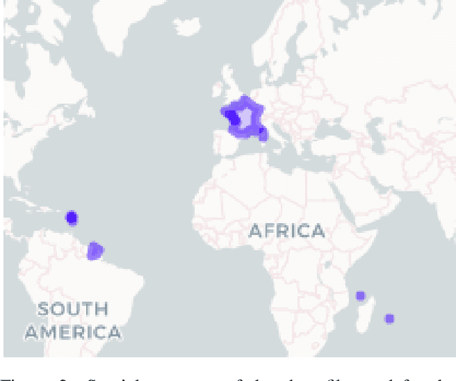
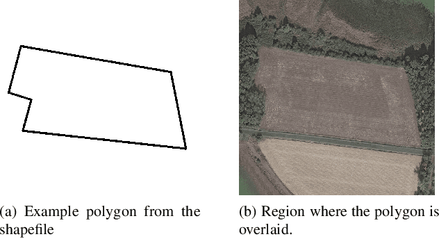
Abstract:Farm parcel delineation provides cadastral data that is important in developing and managing climate change policies. Specifically, farm parcel delineation informs applications in downstream governmental policies of land allocation, irrigation, fertilization, green-house gases (GHG's), etc. This data can also be useful for the agricultural insurance sector for assessing compensations following damages associated with extreme weather events - a growing trend related to climate change. Using satellite imaging can be a scalable and cost effective manner to perform the task of farm parcel delineation to collect this valuable data. In this paper, we break down this task using satellite imaging into two approaches: 1) Segmentation of parcel boundaries, and 2) Segmentation of parcel areas. We implemented variations of UNets, one of which takes into account temporal information, which achieved the best results on our dataset on farmland parcels in France in 2017.
 Add to Chrome
 Add to Firefox
 Add to Edge