SpectralEarth: Training Hyperspectral Foundation Models at Scale
Paper and Code
Aug 15, 2024


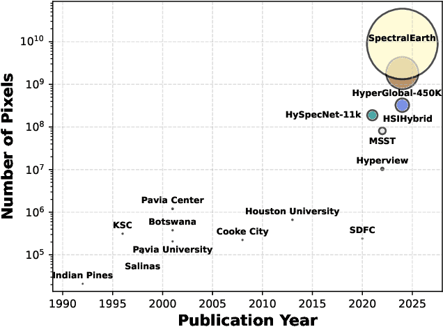
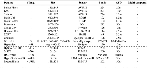
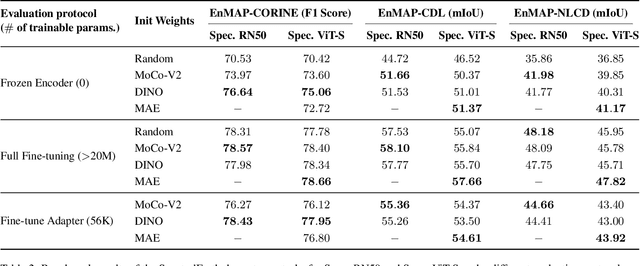
Foundation models have triggered a paradigm shift in computer vision and are increasingly being adopted in remote sensing, particularly for multispectral imagery. Yet, their potential in hyperspectral imaging (HSI) remains untapped due to the absence of comprehensive and globally representative hyperspectral datasets. To close this gap, we introduce SpectralEarth, a large-scale multi-temporal dataset designed to pretrain hyperspectral foundation models leveraging data from the Environmental Mapping and Analysis Program (EnMAP). SpectralEarth comprises 538,974 image patches covering 415,153 unique locations from more than 11,636 globally distributed EnMAP scenes spanning two years of archive. Additionally, 17.5% of these locations include multiple timestamps, enabling multi-temporal HSI analysis. Utilizing state-of-the-art self-supervised learning (SSL) algorithms, we pretrain a series of foundation models on SpectralEarth. We integrate a spectral adapter into classical vision backbones to accommodate the unique characteristics of HSI. In tandem, we construct four downstream datasets for land-cover and crop-type mapping, providing benchmarks for model evaluation. Experimental results support the versatility of our models, showcasing their generalizability across different tasks and sensors. We also highlight computational efficiency during model fine-tuning. The dataset, models, and source code will be made publicly available.
 Add to Chrome
 Add to Firefox
 Add to Edge