DHP-Mapping: A Dense Panoptic Mapping System with Hierarchical World Representation and Label Optimization Techniques
Paper and Code
Mar 25, 2024


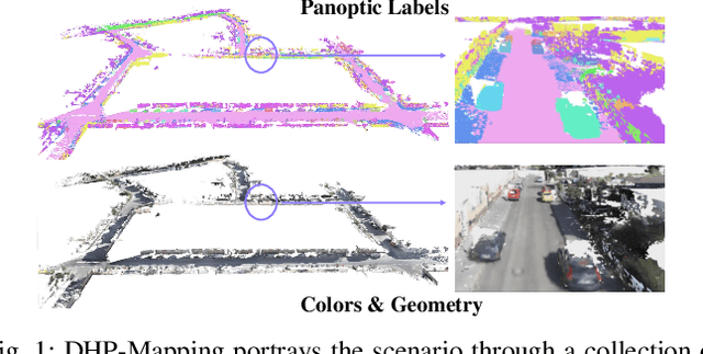
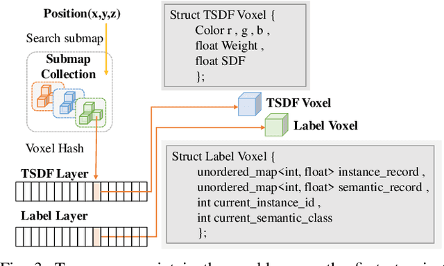
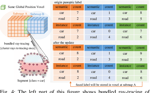
Maps provide robots with crucial environmental knowledge, thereby enabling them to perform interactive tasks effectively. Easily accessing accurate abstract-to-detailed geometric and semantic concepts from maps is crucial for robots to make informed and efficient decisions. To comprehensively model the environment and effectively manage the map data structure, we propose DHP-Mapping, a dense mapping system that utilizes multiple Truncated Signed Distance Field (TSDF) submaps and panoptic labels to hierarchically model the environment. The output map is able to maintain both voxel- and submap-level metric and semantic information. Two modules are presented to enhance the mapping efficiency and label consistency: (1) an inter-submaps label fusion strategy to eliminate duplicate points across submaps and (2) a conditional random field (CRF) based approach to enhance panoptic labels through object label comprehension and contextual information. We conducted experiments with two public datasets including indoor and outdoor scenarios. Our system performs comparably to state-of-the-art (SOTA) methods across geometry and label accuracy evaluation metrics. The experiment results highlight the effectiveness and scalability of our system, as it is capable of constructing precise geometry and maintaining consistent panoptic labels. Our code is publicly available at https://github.com/hutslib/DHP-Mapping.
 Add to Chrome
 Add to Firefox
 Add to Edge