Tim Davis
RapidAI4EO: Mono- and Multi-temporal Deep Learning models for Updating the CORINE Land Cover Product
Oct 26, 2022


Abstract:In the remote sensing community, Land Use Land Cover (LULC) classification with satellite imagery is a main focus of current research activities. Accurate and appropriate LULC classification, however, continues to be a challenging task. In this paper, we evaluate the performance of multi-temporal (monthly time series) compared to mono-temporal (single time step) satellite images for multi-label classification using supervised learning on the RapidAI4EO dataset. As a first step, we trained our CNN model on images at a single time step for multi-label classification, i.e. mono-temporal. We incorporated time-series images using a LSTM model to assess whether or not multi-temporal signals from satellites improves CLC classification. The results demonstrate an improvement of approximately 0.89% in classifying satellite imagery on 15 classes using a multi-temporal approach on monthly time series images compared to the mono-temporal approach. Using features from multi-temporal or mono-temporal images, this work is a step towards an efficient change detection and land monitoring approach.
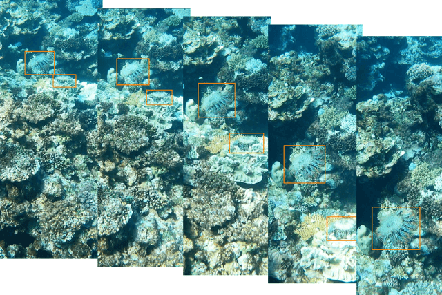
The CSIRO Crown-of-Thorn Starfish Detection Dataset
Nov 29, 2021
Abstract:Crown-of-Thorn Starfish (COTS) outbreaks are a major cause of coral loss on the Great Barrier Reef (GBR) and substantial surveillance and control programs are underway in an attempt to manage COTS populations to ecologically sustainable levels. We release a large-scale, annotated underwater image dataset from a COTS outbreak area on the GBR, to encourage research on Machine Learning and AI-driven technologies to improve the detection, monitoring, and management of COTS populations at reef scale. The dataset is released and hosted in a Kaggle competition that challenges the international Machine Learning community with the task of COTS detection from these underwater images.
 Add to Chrome
 Add to Firefox
 Add to Edge