Teaya Yang
A Tactile Feedback Approach to Path Recovery after High-Speed Impacts for Collision-Resilient Drones
Oct 18, 2024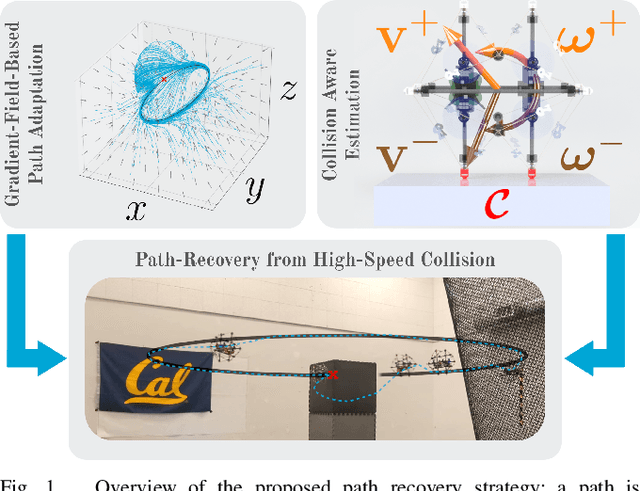
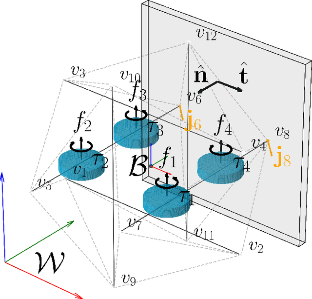

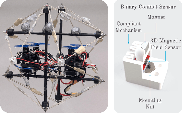
Abstract:Aerial robots are a well-established solution for exploration, monitoring, and inspection, thanks to their superior maneuverability and agility. However, in many environments of interest, they risk crashing and sustaining damage following collisions. Traditional methods focus on avoiding obstacles entirely to prevent damage, but these approaches can be limiting, particularly in complex environments where collisions may be unavoidable, or on weight and compute-constrained platforms. This paper presents a novel approach to enhance the robustness and autonomy of drones in such scenarios by developing a path recovery and adjustment method for a high-speed collision-resistant drone equipped with binary contact sensors. The proposed system employs an estimator that explicitly models collisions, using pre-collision velocities and rates to predict post-collision dynamics, thereby improving the drone's state estimation accuracy. Additionally, we introduce a vector-field-based path representation which guarantees convergence to the path. Post-collision, the contact point is incorporated into the vector field as a repulsive potential, enabling the drone to avoid obstacles while naturally converging to the original path. The effectiveness of this method is validated through Monte Carlo simulations and demonstrated on a physical prototype, showing successful path following and adjustment through collisions as well as recovery from collisions at speeds up to 3.7 m / s.
Towards Safe and Efficient Through-the-Canopy Autonomous Fruit Counting with UAVs
Sep 26, 2024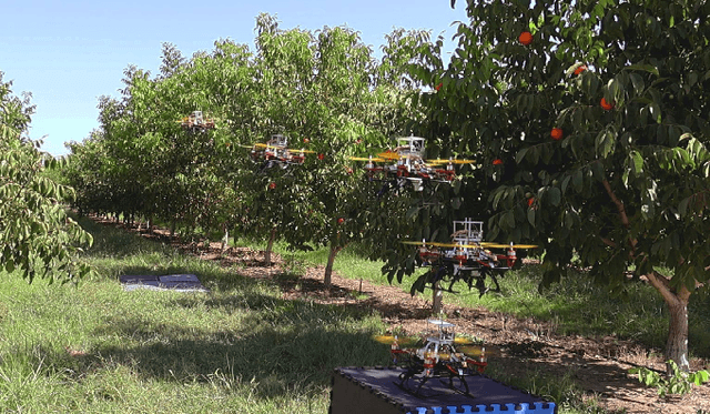

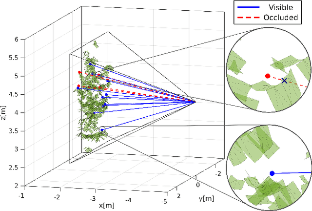
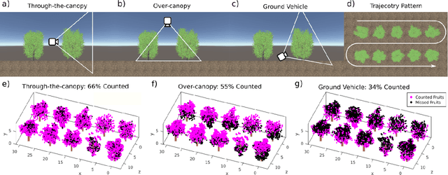
Abstract:We present an autonomous aerial system for safe and efficient through-the-canopy fruit counting. Aerial robot applications in large-scale orchards face significant challenges due to the complexity of fine-tuning flight paths based on orchard layouts, canopy density, and plant variability. Through-the-canopy navigation is crucial for minimizing occlusion by leaves and branches but is more challenging due to the complex and dense environment compared to traditional over-the-canopy flights. Our system addresses these challenges by integrating: i) a high-fidelity simulation framework for optimizing flight trajectories, ii) a low-cost autonomy stack for canopy-level navigation and data collection, and iii) a robust workflow for fruit detection and counting using RGB images. We validate our approach through fruit counting with canopy-level aerial images and by demonstrating the autonomous navigation capabilities of our experimental vehicle.
 Add to Chrome
 Add to Firefox
 Add to Edge