Stephen Wistar
Detecting Comma-shaped Clouds for Severe Weather Forecasting using Shape and Motion
Jun 06, 2018


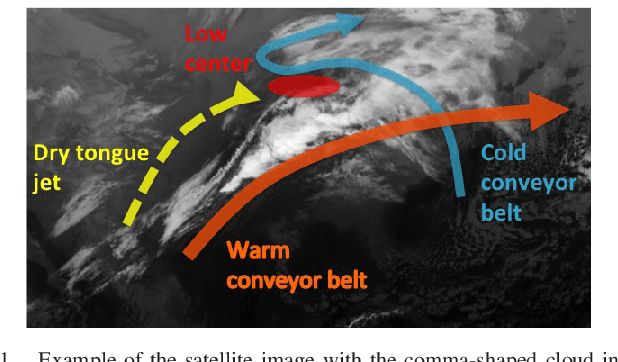
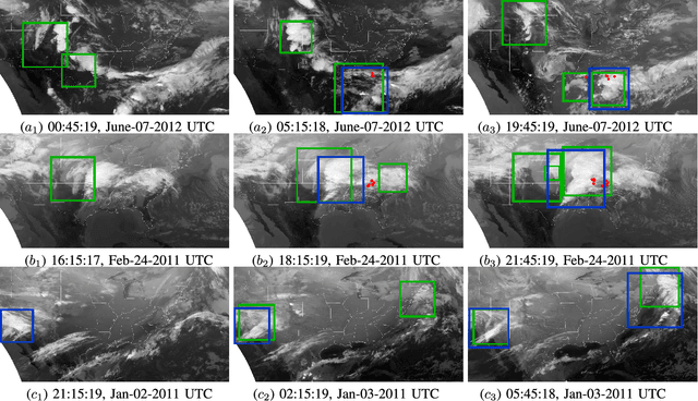
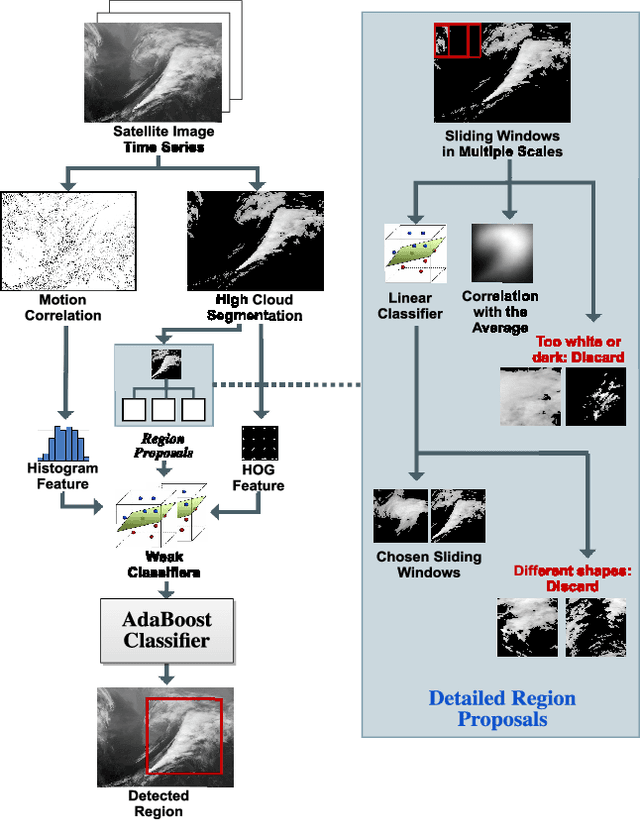
Abstract:Meteorologists use shapes and movements of clouds in satellite images as indicators of several major types of severe storms. Satellite imaginary data are in increasingly higher resolution, both spatially and temporally, making it impossible for humans to fully leverage the data in their forecast. Automatic satellite imagery analysis methods that can find storm-related cloud patterns as soon as they are detectable are in demand. We propose a machine learning and pattern recognition based approach to detect "comma-shaped" clouds in satellite images, which are specific cloud distribution patterns strongly associated with the cyclone formulation. In order to detect regions with the targeted movement patterns, our method is trained on manually annotated cloud examples represented by both shape and motion-sensitive features. Sliding windows in different scales are used to ensure that dense clouds will be captured, and we implement effective selection rules to shrink the region of interest among these sliding windows. Finally, we evaluate the method on a hold-out annotated comma-shaped cloud dataset and cross-match the results with recorded storm events in the severe weather database. The validated utility and accuracy of our method suggest a high potential for assisting meteorologists in weather forecasting.
Storm Detection by Visual Learning Using Satellite Images
Mar 01, 2016


Abstract:Computers are widely utilized in today's weather forecasting as a powerful tool to leverage an enormous amount of data. Yet, despite the availability of such data, current techniques often fall short of producing reliable detailed storm forecasts. Each year severe thunderstorms cause significant damage and loss of life, some of which could be avoided if better forecasts were available. We propose a computer algorithm that analyzes satellite images from historical archives to locate visual signatures of severe thunderstorms for short-term predictions. While computers are involved in weather forecasts to solve numerical models based on sensory data, they are less competent in forecasting based on visual patterns from satellite images. In our system, we extract and summarize important visual storm evidence from satellite image sequences in the way that meteorologists interpret the images. In particular, the algorithm extracts and fits local cloud motion from image sequences to model the storm-related cloud patches. Image data from the year 2008 have been adopted to train the model, and historical thunderstorm reports in continental US from 2000 through 2013 have been used as the ground-truth and priors in the modeling process. Experiments demonstrate the usefulness and potential of the algorithm for producing more accurate thunderstorm forecasts.
 Add to Chrome
 Add to Firefox
 Add to Edge