Stefano Zorzi
PolyWorld: Polygonal Building Extraction with Graph Neural Networks in Satellite Images
Dec 07, 2021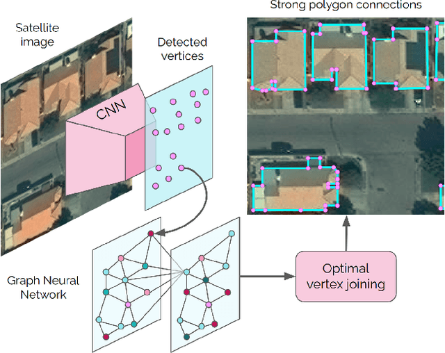

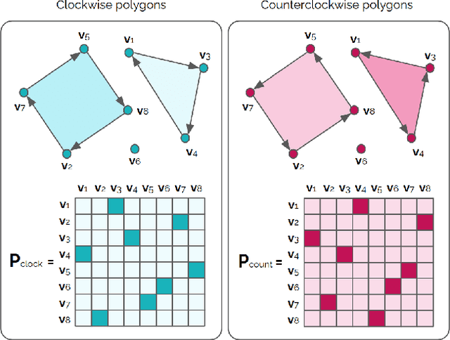

Abstract:Most state-of-the-art instance segmentation methods produce binary segmentation masks, however, geographic and cartographic applications typically require precise vector polygons of extracted objects instead of rasterized output. This paper introduces PolyWorld, a neural network that directly extracts building vertices from an image and connects them correctly to create precise polygons. The model predicts the connection strength between each pair of vertices using a graph neural network and estimates the assignments by solving a differentiable optimal transport problem. Moreover, the vertex positions are optimized by minimizing a combined segmentation and polygonal angle difference loss. PolyWorld significantly outperforms the state-of-the-art in building polygonization and achieves not only notable quantitative results, but also produces visually pleasing building polygons. Code and trained weights will be soon available on github.
Machine-learned 3D Building Vectorization from Satellite Imagery
Apr 13, 2021

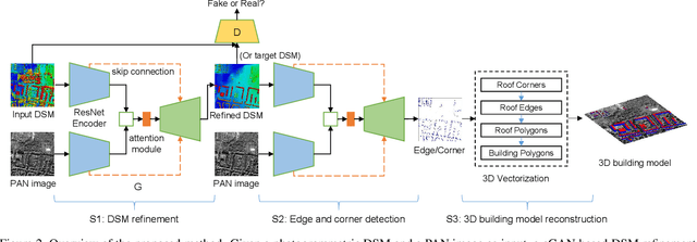

Abstract:We propose a machine learning based approach for automatic 3D building reconstruction and vectorization. Taking a single-channel photogrammetric digital surface model (DSM) and panchromatic (PAN) image as input, we first filter out non-building objects and refine the building shapes of input DSM with a conditional generative adversarial network (cGAN). The refined DSM and the input PAN image are then used through a semantic segmentation network to detect edges and corners of building roofs. Later, a set of vectorization algorithms are proposed to build roof polygons. Finally, the height information from the refined DSM is added to the polygons to obtain a fully vectorized level of detail (LoD)-2 building model. We verify the effectiveness of our method on large-scale satellite images, where we obtain state-of-the-art performance.
Machine-learned Regularization and Polygonization of Building Segmentation Masks
Aug 03, 2020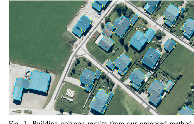


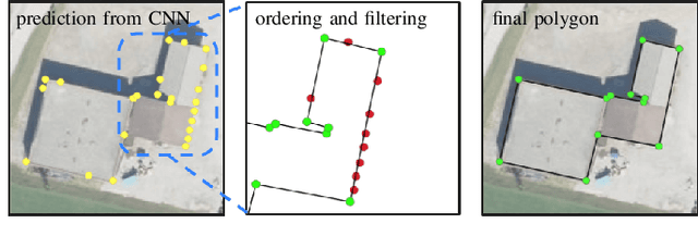
Abstract:We propose a machine learning based approach for automatic regularization and polygonization of building segmentation masks. Taking an image as input, we first predict building segmentation maps exploiting generic fully convolutional network (FCN). A generative adversarial network (GAN) is then involved to perform a regularization of building boundaries to make them more realistic, i.e., having more rectilinear outlines which construct right angles if required. This is achieved through the interplay between the discriminator which gives a probability of input image being true and generator that learns from discriminator's response to create more realistic images. Finally, we train the backbone convolutional neural network (CNN) which is adapted to predict sparse outcomes corresponding to building corners out of regularized building segmentation results. Experiments on three building segmentation datasets demonstrate that the proposed method is not only capable of obtaining accurate results, but also of producing visually pleasing building outlines parameterized as polygons.
Map-Repair: Deep Cadastre Maps Alignment and Temporal Inconsistencies Fix in Satellite Images
Jul 24, 2020

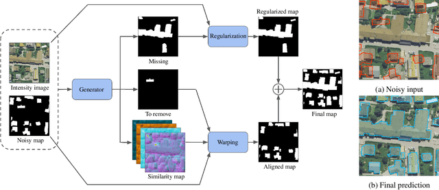

Abstract:In the fast developing countries it is hard to trace new buildings construction or old structures destruction and, as a result, to keep the up-to-date cadastre maps. Moreover, due to the complexity of urban regions or inconsistency of data used for cadastre maps extraction, the errors in form of misalignment is a common problem. In this work, we propose an end-to-end deep learning approach which is able to solve inconsistencies between the input intensity image and the available building footprints by correcting label noises and, at the same time, misalignments if needed. The obtained results demonstrate the robustness of the proposed method to even severely misaligned examples that makes it potentially suitable for real applications, like OpenStreetMap correction.
Regularization of Building Boundaries in Satellite Images using Adversarial and Regularized Losses
Jul 23, 2020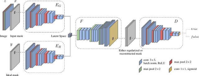

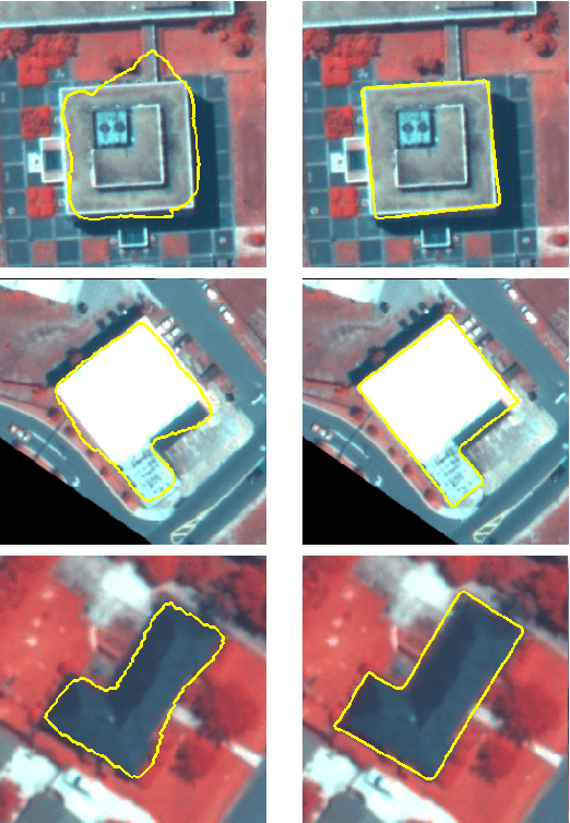

Abstract:In this paper we present a method for building boundary refinement and regularization in satellite images using a fully convolutional neural network trained with a combination of adversarial and regularized losses. Compared to a pure Mask R-CNN model, the overall algorithm can achieve equivalent performance in terms of accuracy and completeness. However, unlike Mask R-CNN that produces irregular footprints, our framework generates regularized and visually pleasing building boundaries which are beneficial in many applications.
 Add to Chrome
 Add to Firefox
 Add to Edge