 Add to Chrome
 Add to Firefox
 Add to Edge
Pure Inertial Navigation in Challenging Environments with Wheeled and Chassis Mounted Inertial Sensors
Jan 01, 2026Autonomous vehicles and wheeled robots are widely used in many applications in both indoor and outdoor settings. In practical situations with limited GNSS signals or degraded lighting conditions, the navigation solution may rely only on inertial sensors and as result drift in time due to errors in the inertial measurement. In this work, we propose WiCHINS, a wheeled and chassis inertial navigation system by combining wheel-mounted-inertial sensors with a chassis-mounted inertial sensor for accurate pure inertial navigation. To that end, we derive a three-stage framework, each with a dedicated extended Kalman filter. This framework utilizes the benefits of each location (wheel/body) during the estimation process. To evaluate our proposed approach, we employed a dataset with five inertial measurement units with a total recording time of 228.6 minutes. We compare our approach with four other inertial baselines and demonstrate an average position error of 11.4m, which is $2.4\%$ of the average traveled distance, using two wheels and one body inertial measurement units. As a consequence, our proposed method enables robust navigation in challenging environments and helps bridge the pure-inertial performance gap.
Multiple and Gyro-Free Inertial Datasets
Mar 21, 2024
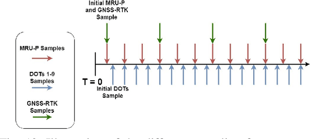
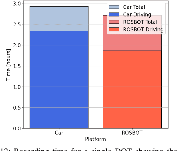
An inertial navigation system (INS) utilizes three orthogonal accelerometers and gyroscopes to determine platform position, velocity, and orientation. There are countless applications for INS, including robotics, autonomous platforms, and the internet of things. Recent research explores the integration of data-driven methods with INS, highlighting significant innovations, improving accuracy and efficiency. Despite the growing interest in this field and the availability of INS datasets, no datasets are available for gyro-free INS (GFINS) and multiple inertial measurement unit (MIMU) architectures. To fill this gap and to stimulate further research in this field, we designed and recorded GFINS and MIMU datasets using 54 inertial sensors grouped in nine inertial measurement units. These sensors can be used to define and evaluate different types of MIMU and GFINS architectures. The inertial sensors were arranged in three different sensor configurations and mounted on a mobile robot and a passenger car. In total, the dataset contains 35 hours of inertial data and corresponding ground truth trajectories. The data and code are freely accessible through our GitHub repository.