Hongle Xie
NeSLAM: Neural Implicit Mapping and Self-Supervised Feature Tracking With Depth Completion and Denoising
Mar 29, 2024


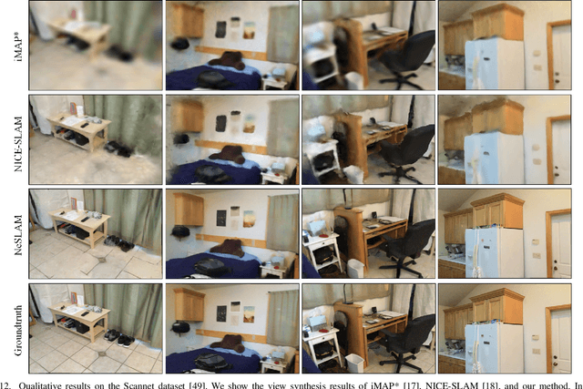
Abstract:In recent years, there have been significant advancements in 3D reconstruction and dense RGB-D SLAM systems. One notable development is the application of Neural Radiance Fields (NeRF) in these systems, which utilizes implicit neural representation to encode 3D scenes. This extension of NeRF to SLAM has shown promising results. However, the depth images obtained from consumer-grade RGB-D sensors are often sparse and noisy, which poses significant challenges for 3D reconstruction and affects the accuracy of the representation of the scene geometry. Moreover, the original hierarchical feature grid with occupancy value is inaccurate for scene geometry representation. Furthermore, the existing methods select random pixels for camera tracking, which leads to inaccurate localization and is not robust in real-world indoor environments. To this end, we present NeSLAM, an advanced framework that achieves accurate and dense depth estimation, robust camera tracking, and realistic synthesis of novel views. First, a depth completion and denoising network is designed to provide dense geometry prior and guide the neural implicit representation optimization. Second, the occupancy scene representation is replaced with Signed Distance Field (SDF) hierarchical scene representation for high-quality reconstruction and view synthesis. Furthermore, we also propose a NeRF-based self-supervised feature tracking algorithm for robust real-time tracking. Experiments on various indoor datasets demonstrate the effectiveness and accuracy of the system in reconstruction, tracking quality, and novel view synthesis.
ROLL: Long-Term Robust LiDAR-based Localization With Temporary Mapping in Changing Environments
Mar 08, 2022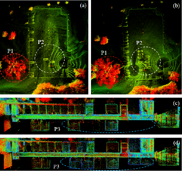
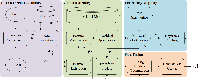
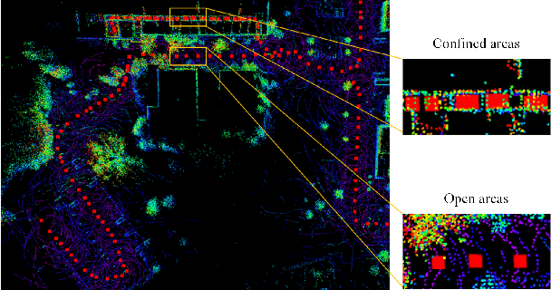
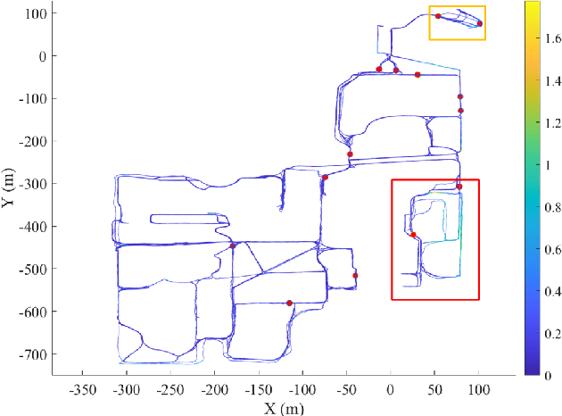
Abstract:Long-term scene changes present challenges to localization systems using a pre-built map. This paper presents a LiDAR-based system that can provide robust localization against those challenges. Our method starts with activation of a mapping process temporarily when global matching towards the pre-built map is unreliable. The temporary map will be merged onto the pre-built map for later localization runs once reliable matching is obtained again. We further integrate a LiDAR inertial odometry (LIO) to provide motion-compensated LiDAR scans and a reliable initial pose guess for the global matching module. To generate a smooth real-time trajectory for navigation purposes, we fuse poses from odometry and global matching by solving a pose graph optimization problem. We evaluate our localization system with extensive experiments on the NCLT dataset including a variety of changing indoor and outdoor environments, and the results demonstrate a robust and accurate localization performance for over a year. The implementations are open sourced on GitHub.
 Add to Chrome
 Add to Firefox
 Add to Edge