Christina Kumler-Bonfanti
Tropical and Extratropical Cyclone Detection Using Deep Learning
May 18, 2020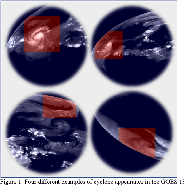

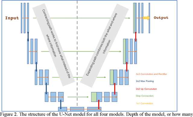
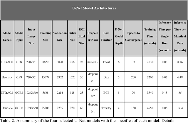
Abstract:Extracting valuable information from large sets of diverse meteorological data is a time-intensive process. Machine learning methods can help improve both speed and accuracy of this process. Specifically, deep learning image segmentation models using the U-Net structure perform faster and can identify areas missed by more restrictive approaches, such as expert hand-labeling and a priori heuristic methods. This paper discusses four different state-of-the-art U-Net models designed for detection of tropical and extratropical cyclone Regions Of Interest (ROI) from two separate input sources: total precipitable water output from the Global Forecasting System (GFS) model and water vapor radiance images from the Geostationary Operational Environmental Satellite (GOES). These models are referred to as IBTrACS-GFS, Heuristic-GFS, IBTrACS-GOES, and Heuristic-GOES. All four U-Nets are fast information extraction tools and perform with a ROI detection accuracy ranging from 80% to 99%. These are additionally evaluated with the Dice and Tversky Intersection over Union (IoU) metrics, having Dice coefficient scores ranging from 0.51 to 0.76 and Tversky coefficients ranging from 0.56 to 0.74. The extratropical cyclone U-Net model performed 3 times faster than the comparable heuristic model used to detect the same ROI. The U-Nets were specifically selected for their capabilities in detecting cyclone ROI beyond the scope of the training labels. These machine learning models identified more ambiguous and active ROI missed by the heuristic model and hand-labeling methods commonly used in generating real-time weather alerts, having a potentially direct impact on public safety.
Tropical Cyclone Track Forecasting using Fused Deep Learning from Aligned Reanalysis Data
Oct 23, 2019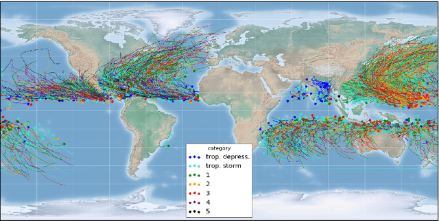
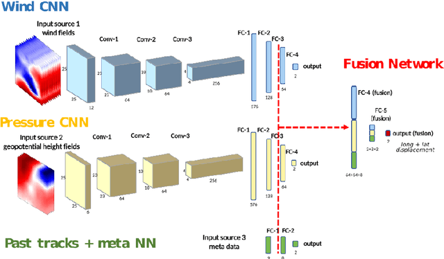
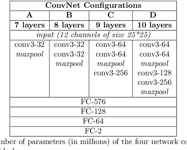
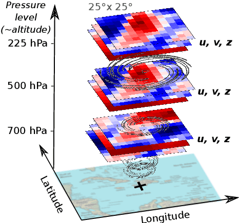
Abstract:The forecast of tropical cyclone trajectories is crucial for the protection of people and property. Although forecast dynamical models can provide high-precision short-term forecasts, they are computationally demanding, and current statistical forecasting models have much room for improvement given that the database of past hurricanes is constantly growing. Machine learning methods, that can capture non-linearities and complex relations, have only been scarcely tested for this application. We propose a neural network model fusing past trajectory data and reanalysis atmospheric images (wind and pressure 3D fields). We use a moving frame of reference that follows the storm center for the 24h tracking forecast. The network is trained to estimate the longitude and latitude displacement of tropical cyclones and depressions from a large database from both hemispheres (more than 3000 storms since 1979, sampled at a 6 hour frequency). The advantage of the fused network is demonstrated and a comparison with current forecast models shows that deep learning methods could provide a valuable and complementary prediction. Moreover, our method can give a forecast for a new storm in a few seconds, which is an important asset for real-time forecasts compared to traditional forecasts.
 Add to Chrome
 Add to Firefox
 Add to Edge